
Philip's Maps
 Wegenatlas Navigator Britain - Engeland en Schotland 1:100.000 | Ringband | Philip's Maps
Bijzonder gedetaileerde wegenatlas van Engeland en Schotland op schaal 1:100.000 (met het noorden van Schotland 1:200.000). Alle wegen, bezienswaardigheden, National Trails, campings ... noem maar op en je vindt het …
★★★★★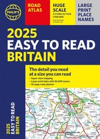 Wegenatlas Easy to Read Road Atlas Britain 2025 | Philip's Maps
"The detail you need at a size you can read". The latest 2025 Philip's Easy to Read Road Atlas of Britain from the best-selling Road Atlas range has over 350 …
★★★★★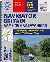 Wegenatlas Navigator Camping and Caravanning – Atlas of Britain | Philip's Maps
THE MUST-HAVE ATLAS OF BRITAIN FOR CAMPING, CARAVANNING AND MOTORHOMES'A map that beats all others' - The Daily Telegraph'Scale, accuracy and clarity are without parallel' - Driving Magazine'No. 1 in …
★★★★★ Wegenatlas Great British Road Trip Atlas : Easy to Read Edition | Philip's Maps
Looking for inspiration to hit the open road? Fancy exploring the best routes Britain and Ireland has to offer? This user-friendly atlas is designed to make your road trips both …
 Wegenatlas Local Explorer Street Atlas Cheshire | Philip's Maps
Who hasn't explored and enjoyed their surrounding area recently and come to appreciate what is on our respective doorsteps? Philip's have created this new series for walkers, cyclists and local …
 Wegenatlas Wales Navigator | A4 | Ringband | Philip's Maps
Ideaal voor fietsers! Explore the many attractions of Wales with this easy-to-use road atlas showing all the top spots. Easy-to-read mapping, superb extra detail, and a great lie-flat format make …
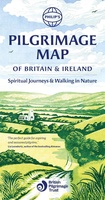 Wandelkaart Pilgrimage Map of Britain and Ireland | Philip's Maps
Overzichtskaart van Pelgrimsroutes in Engeland en Ierland. In association with The British Pilgrimage Trust, for walkers, thinkers and nature seekers, Philip's Pilgrimage map of Britain and Ireland depicts the …
 Wegenkaart - landkaart The Cotswolds | Philip's Maps
A new edition of this double-sided map of the Cotswolds clearly featuring places of tourist and historic interest in an easy-to-read style of mapping, alongside six handy town centre plans. …
Laatste reviews

Heel duidelijke wandelkaart. De kaart maakt het ook zeer eenvoudig om verschillende routes te combineren.
★★★★★ door Stefan 09 november 2026 | Heeft dit artikel gekocht
Vertrouwde fietsgids van Paul Benjaminse, met veel keuzemogelijkheden van fietsroutes.
★★★★★ door Wilco Meijers 09 november 2026 | Heeft dit artikel gekocht
Vertrouwde fietsgids van Paul Benjaminse, dan weet je dat het goed zit.
★★★★★ door Wilco Meijers 09 november 2026 | Heeft dit artikel gekocht
Snelle levering, duidelijke kaart!
★★★★★ door Christa 06 november 2026 | Heeft dit artikel gekocht