Knife Edge Outdoor
Knife Edge Outdoor Wandelgidsen met echte wandelkaarten!
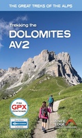 Wandelgids The Great Treks of the Alps Dolomites AV2 • Alta Via 2 | Knife Edge Outdoor
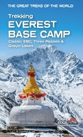 Wandelgids Trekking Everest Base Camp: | Knife Edge Outdoor
The definitive guidebook for trekking in the Everest Region: essential reading for both guided and self-guided trekkers. This book really knocks the ball out of the park. It fully describes …
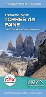 Wandelkaart The Great Treks of the Alps Patagonia’s Torres del Paine trekking map | Knife Edge Outdoor
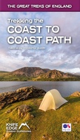 Wandelgids Trekking the Coast to Coast Path | Knife Edge Outdoor
The definitive two-way guide to the Coast to Coast Path: both eastbound and westbound routes are described in full. Real Maps: Full Ordnance Survey mapping inside (1:25,000). All accommodation is …
★★★★★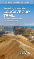 Wandelgids Trekking Iceland's Laugavegur Trail and Fimmvorouhals Trail | Knife Edge Outdoor
The definitive two-way guide to Iceland's Laugavegur Trail (& Fimmvörðuháls Trail): both southbound and northbound routes are described in full. Real Maps: full mapping inside (1:40,000), made specifically for the …
★★★★★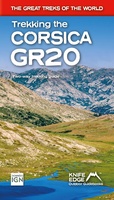 Wandelgids Trekking the Corsica GR20 | Knife Edge Outdoor
The only two-way guidebook to the GR20: both northbound and southbound routes are described in full. Real IGN Maps included (1:25,000): no need to carry separate maps. 15 different itineraries: …
 Wandelkaart Tour du Mont Blanc | Knife Edge Outdoor
Wandelkaart Tour du Mont Blanc – Alle accommodaties, eten & vervoer op één kaart De enige wandelkaart voor de Tour du Mont Blanc waarop álle accommodaties, eetgelegenheden en transportopties staan …
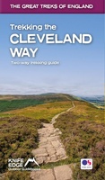 Wandelgids Trekking the Cleveland Way | Knife Edge Outdoor
The definitive two-way guide to the Cleveland Way, one of England's epic National Trails: both eastbound and westbound routes are described in full. Real Maps: Full Ordnance Survey mapping …
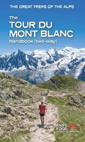 Wandelgids The Great Treks of the Alps Tour du Mont Blanc | Knife Edge Outdoor
The second edition of the definitive guidebook for the Tour du Mont Blanc: now covers the trek in both directions (anti-clockwise and clockwise). Fully rewritten from scratch to provide complete …
 Wandelgids The Great Treks of the Alps Patagonia’s Torres del Paine trekking guide | Knife Edge Outdoor
 Wandelgids Trekking the Cotswold Way | Knife Edge Outdoor
The definitive two-way guide to the Cotswold Way: both southbound and northbound routes are described in full. Real Maps: Full Ordnance Survey mapping inside (1:25,000). All accommodation is numbered and …
 Wandelkaart Everest Base Camp Trekking Map | Knife Edge Outdoor
The best sheet map for the Everest treks: Classic EBC, Three Passes & Gokyo Lakes (all clearly colour coded). 1:40,000 - larger scale and more detail than any other …
 Wandelgids Trekking the West Highland Way: Two-Way Trekking Guide | Knife Edge Outdoor
The definitive two-way guide to the West Highland Way: both northbound and southbound routes are described in full. Real Maps: Full Ordnance Survey Explorer mapping inside (1:25,000). All accommodation is …
 Wandelgids Trekking the Dolomites Av1 | Knife Edge Outdoor
Superhandige wandelgids voor de Alta Via 1 in de Dolomieten. Met deze gids heb je verder niks nodig: alle benodigde Tabacco wandelkaarten zitten in deze gids! The only guidebook exclusively …
★★★★★ Wandelkaart Tour of Monte Rosa Trekking Map | Knife Edge Outdoor
The best sheet map for the Tour of Monte Rosa. Displays the entire route and variants on a single sheet: perfect for planning and navigation. 1:40,000 - larger scale …
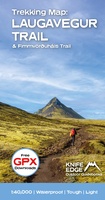 Wandelkaart Laugavegur Trail and Fimmvorduhals Trail | Knife Edge Outdoor
Waterproof sheet map for Iceland's Laugavegur Trail (& Fimmvorduhals Trail): 1:40,000. Includes free GPX downloads for the trails. The definitive map to Iceland's two best trails: larger scale and more …
★★★★★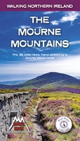 Wandelgids The Mourne Mountains | Knife Edge Outdoor
The only guidebook for the Mourne Mountains written by a County Down local hiker: 30 handpicked routes. The only guidebook for the Mourne Mountains with Real 1:25,000 Maps: this makes …
 Wandelgids Trekking the Mallorca GR221 | Knife Edge Outdoor
Goede wandelgids met duidelijke routekaarten en praktische informatie. The definitive two-way guide to the Mallorca GR221 (the Drystone Way): both northbound and southbound routes are described in full. …
★★★★★ Wandelgids Trekking the Tour Des Combins | Knife Edge Outdoor
The definitive guidebook for the Tour des Combins: the new bucket list trek in the Swiss/Italian Alps. A superb alternative to the more famous Tour du Mont Blanc. Two-way guide: …
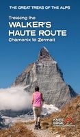 Wandelgids Walker's Haute Route: Chamonix to Zermatt | Knife Edge Outdoor
Overzichtelijke routegids van deze prachtige wandelroute. Per etappe vind je een hoogteprofiel, goede beschrijvingen van de wandelroute, een topografische kaart op gedetailleerde schaal. Voor en achterin de gids staat aanvullende …
Laatste reviews

Ben nog niet het veld in geweest met de gids maar de eerste indruk is veel informatie om een meerdaagse tocht uit te stippelen.
★★★★★ door Henk 04 juli 2026 | Heeft dit artikel gekocht
Prima in orde!
★★★★★ door Marko 04 juli 2026 | Heeft dit artikel gekocht
Fijn boekje met veel informatie, behalve knooppunten Utrecht af en toe incorrect. Wat heerlijk om offline te navigeren, lekker analoog. Zodra je het systeem begrijpt …
★★★★★ door Daan 03 juli 2026 | Heeft dit artikel gekocht
Als je van geschiedenis, Groningen en kaarteen houdt, is dit echt een aanrader!
★★★★★ door Reinout 03 juli 2026 | Heeft dit artikel gekocht