Winkelwagen
Geen items in winkelwagen
Ga naar winkelwagen
IGN - Institut Géographique National
IGN is de officiële instantie voor geografische informatie in Frankrijk ofwel Institut Géographique National. Ze staan bekend om de zeer goede wandelkaarten op schaal 1:25.000 (Serie Bleue en Top 25) van Frankrijk. De wandelkaarten zijn dan ook zeer uitgebreid. De wandelaar vindt hier alle wandelpaden, campings en langeafstandswandelpaden, ook wel GR-paden (Grande Randonnée) genoemd. Kleine weggetjes en paden, maar ook de verschillende types landschappen en bebouwingen, populaire gebieden en onontdekte parels: de wandelaar in Frankrijk vindt alles terug op deze betrouwbare kaarten van IGN.
Naast wandelkaarten geeft het IGN ook goede fiets- c.q. wegenkaarten op schaal 1:100.000 (serie Top 100) en fietskaarten op schaal 1:75.000 (serie Top 75) uit.
 Wandelkaart - Topografische kaart 3335ETR Le Bourg-d'Oisans - L'Alpe d'Huez | IGN - Institut Géographique National
 Wandelkaart - Topografische kaart 3335OT Grenoble | IGN - Institut Géographique National★★★★★
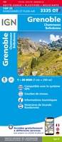 Wandelkaart - Topografische kaart 3335OTR Grenoble | IGN - Institut Géographique National
 Wandelkaart - Topografische kaart 3336ET Les Deux Alpes | IGN - Institut Géographique National★★★★★
 Wandelkaart - Topografische kaart 3336ETR Les Deux Alpes / Olan / Muzelle /PNR des Ecrins | IGN - Institut Géographique National
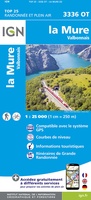 Wandelkaart - Topografische kaart 3336OT La Mure | IGN - Institut Géographique National★★★★★
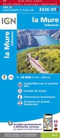 Wandelkaart - Topografische kaart 3336OTR La Mure / Valbonnais | IGN - Institut Géographique National
 Wandelkaart - Topografische kaart 3337OT Dévoluy | IGN - Institut Géographique National★★★★★★★★★★
 Wandelkaart - Topografische kaart 3337OTR Dévoluy | IGN - Institut Géographique National★★★★★
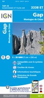 Wandelkaart - Topografische kaart 3338ET Gap | IGN - Institut Géographique National★★★★★
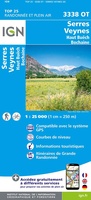 Wandelkaart - Topografische kaart 3338OT Serres - Veynes | IGN - Institut Géographique National
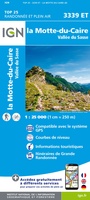 Wandelkaart - Topografische kaart 3339ET la Motte-du-Caire | IGN - Institut Géographique National
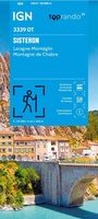 Wandelkaart 3339OT Sisteron / Laragne-Montéglin / Montagne de Chabre | IGN - Institut Géographique National★★★★★
 Wandelkaart - Topografische kaart 3340ET Digne-les-Bains | IGN - Institut Géographique National
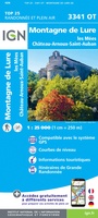 Wandelkaart - Topografische kaart 3341OT Montagne de Lure | IGN - Institut Géographique National
 Wandelkaart - Topografische kaart 3342ET Plateau de Valensole | IGN - Institut Géographique National
 Wandelkaart - Topografische kaart 3342OT Manosque - Forcalquier | IGN - Institut Géographique National
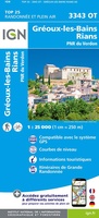 Wandelkaart - Topografische kaart 3343OT Gréoux-les-Bains - Rians | IGN - Institut Géographique National
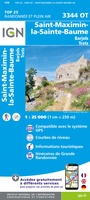 Wandelkaart - Topografische kaart 3344OT Saint-Maximin-la-Sainte-Baume | IGN - Institut Géographique National
 Wandelkaart - Topografische kaart 3345OT Signes – Tourves | IGN - Institut Géographique National
Laatste reviews

Perfect geregeld.
Michelin Camping gids Frankrijk 2026: Per omgaande, netjes verpakt geleverd.
★★★★★ door Cor 27 april 2026 | Heeft dit artikel gekocht
Leuk informatief boekje
Het boekje geeft een goede indruk van de Mullerthal Trail met wat feitelijke info, heel handig, en vooral ook een mooi sfeerbeeld.
★★★★★ door Odette 27 april 2026 | Heeft dit artikel gekocht
Prima wandelkaart
De routes zijn zo goed bewegwijzerd, dat je bijna geen kaart nodig hebt. Wij hebben hem vooral gebruikt om per dag te bekijken wat we …
★★★★★ door Odette 27 april 2026 | Heeft dit artikel gekocht
Kwalitatieve topkaart
Heldere gedetailleerde kaart, onmisbaar voor tochtplanning, waterafstotend
★★★★★ door Walter 24 april 2026 | Heeft dit artikel gekocht