Winkelwagen
Geen items in winkelwagen
Ga naar winkelwagen
IGN - Institut Géographique National
IGN is de officiële instantie voor geografische informatie in Frankrijk ofwel Institut Géographique National. Ze staan bekend om de zeer goede wandelkaarten op schaal 1:25.000 (Serie Bleue en Top 25) van Frankrijk. De wandelkaarten zijn dan ook zeer uitgebreid. De wandelaar vindt hier alle wandelpaden, campings en langeafstandswandelpaden, ook wel GR-paden (Grande Randonnée) genoemd. Kleine weggetjes en paden, maar ook de verschillende types landschappen en bebouwingen, populaire gebieden en onontdekte parels: de wandelaar in Frankrijk vindt alles terug op deze betrouwbare kaarten van IGN.
Naast wandelkaarten geeft het IGN ook goede fiets- c.q. wegenkaarten op schaal 1:100.000 (serie Top 100) en fietskaarten op schaal 1:75.000 (serie Top 75) uit.
 Wandelkaart - Topografische kaart 2528 SB - Serie Bleue Tronget - Montmarault | IGN - Institut Géographique National
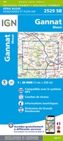 Wandelkaart - Topografische kaart 2529 SB - Serie Bleue Gannat | IGN - Institut Géographique National
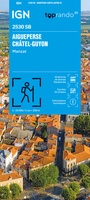 Wandelkaart 2530 SB - Serie Bleue Aigueperse / Châtel-Guyon / Manzat | IGN - Institut Géographique National
 Wandelkaart - Topografische kaart 2531 SB - Serie Bleue Clermont-Ferrand | IGN - Institut Géographique National
 Wandelkaart - Topografische kaart 2531ET Chaîne des Puys | IGN - Institut Géographique National
 Wandelkaart - Topografische kaart 2531ETR Chaîne des Puys / PNR Volcans d'Auvergne | IGN - Institut Géographique National
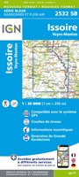 Wandelkaart - Topografische kaart 2532 SB - Serie Bleue Veyre-Monton, Issoire | IGN - Institut Géographique National
 Wandelkaart - Topografische kaart 2534 SB - Serie Bleue Massiac - Ardes | IGN - Institut Géographique National
 2534OT Monts du Cézallier | IGN - Institut Géographique National
 Wandelkaart - Topografische kaart 2535 SB - Serie Bleue St-Flour, Murat | IGN - Institut Géographique National
 Wandelkaart - Topografische kaart 2536 SB - Serie Bleue Chaudes-Aigues, Gorges de la Truyère, Faverolles | IGN - Institut Géographique National
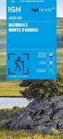 Wandelkaart 2537OT Nasbinals - Monts d'Aubrac | IGN - Institut Géographique National
 Wandelkaart 2538OT Ste-Eulalie-d'Olt | IGN - Institut Géographique National
 Wandelkaart - Topografische kaart 2539 SB - Serie Bleue Sévérac-le-Château, Lapanouse | IGN - Institut Géographique National
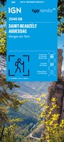 Wandelkaart 2540 SB - Serie Bleue St-Beauzély / Aguessac / Gorges du Tarn | IGN - Institut Géographique National
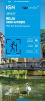 Wandelkaart 2541OT Millau / St-Affrique / PNR Grands Causses | IGN - Institut Géographique National
 Wandelkaart - Topografische kaart 2542OT Camarès - Avène | IGN - Institut Géographique National
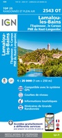 Wandelkaart - Topografische kaart 2543OT Lamalou-les-Bains, Olargues, Roquebrun, Le Caroux, PNR du Haut Languedoc | IGN - Institut Géographique National★★★★★
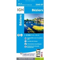 Wandelkaart 2545ET Béziers | IGN - Institut Géographique National★★★★★
 Wandelkaart - Topografische kaart 2545OT St-Chinian - L'etang de Montady | IGN - Institut Géographique National
Laatste reviews

Compact gidsje
Ben nog niet het veld in geweest met de gids maar de eerste indruk is veel informatie om een meerdaagse tocht uit te stippelen.
★★★★★ door Henk 04 juli 2026 | Heeft dit artikel gekocht
Beschikbaarheid en snelheid
Prima in orde!
★★★★★ door Marko 04 juli 2026 | Heeft dit artikel gekocht
Lekker analoog
Fijn boekje met veel informatie, behalve knooppunten Utrecht af en toe incorrect. Wat heerlijk om offline te navigeren, lekker analoog. Zodra je het systeem begrijpt …
★★★★★ door Daan 03 juli 2026 | Heeft dit artikel gekocht
Aanrader
Als je van geschiedenis, Groningen en kaarteen houdt, is dit echt een aanrader!
★★★★★ door Reinout 03 juli 2026 | Heeft dit artikel gekocht