Harvey Maps
Superhandige wandelkaarten van Harvey Maps voor Engeland, Schotland & Wales
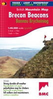 Wandelkaart Brecon Beacons | Harvey Maps
"The Brecon Beacons have an irresistible draw and this is where I began my journey to the roof of the world. The breathtaking landscape provides challenges and adventures for all …
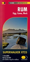 Wandelkaart Rum, Eigg, Canna, Muck | Harvey Maps
More than "just" a map, this map is an essential piece of equipment, this new generation of HARVEY Superwalkers is designed to be the most practical tool for navigation outdoors. …
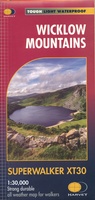 Wandelkaart Wicklow Mountains | Harvey Maps
Zeer duidelijke kaart van de Wicklow Mountains in Ierland. Met o.a. hoogtelijnen en geschikt voor gebruik met GPS. HARVEY Superwalker map at 1:30,000 scale. Clear, easy to use, waterproof. GPS …
★★★★★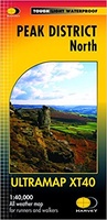 Wandelkaart Peak District Noord | Harvey Maps
HARVEY launch innovative new series: Ultramap XT40. 16 titles featuring in Trail magazine through spring 2016. 40 years experience have gone into HARVEY's most creative new series. The Ultramap covers …
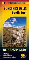 Wandelkaart Yorkshire Dales Zuid Oost | Harvey Maps
HARVEY launch innovative new series: Ultramap XT40. 16 titles featuring in Trail magazine through spring 2016. 40 years experience have gone into HARVEY's most creative new series. The Ultramap covers …
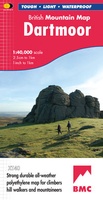 Wandelkaart Dartmoor | Harvey Maps
"This inspiring new map will help walkers and climbers explore Dartmoor's wild granite landscapes, and, like the granite, is virtually indestructible." Sir Ranulph Fiennes, adventurer and explorer. Dartmoor, the …
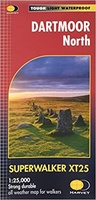 Wandelkaart Dartmoor Noord | Harvey Maps
The whole of Dartmoor on two Maps. Dartmoor's famous Tors including Haytor Rocks and Yes Tor. The format gives more mapping on the sheet without making the map heavy and …
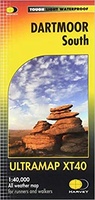 Wandelkaart Dartmoor Zuid | Harvey Maps
Covers a large area yet is handily compact. Pocket perfect! Detailed map for runners and walkers of the south section of Dartmoor National Park at the magic scale of …
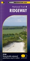 Wandelkaart - Fietskaart Ridgeway | Harvey Maps
Mooie, duidelijke kaart van de Ridgeway in Engeland. Geplastificeerd met veel extra informatie en uitsnedes van de route. Leap forward in technical excellence. Tough, light and 100% wateproof …
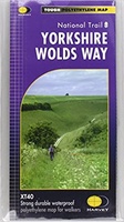 Wandelkaart Yorkshire Wolds Way | Harvey Maps
The Yorkshire Wolds Way is a 79 mile (127 km) walking route in the chalk landscape of the Yorkshire Wolds. The National Trail wends through some of the most tranquil …
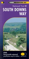 Wandelkaart - Fietskaart South Downs Way | Harvey Maps
Mooie, geplastificcerde kaart van de South Downs Way. De kaart is geschikt voor zowel wandelaars, fietsers als ruiters. Met veel extra informatie en uitsnedes van de route. Suitable …
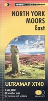 Wandelkaart North York Moors Oost | Harvey Maps
Covers a large area yet is handily compact. Pocket perfect! Detailed map for runners and walkers of the eastern section of the North York Moors National Park at the …
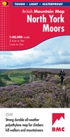 Wandelkaart North York Moors | Harvey Maps
"I’ve enjoyed and endured tough and challenging walks throughout the North York Moors, and this tough, durable, detailed map is the ideal companion and guide." Paddy Dillon, outdoor writer. …
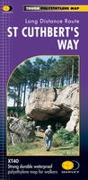 Wandelkaart St Cuthbert's Way | Harvey Maps
Handige, stevige kaart (waterproof) van de St. Cuthbert's Way in Schotland. Met uitsnedes van deze 100km lange route. Bevat veel extra informatie. Information on finding accommodation, camping, food. Directions to …
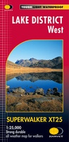 Wandelkaart Lake District West | Harvey Maps
New Superwalker XT25 of the Lake District Revised and re-designed. It's got everything! Genuine original HARVEY mapping at 1:25,000. Clear, easy to read. Easy to re-fold. Opens directly to either …
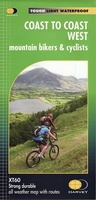 Fietskaart mountainbike Coast to Coast WEST | Harvey Maps
Deze kaart toont het westelijke deel van de route tussen St Bees/Ravenglass en Kirkby Stephen/Aysgarth via Ambleside/Windermere. Er zijn meerdere alternatieve routes ingetekend op een duidelijke topografische ondergrond. De …
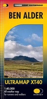 Wandelkaart Ben Alder | Harvey Maps
Covers a large area yet is handily compact. Pocket perfect!Detailed map for runners and walkers of the hills between Loch Tay and Loch Rannoch at the magic scale of 1:40,000.Includes …
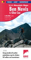 Wandelkaart Ben Nevis & Glen Coe | Harvey Maps
"This excellent Ben Nevis and Glen Coe map provides all the details needed for safe navigation on these iconic mountains". Cameron McNeish, outdoor writer and broadcaster. Detailed map for …
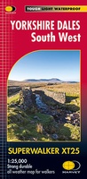 Wandelkaart Yorkshire Dales Zuid-West | Harvey Maps
The Yorkshire Dales National Park on just 4 sheets. Yorkshire Dales South West: The coverage of this map includes Yorkshire Three Peaks, Whernside, Ingleborough and Pen-y-Ghent. Genuine original HARVEY mapping …
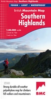 Wandelkaart Southern Highlands | Harvey Maps
"I've researched Scottish Guidebooks using HARVEY maps. They are the clearest, and the most accurate. They don't fall to pieces in the rain and the geology bits are pure bonus". …
Laatste reviews

Duidelijke kaart, ook met kleinere wegen. Snelle levering
★★★★★ door Ger Sulkers 02 mei 2024 | Heeft dit artikel gekocht
Ja wij zijn tevreden, alleen is mijn vriendin het boekje al kwijtgeraakt bij onze eerste wandeling.🙁
★★★★★ door Mark 02 mei 2024 | Heeft dit artikel gekocht
Ja ik ben dik tevreden over de wegenkaart van Kazachstan. Stond alles op wat ik wou dus heel erg tevreden daarover.
★★★★★ door Sjoerd Westra 02 mei 2024 | Heeft dit artikel gekocht
Zoals altijd mooie verzorgde kaarten die tijdens de reis van pas komen en achteraf mooie herinneringen oproepen.
★★★★★ door Klaas Wijnberg 02 mei 2024 | Heeft dit artikel gekocht