Harvey Maps
Superhandige wandelkaarten van Harvey Maps voor Engeland, Schotland & Wales
 Wandelkaart Lake District South East - Zuid Oost XT40 ultra | Harvey Maps
 Wandelkaart Ben Alder | Harvey Maps
Superwalker is designed to be the most practical tool for navigation outdoors. The Superwalker XT25 is based on original HARVEY mapping with all the information a walker would expect on …
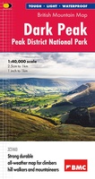 Wandelkaart Dark Peak - Peak District National Park XT40 BMM | Harvey Maps
 Wandelkaart Snowdonia Zuid | Harvey Maps
 Wegenkaart - landkaart Galloway Hills XT40 ultra | Harvey Maps
 Wandelkaart Snowdonia Noord | Harvey Maps★★★★★
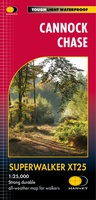 Wandelkaart Cannock Chase XT25 | Harvey Maps
 Wandelkaart Dartmoor | Harvey Maps
"This inspiring new map will help walkers and climbers explore Dartmoor's wild granite landscapes, and, like the granite, is virtually indestructible." Sir Ranulph Fiennes, adventurer and explorer. Dartmoor, the …
 Fietskaart Cycle Rides in the Yorkshire Dales | Harvey Maps
8 cycle rides in the Yorkshire Dales varying in length from 11 to 23 miles. Includes detailed maps plus written route directions. Information on local points of interest and …
 Wandelkaart Cairn Gorm | Harvey Maps
Includes 18 Munros of which 5 over 4000' (Cairn Gorm, Ben Macdui, Cairn Toul, Braeriach & Sgor an Loachain Uaine) and 3 Corbetts. Detailed map for hillwalkers of the …
 Wandelkaart Lake District West | Harvey Maps
 Wandelkaart Ochil Hills | Harvey Maps
Superwalker is designed to be the most practical tool for navigation outdoors. The format gives more mapping on the sheet without making the map heavy and bulky. The fold has …
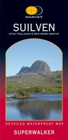 Wandelkaart Suilven / Stac Pollaidh & Ben More Assynt harve | Harvey Maps
Suilven covers the spectacular group of remote northerly munros popular with walkers and climbers. The map area includes Suilven, Canisp, CulMor,Breabag Stac Pollaidh, Conival & Ben More Assynt. This map …
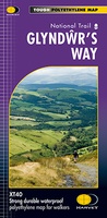 Wandelkaart Glyndwr's Way | Harvey Maps
XT40. Leap forward in technical excellence. Tough, light and 100% waterproof Compact and light - the map itself weighs just 60gms - a third of the weight of a …
 Wandelkaart The Great Trossachs Path | Harvey Maps
Een bijzonder handige kaart van dit lange-afstands-wandelpad. Op waterafstotend papier met veel details. Het enige dat je eigenlijk een beetje mist is een overzicht. Verder uitstekend en voldoende voor de …
 Fietskaart mountainbike Coast to Coast OOST | Harvey Maps
Deze kaart toont het oostelijke deel van de route tussen Kirkby Stephen/Aysgarth en Robin Hood's Bay/Ravenscar via Richmond/Osmotherley. Er zijn meerdere alternatieve routes ingetekend op een duidelijke topografische ondergrond. …
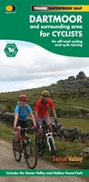 Fietskaart Dartmoor | Harvey Maps
New map for cycling on Dartmoor and the surrounding area. 2 maps in one: one side mountain biking the other side for cycle touring Tried and tested cycle …
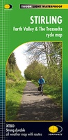 Fietskaart Stirling / Forth Valley &The Trossachs | Harvey Maps
Cycling map of Stirling, the Forth Valley and the Trossachs at 1:80,000 scale Map shows 16 graded cycle routes with detailed route descriptions on reverse Includes enlargement of …
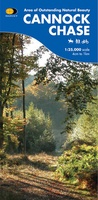 Wandelkaart Cannock Chase | Harvey Maps
New 1:25,000 scale map of this popular area in the West Midlands. Ideal for walking, mountain biking and other outdoor activities. Made with support from the Cannock Chase Area of …
 Wandelkaart Rum, Eigg, Canna, Muck | Harvey Maps
More than "just" a map, this map is an essential piece of equipment, this new generation of HARVEY Superwalkers is designed to be the most practical tool for navigation outdoors. …
Laatste reviews

Kort voor vakantie naar de Galapagos eilanden toch nog behoefte aan extra reisgids. Simpel kunnen bestellen en snelle levering. Zou niet weten wat er beter …
★★★★★ door Piet Grootenboer 25 juni 2026 | Heeft dit artikel gekocht
Enorm mooie wereldkaart met details en snelle fijne levering.
★★★★★ door Steven Goyvaerts 25 juni 2026 | Heeft dit artikel gekocht
Deze Cicerone gids over de via Francigena is uitermate geschikt om je route en etappes te plannen als je de Via Francigena vanuit Zwitserland gaat …
★★★★★ door Vic 24 juni 2026 | Heeft dit artikel gekocht
Heerlijk om al te kunnen voorbereiden op een fantastische vakantie met dit uiterst fijne boek.
★★★★★ door Harry 24 juni 2026 | Heeft dit artikel gekocht