Collins
Maak je reis compleet met de handige reisgidsen en wegenkaarten van Collins
 Woordenboek Visual Dictionary Ukrainian - English, Ukrains taalgids | Collins
A photographic guide to 3000 key words and phrases in Ukrainian with English translations. Фотографічний довідник близько 3000 опорних слів і фраз. This attractive pocket-sized book is a perfect English …
 Wandelgids Edinburgh Hidden Walks | Collins
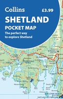
 Wegenkaart - landkaart Pocket Map Shetland | Collins
Handy little full colour map of Shetland. Main features of this map include: • Clear mapping • Main tourist attractions located and described • Ideal for touring with sights, …
 Wandelkaart National Trail Map Hadrian’s Wall Path | Collins
Overzichtskaart op vrij grove schaal van deze LAW Lange Afstands Wandeling in Engeland. Let op: je kunt er niet op lopen. Wel met veel informatie op de kaart, goed ingetekend, …
★★★★★ Wegenkaart - landkaart National Park Pocket Map Cairngorms | Collins
Handige kleine kaart van dit Nationaal Park. De kaart geeft een goed en helder overzicht van het gebied met alle plaatsen, doorgaande wandelpaden (alhoewel grof van schaal), bezienswaardigheden etc. Met …
 Atlas World Atlas complete | Collins
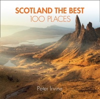 Reisgids Scotland the Best 100 Places - Schotland | Collins
100 beautiful places in Scotland to walk, eat and sleep Peter Irvine, bestselling author of SCOTLAND THE BEST,has selected 100 extraordinary places that epitomise what istruly great about Scotland. This …
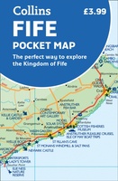 Wegenkaart - landkaart Pocket Map Fife | Collins
Handy little full colour map of the coastal Kingdom of Fife. Detailed mapping and tourist information from Dundee in the North to Edinburgh in the south and from Fife coast …
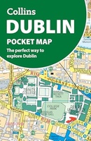 Stadsplattegrond Pocket Map Dublin | Collins
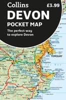 Wegenkaart - landkaart Pocket Map Devon | Collins
Handy little full colour map of Devon. Main features of this map include: • Clear mapping • Main tourist attractions located and described • Ideal for touring with sights, …
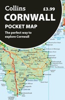 Wegenkaart - landkaart Pocket Map Cornwall | Collins
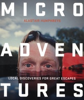 Reisgids Microadventures | Collins
Deze praktische gids staat vol met ideeën voor microadventures - om zelf of met vrienden en familie te beleven - en meer dan 150 verbluffende foto's, plus tips en advies …
 Reisgids - Accommodatiegids North Coast 500 | Collins
A guide to the best places to enjoy the local Scottish cuisine and where to rest for the night along the famous North Coast 500. Elemental, enchanting and inspiring, the …
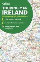 Wegenkaart - landkaart Ireland | Collins
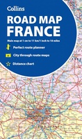 Wegenkaart - landkaart France road map | Collins
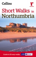 Wandelgids Northumbria short walks | Collins
 Wandelgids Park Rangers Favourite Walks South Downs | Collins
Compacte wandelgids met 20 wandelingen geselecteerd door park rangers en met duidelijke beschrijvingen en routekaartjes. Walking guide to the South Downs National Park, with 20 best routes chosen by …
 Wandelgids Park Rangers Favourite Walks Northumberland | Collins
The perfect companions for exploring the National Parks. Walking guide to the Northumberland National Park, with 20 best routes chosen by the park rangers. Each walk varies in length from …
 Wegenkaart - landkaart National Park Pocket Map Pembrokeshire Coast | Collins
Duidelijke pocket wandelkaart met belangrijke toeristische informatie, bezienswaardigheden, campeerplekken e.d. Handy little full colour map and guide of Pembrokeshire Coast National Park. Detailed mapping and visitor information to the National …
★★★★★ Wegenkaart - landkaart Pocket Map Shetland pocket map | Collins
Discover new places with handy pocket maps from Collins. The Shetland Islands, Scotland’s northernmost archipelago, are famous for their wild beauty, rich Viking heritage, and dramatic coastal scenery. With …
Laatste reviews

Uitstekend
★★★★★ door Nelly van Ginkel 24 juli 2026 | Heeft dit artikel gekocht
Fijne kaart waterafstootend.
★★★★★ door Nicole 21 juli 2026 | Heeft dit artikel gekocht
Mooie helder kaart, netjes bezorgd
★★★★★ door Michael Rijke 21 juli 2026 | Heeft dit artikel gekocht
Fijne wandelkaart, gedetailleerd en met veel extra info. Super fijn om m voor onze vakantie al te kunnen kopen, zo kon de voorpret al beginnen …
★★★★★ door Wille Groenewolt 21 juli 2026 | Heeft dit artikel gekocht