Winkelwagen
Geen items in winkelwagen
Ga naar winkelwagen
Kaarten
De beste wegenkaarten, routekaarten, fiets- of wandelkaarten en topografische kaarten vindt u hier!
Gaat u wandelen, met de auto toeren of op andere manier de omgeving op uw vakantiebestemming verkennen? Onze tip: neem een goede kaart mee! Er zijn speciale kaarten beschikbaar voor campervakanties, fietsroutes, pelgrimsroutes, wandeltochten en veel meer. Ook wegenatlassen en wegenkaarten kunnen handig zijn onderweg.
 Wandelkaart 140 Weminuche Wilderness /CO | National Geographic
 Wandelkaart - Topografische kaart 140 OS Explorer Map Quantock Hills, Bridgewater | Ordnance Survey
 Wandelkaart - Topografische kaart 140 Landranger Leicester, Coventry & Rugby | Ordnance Survey
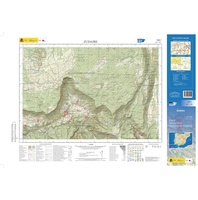 Topografische kaart 140-I Zudaire | CNIG - Instituto Geográfico Nacional1
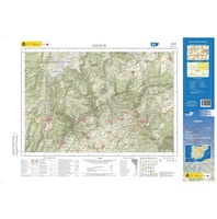 Topografische kaart 140-II Lezáun | CNIG - Instituto Geográfico Nacional1
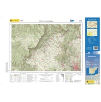 Topografische kaart 140-III Estella-Lizarra | CNIG - Instituto Geográfico Nacional1
 Topografische kaart 140-IV Abárzuza/Abartzuza | CNIG - Instituto Geográfico Nacional1
 Wandelkaart - Topografische kaart 141 Landranger Kettering and Corby | Ordnance Survey
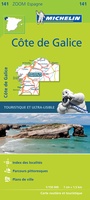 Wegenkaart - landkaart 141 Galicië - Costa de Galicia | Michelin
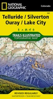 Wandelkaart - Topografische kaart 141 Telluride, Silverton, Ouray, Lake City | National Geographic
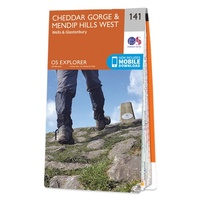 Wandelkaart - Topografische kaart 141 OS Explorer Map Cheddar Gorge, Mendip Hills West | Ordnance Survey★★★★★
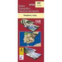 Topografische kaart 141 MT50 Pamplona-Iruña | CNIG - Instituto Geográfico Nacional
 Wandelkaart 141 WK Julische Alpen | Freytag & Berndt★★★★★
 Wandelkaart - Topografische kaart 1412OT Pointe Du Hoc - Omaha Beach | IGN - Institut Géographique National★★★★★
 Wandelkaart - Topografische kaart 1413 SB - Serie Bleue Condé-sur-Vire, Caumont- sur-Aure | IGN - Institut Géographique National
 Wandelkaart - Topografische kaart 1414 SB - Serie Bleue Vire Normandie, Souleuvre en Bocage | IGN - Institut Géographique National
 Wandelkaart - Topografische kaart 1415 SB - Serie Bleue Tinchebray - Bocage | IGN - Institut Géographique National
 Wandelkaart - Topografische kaart 1416 SB - Serie Bleue Le Teilleul | IGN - Institut Géographique National
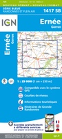 Wandelkaart - Topografische kaart 1417 SB - Serie Bleue Ernée - Gorron | IGN - Institut Géographique National
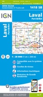 Wandelkaart - Topografische kaart 1418 SB - Serie Bleue Laval - Port-Brillet | IGN - Institut Géographique National★★★★★
Laatste reviews

Onmisbaar
Deze kaart is onmisbaar bij het wandelen in de Eifel, we lopen jaarlijks de Hermannsweg met een vergelijkbare kaart en we kunnen echt niet zonder, …
★★★★★ door R. van den Driesche 01 juli 2026 | Heeft dit artikel gekocht
Prima kaart doe vlot is geleverd.
Ideale kaart om als toerist door Jutland te trekken. Prettige schaal.
★★★★★ door Irma van Hof 01 juli 2026 | Heeft dit artikel gekocht
Prima wandelgidsen
Kompassboekjes zijn prima gidsen. Dat wordt een leuke vakantie.
★★★★★ door Anna 01 juli 2026 | Heeft dit artikel gekocht
Handig formaat en gedetailleerd
Perfecte wegenatlas en door het A4 formaat handiger dan een uitvouwbare kaart. Fijne combinatie van de wegenatlas en het navigatiesysteem van google maps
★★★★★ door Hay van Emden 30 juni 2026 | Heeft dit artikel gekocht