Winkelwagen
Geen items in winkelwagen
Ga naar winkelwagen
Top 25
De kaarten van IGN (kort voor Institute Geographique National), wandelkaarten voor Frankrijk, zijn van een ongekend hoog niveau. Met name de wandelkaarten 1:25.000 vinden wij geweldig: werkelijk alles staat erop, de kaarten bevatten zeer veel details en het kleurgebruik is fantastisch, waardoor alles ook nog eens heel goed leesbaar. Je hoort het: wij zijn fan van deze kaarten!
 2534OT Monts du Cézallier | IGN - Institut Géographique National
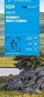 Wandelkaart 2537OT Nasbinals - Monts d'Aubrac | IGN - Institut Géographique National
 Wandelkaart 2538OT Ste-Eulalie-d'Olt | IGN - Institut Géographique National
 Wandelkaart 2541OT Millau / St-Affrique / PNR Grands Causses | IGN - Institut Géographique National
 Wandelkaart - Topografische kaart 2542OT Camarès - Avène | IGN - Institut Géographique National
 Wandelkaart - Topografische kaart 2543OT Lamalou-les-Bains, Olargues, Roquebrun, Le Caroux, PNR du Haut Languedoc | IGN - Institut Géographique National★★★★★
 2545ET Béziers | IGN - Institut Géographique National1★★★★★
 Wandelkaart - Topografische kaart 2545OT St-Chinian - L'etang de Montady | IGN - Institut Géographique National
 Wandelkaart - Topografische kaart 2546OT Narbonne | IGN - Institut Géographique National
 Wandelkaart 2548OT Perpignan / Plages du Roussillon | IGN - Institut Géographique National
 Wandelkaart - Topografische kaart 2549OT Banyuls-sur-Mer | IGN - Institut Géographique National
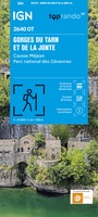 Topografische kaart - Wandelkaart 2640OT Gorges du Tarn et de la Jonte / Causse Méjan PNR | IGN - Institut Géographique National★★★★★
 Wandelkaart - Topografische kaart 2641ET Mont Aigoual | IGN - Institut Géographique National
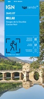 Wandelkaart 2641OT Millau / Gorges de la Dourbie / Causse Noir | IGN - Institut Géographique National★★★★★
 Wandelkaart - Topografische kaart 2642ET St.-Guilhem-le-Desert | IGN - Institut Géographique National
 Wandelkaart - Topografische kaart 2642OT Le Caylar - La Couvertoirade | IGN - Institut Géographique National★★★★★
 Wandelkaart 2643ET Clermont-l'Hérault | IGN - Institut Géographique National
 Wandelkaart - Topografische kaart 2643OT Lodeve | IGN - Institut Géographique National
 Wandelkaart - Topografische kaart 2644OT Pézenas - Murviel-lès-Béziers | IGN - Institut Géographique National
 Wandelkaart - Topografische kaart 2645ET Cap d'Agde - Sète - Etang de Thau | IGN - Institut Géographique National
Laatste reviews

Bruikbare kaart
Bruikbare kaart door interessante delen van Spanje. Er moet wel nog informatie bijgezocht worden
★★★★★ door Jef 27 december 2025 | Heeft dit artikel gekocht
Prima kaart
Prima kaart die veel informatie biedt. Goed om ritten te plannen over geasfalteerde wegen
★★★★★ door Jef 27 december 2025 | Heeft dit artikel gekocht
Prima kaart
Goede kaart om ritten over geasfalteerde wegen te plannen. Biedt veel informatie.
★★★★★ door Jef 27 december 2025 | Heeft dit artikel gekocht
adventure ver zoek
Overbodige kaart die niet biedt wat de titel beloofd. Bevat nauwelijks bruikbare informatie
★★★★★ door Jef 27 december 2025 | Heeft dit artikel gekocht