Top 25
De kaarten van IGN (kort voor Institute Geographique National), wandelkaarten voor Frankrijk, zijn van een ongekend hoog niveau. Met name de wandelkaarten 1:25.000 vinden wij geweldig: werkelijk alles staat erop, de kaarten bevatten zeer veel details en het kleurgebruik is fantastisch, waardoor alles ook nog eens heel goed leesbaar. Je hoort het: wij zijn fan van deze kaarten!
 Wandelkaart - Topografische kaart 1433OT Soulac-Sur-Mer & Montalivet Pointe De Grave | IGN - Institut Géographique National
 Topografische kaart - Wandelkaart 1434OT Hourtin, Lacs d'Hourtin Et De Carcans | IGN - Institut Géographique National
 Wandelkaart - Topografische kaart 1446ET Tardets-Sorholus, Arette | IGN - Institut Géographique National★★★★★
 Wandelkaart - Topografische kaart 1512OT Bayeux Arromanches Les Bains Plages - Normandië | IGN - Institut Géographique National★★★★★
 Wandelkaart - Topografische kaart 1522ET Angers | IGN - Institut Géographique National
 Topografische kaart - Wandelkaart 1536OT Bordeaux / Sud Médoc | IGN - Institut Géographique National
 Wandelkaart - Topografische kaart 1545ET Pau | IGN - Institut Géographique National
 Wandelkaart - Topografische kaart 1546ET Laruns, Gourette | IGN - Institut Géographique National★★★★★
 Wandelkaart - Topografische kaart 1546OT Oloron-Sainte.Marie, Vallee d'Aspe | IGN - Institut Géographique National★★★★★
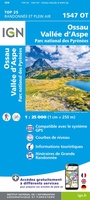 Wandelkaart - Topografische kaart 1547OT Ossau - Vallée D'Aspe | IGN - Institut Géographique National
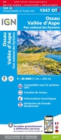 Wandelkaart - Topografische kaart 1547OTR Ossau - Vallée d'Aspe | IGN - Institut Géographique National
 Wandelkaart - Topografische kaart 1612OT Caen - Ouistreham , Normandië | IGN - Institut Géographique National
 Wandelkaart 1623ET Saumur / Bourgueil / Fontevraud-l'Abbaye | IGN - Institut Géographique National
 Wandelkaart - Topografische kaart 1647ET Lourdes, Argeles-Gazost, Le Lavedan, Pierrefitte-Nestalas, Aucun | IGN - Institut Géographique National★★★★★
 Wandelkaart - Topografische kaart 1647OT Vignemale, Ossau, Cauterets, Gourette | IGN - Institut Géographique National★★★★★
 Wandelkaart 1647OTR Vignemale | IGN - Institut Géographique National
 Wandelkaart - Topografische kaart 1710ET Le Havre, Etretat, PNR des Boucles Seine Normandie | IGN - Institut Géographique National★★★★★
 Wandelkaart - Topografische kaart 1711OT Honfleur Deauville | IGN - Institut Géographique National★★★★★
 Wandelkaart - Topografische kaart 1723ET Chinon | IGN - Institut Géographique National
 Wandelkaart - Topografische kaart 1747ET Bagnères-de-Bigorre | IGN - Institut Géographique National
Laatste reviews

Mooi om te geven
★★★★★ door Martsjen Wiersma 01 januari 2026 | Heeft dit artikel gekocht
Voor mij een lastig te gebruiken plattegrond. Moeilijk om hiermee te oriënteren in de omgeving.
★★★★★ door Marco 01 januari 2026 | Heeft dit artikel gekocht
dit boekje aangeschaft ter ondersteuning bij mogelijke taalproblemen; de waarde ervan zal blijken tijden de reis in juni 2026
★★★★★ door Bert Bosch 31 december 2025 | Heeft dit artikel gekocht
het is nog te vroeg om iets zinnigs over het up-to-date zijn van de wegenkaart te vermelden, daar de reis pas over enige maanden start
★★★★★ door Bert Bosch 31 december 2025 | Heeft dit artikel gekocht