Top 25
De kaarten van IGN (kort voor Institute Geographique National), wandelkaarten voor Frankrijk, zijn van een ongekend hoog niveau. Met name de wandelkaarten 1:25.000 vinden wij geweldig: werkelijk alles staat erop, de kaarten bevatten zeer veel details en het kleurgebruik is fantastisch, waardoor alles ook nog eens heel goed leesbaar. Je hoort het: wij zijn fan van deze kaarten!
 Wandelkaart - Topografische kaart 0822OT Belle-Ile - Ile d'Houat et d'Hoëdic Bretagne | IGN - Institut Géographique National★★★★★
 Wandelkaart - Topografische kaart 0916ET Erquy - le Val-André | IGN - Institut Géographique National
 Wandelkaart - Topografische kaart 0916OT Saint-Brieuc | IGN - Institut Géographique National★★★★★
 Wandelkaart - Topografische kaart 0921OT Vannes | IGN - Institut Géographique National★★★★★
 Wandelkaart - Topografische kaart 0921OTR Vannes / Golfe du Morbihan | IGN - Institut Géographique National
 Wandelkaart - Topografische kaart 1016ET St.-Cast-le-Guildo - Cap Fréhel | IGN - Institut Géographique National
 Wandelkaart - Topografische kaart 1022ET Saint-Nazaire & Parc Naturel Regional de Briere | IGN - Institut Géographique National
 Wandelkaart - Topografische kaart 1022OT La Roche-Bernard & Parc Naturel Regional de Briere | IGN - Institut Géographique National
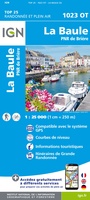 Topografische kaart - Wandelkaart 1023OT La Baule & Parc Naturel Regional de Briere | IGN - Institut Géographique National
 Wandelkaart - Topografische kaart 1116ET Saint-Malo – Dinard – Dinan – Rothéneuf – Cancale – Châteauneuf-d'ille-Vilaine | IGN - Institut Géographique National
 Wandelkaart - Topografische kaart 1123OT Saint-Nazaire - Pornic – Cote de Jade | IGN - Institut Géographique National
 Wandelkaart - Topografische kaart 1125OT Ile de Noirmoutier, Beauvoir-sur-Mer & Bourgneuf-en-Ret | IGN - Institut Géographique National
 Wandelkaart - Topografische kaart 1126OT Ile d'Yeu, Saint-Gilles-Croix-de-Vie & Saint-Jean-de-Mont | IGN - Institut Géographique National
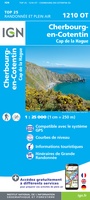 Wandelkaart - Topografische kaart 1210OT Cherbourg-en-Cotentin, Cap de la Hague | IGN - Institut Géographique National
 Wandelkaart - Topografische kaart 1211OT Les Pieux, Barneville, Carteret | IGN - Institut Géographique National
 Topografische kaart - Wandelkaart 1212ET La Haye-du-Puits / Lessay | IGN - Institut Géographique National
 Wandelkaart - Topografische kaart 1214ET Granville, Coutances, Iles Chausey | IGN - Institut Géographique National
 Wandelkaart - Topografische kaart 1215ET Avranches, Granville, Le Mont Saint Michel | IGN - Institut Géographique National
 Wandelkaart - Topografische kaart 1215OT Le Mont St.-Michel, Dol-de-Bretagne | IGN - Institut Géographique National
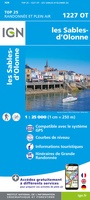 Wandelkaart 1227OT Les Sables-d'Olonne | IGN - Institut Géographique National
Laatste reviews

Bevat de gehele Picos de Europa. Goed in detail. Alle routes GR en PR-PNPE. Refugres en nog veel meer. Schaal 1 op 25.000 is fijn …
★★★★★ door M H 03 april 2026 | Heeft dit artikel gekocht
De bestelling snel en netjes afgehandeld
★★★★★ door Tiny Waltmans 03 april 2026 | Heeft dit artikel gekocht
Ik ben dol op de veldkaarten over verschillende vogelsoorten, per land of werelddelen. Deze keer de kaart besteld over vogelsoorten in Afrika en tijdens mijn …
★★★★★ door Kelly Bosch 02 april 2026 | Heeft dit artikel gekocht
Precies wat ik zocht. De informatie op de website was duidelijk en klopte. Het was eerst niet leverbaar, maar ik had aangegeven dat ik bericht …
★★★★★ door Mieke van den Broek 01 april 2026 | Heeft dit artikel gekocht