Winkelwagen
Geen items in winkelwagen
Ga naar winkelwagen
Top 25
De kaarten van IGN (kort voor Institute Geographique National), wandelkaarten voor Frankrijk, zijn van een ongekend hoog niveau. Met name de wandelkaarten 1:25.000 vinden wij geweldig: werkelijk alles staat erop, de kaarten bevatten zeer veel details en het kleurgebruik is fantastisch, waardoor alles ook nog eens heel goed leesbaar. Je hoort het: wij zijn fan van deze kaarten!
 Wandelkaart - Topografische kaart 1245OT Hendaye - St.Jean de Luz - Cote d'Argent | IGN - Institut Géographique National
 Wandelkaart 1310OT Cherbourg-en-Cotentin / Pointe de Barfleur | IGN - Institut Géographique National
 Wandelkaart - Topografische kaart 1311OT Valoges - Ste-Mère-Eglise Utah Beach | IGN - Institut Géographique National
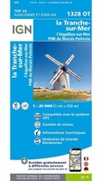 Wandelkaart 1328OT La Tranche-s-Mer / l'Aiguillon-s-Mer PNR Marais Poitevin | IGN - Institut Géographique National
 Wandelkaart - Topografische kaart 1329ET La Rochelle - Anse de l'Aiguillon | IGN - Institut Géographique National
 Wandelkaart - Topografische kaart 1329OT Ile De Re | IGN - Institut Géographique National
 Wandelkaart - Topografische kaart 1330OT Ile d'Oleron & Ile d'Aix | IGN - Institut Géographique National
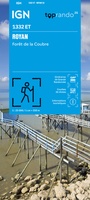 Wandelkaart 1332ET Royan / Forêt de la Coubre | IGN - Institut Géographique National
 Wandelkaart - Topografische kaart 1336ET Lac de Lacanau & Le Porge | IGN - Institut Géographique National
 Wandelkaart - Topografische kaart 1337ET Bassin D'Arcachon | IGN - Institut Géographique National★★★★★
 Wandelkaart - Topografische kaart 1339ET Biscarrosse | IGN - Institut Géographique National
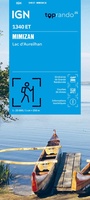 Wandelkaart 1340ET Mimizan / Lac d'Aureilhan | IGN - Institut Géographique National
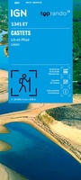 Wandelkaart 1341ET Castets / Lit-et-Mixe / Léon | IGN - Institut Géographique National
 Wandelkaart 1343OT Capbreton / Vieux-Boucau-les-Bains / Soustons | IGN - Institut Géographique National
 Wandelkaart - Topografische kaart 1344OT Bayonne | IGN - Institut Géographique National
 Wandelkaart - Topografische kaart 1345OT Cambo-les-Bains – Hasparren | IGN - Institut Géographique National
 Topografische kaart - Wandelkaart 1346ET Forêt d'Iraty - Pic d'Orly | IGN - Institut Géographique National
 Topografische kaart - Wandelkaart 1346OT St.-Jean-Pied-de-Port | IGN - Institut Géographique National
 Wandelkaart - Topografische kaart 1412OT Pointe Du Hoc - Omaha Beach | IGN - Institut Géographique National★★★★★
 Wandelkaart 1430OT Rochefort / Marennes | IGN - Institut Géographique National
Laatste reviews

Duidelijk, overzichtelijk en geplastificeerde wandelkaart
Uitstekend
★★★★★ door Nelly van Ginkel 24 juli 2026 | Heeft dit artikel gekocht
Handige kaart
Fijne kaart waterafstootend.
★★★★★ door Nicole 21 juli 2026 | Heeft dit artikel gekocht
Mooie kaart.
Mooie helder kaart, netjes bezorgd
★★★★★ door Michael Rijke 21 juli 2026 | Heeft dit artikel gekocht
Mooie wandelkaart, lekker stevig ook!
Fijne wandelkaart, gedetailleerd en met veel extra info. Super fijn om m voor onze vakantie al te kunnen kopen, zo kon de voorpret al beginnen …
★★★★★ door Wille Groenewolt 21 juli 2026 | Heeft dit artikel gekocht