Wandelkaart - Topografische kaart 263 Grand Canyon West | National Geographic (9781566954969)
Grand Canyon National Park - Arizona

- ISBN / CODE: 9781566954969
- Editie: 01-12-2024
- Aantal blz.: 1
- Schaal: 1:90000
- Uitgever: National Geographic
- Soort: Topografische kaart, Wandelkaart
- Taal: Engels
- Hoogte: 19.0 cm
- Breedte: 10.0 cm
- Gewicht: 95.0 g
- Uitvoering: Scheur- en watervast
- Schrijf als eerste een review
-
€ 17,95
Op voorraad
Op werkdagen vóór 17:00 besteld = dezelfde dag verzonden
Bezorging meestal binnen 1–2 werkdagen. Levertijd BelgieGratis verzending in Nederland vanaf €50,-
-
Overzicht Wandelkaarten Arizona Trails Illustrated National Geographic

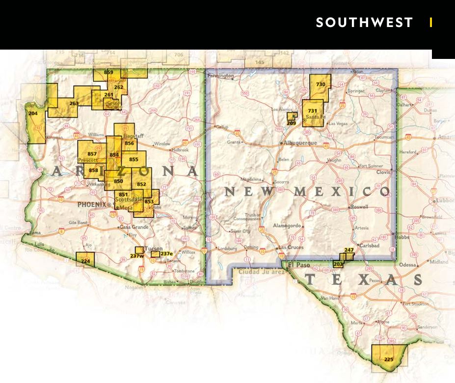
Producten op deze overzichtskaart:
Klik op een product om naar de pagina van dat product te gaan.
- Wandelkaart - Topografische kaart 213 Glen Canyon National Recreation Area | National Geographic
- Wandelkaart - Topografische kaart 224 Organ Pipe Cactus National Monument | National Geographic
- Wandelkaart - Topografische kaart 261 Grand Canyon | National Geographic
- Wandelkaart 262 Grand Canyon East - Oost | National Geographic
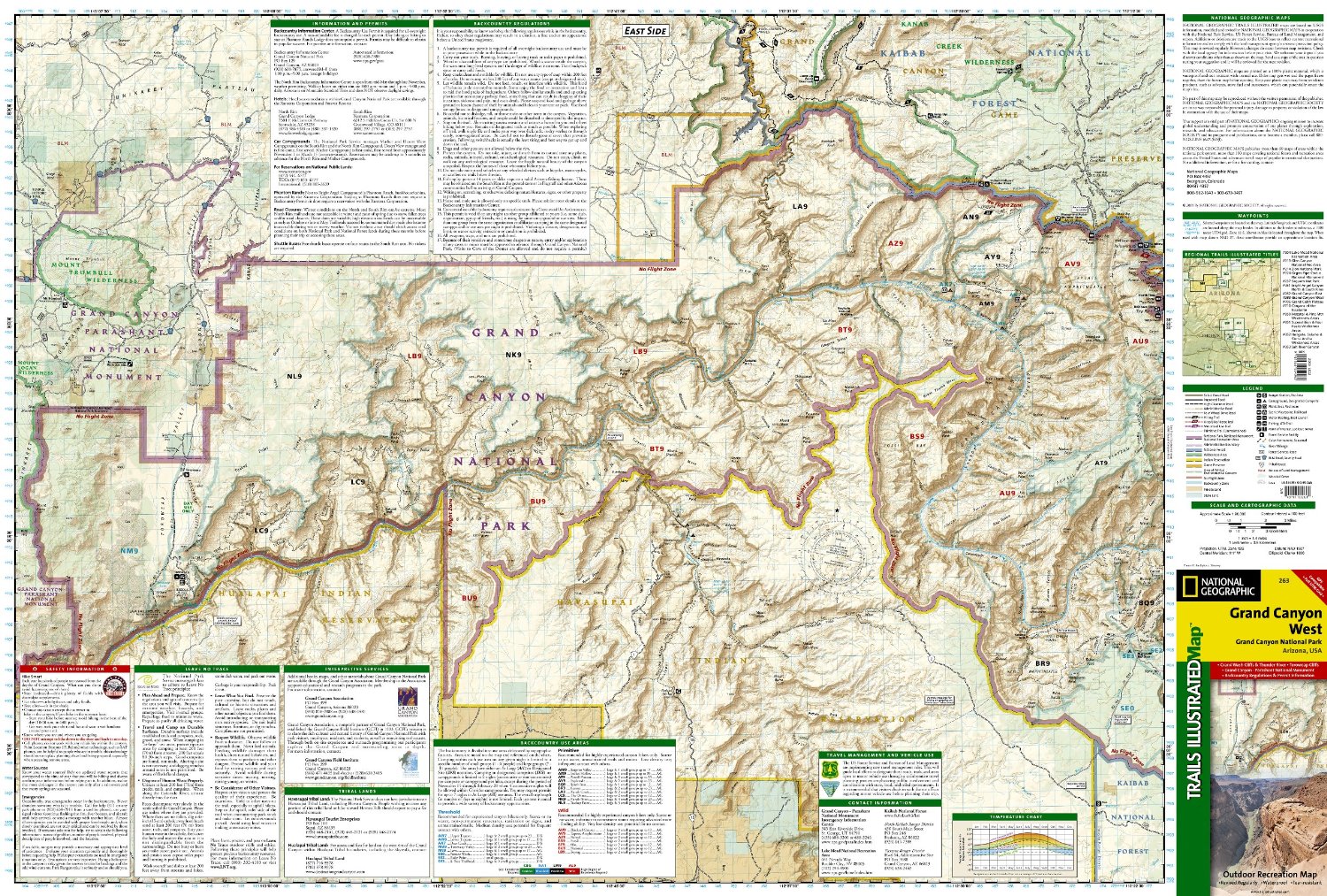
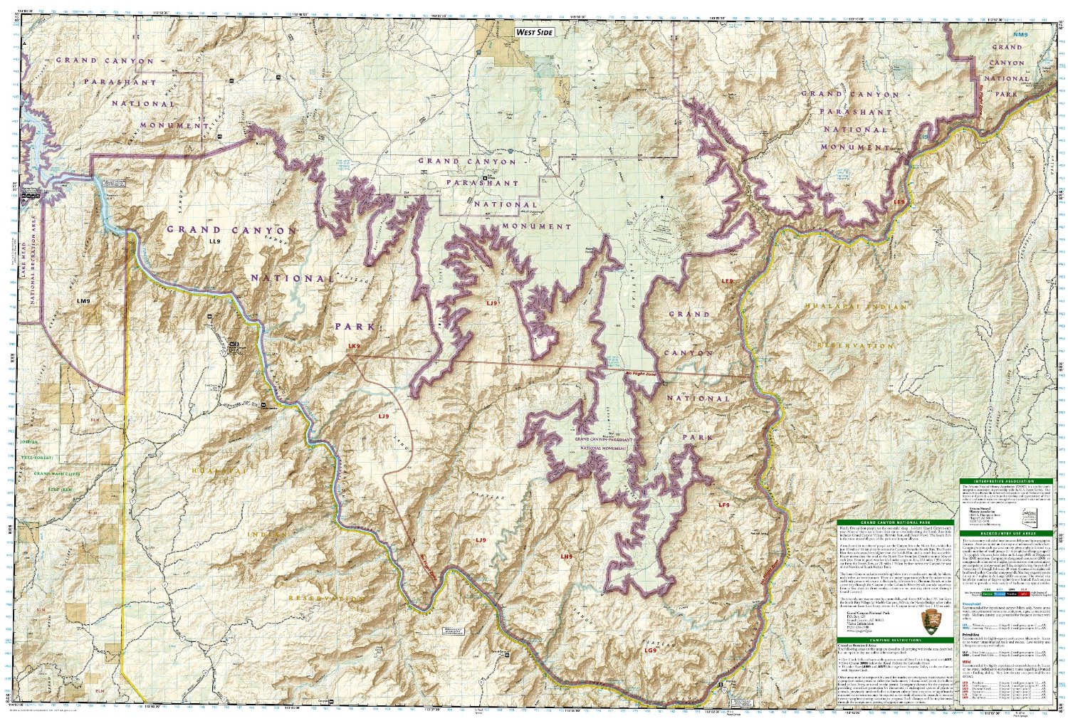
- Wandelkaart - Topografische kaart 263 Grand Canyon West | National Geographic
- Wandelkaart 852 Hellsgate, Salome, Sierra Ancha Wilderness Areas | National Geographic
Overzichtskaarten
Beschrijving
Prachtige geplastificeerde kaart van het nationaal park. Met alle recreatieve voorzieningen als campsites, maar ook met topografische details en wandelroutes ed. Door uitgekiend kleurgebruik zeer prettig in gebruik. Scheur en watervast!
Reviews
Geen reviews gevonden voor dit product.
Schrijf een review
Graag horen wij wat u van dit artikel vindt. Vindt u het goed, leuk, mooi, slecht, lelijk, onbruikbaar of erg handig: schrijf gerust alles op! Het is niet alleen leuk om te doen maar u informeert andere klanten er ook nog mee!
Ook interessant voor noord-amerika/verenigde-staten-van-amerika/nationale-parken
-

Wandelkaart - Topografische kaart 31
€ 14,95Topografische kaarten Nationale Parken Verenigde Staten van Amerika -

Wegenkaart - landkaart 3121 United S
€ 18,50Wegenkaarten Rocky Mountains -

Wandelkaart - Topografische kaart 21
€ 17,95Topografische kaarten Nationale Parken Verenigde Staten van Amerika -

Wandelkaart - Topografische kaart 24
€ 17,95Topografische kaarten Nationale Parken Verenigde Staten van Amerika -

Wandelkaart - Topografische kaart 20
€ 17,95Topografische kaarten Nationale Parken Verenigde Staten van Amerika