
Winkelwagen
Geen items in winkelwagen
Ga naar winkelwagen
Wandelkaart 217 Skiathos | Road Editions (9789604489701)
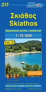
- ISBN / CODE: 9789604489701
- Editie: 01-02-2018
- Aantal blz.: 1
- Schaal: 1:15000
- Uitgever: Road Editions
- Soort: Wandelkaart
- Taal: Engels, andere talen
- Hoogte: 25.0 cm
- Breedte: 13.0 cm
- Gewicht: 71.0 g
- Uitvoering: Scheur- en watervast
- Bindwijze: -
- Schrijf als eerste een review
-
€ 9,95
Dit artikel is (tijdelijk) niet leverbaar
Beschrijving
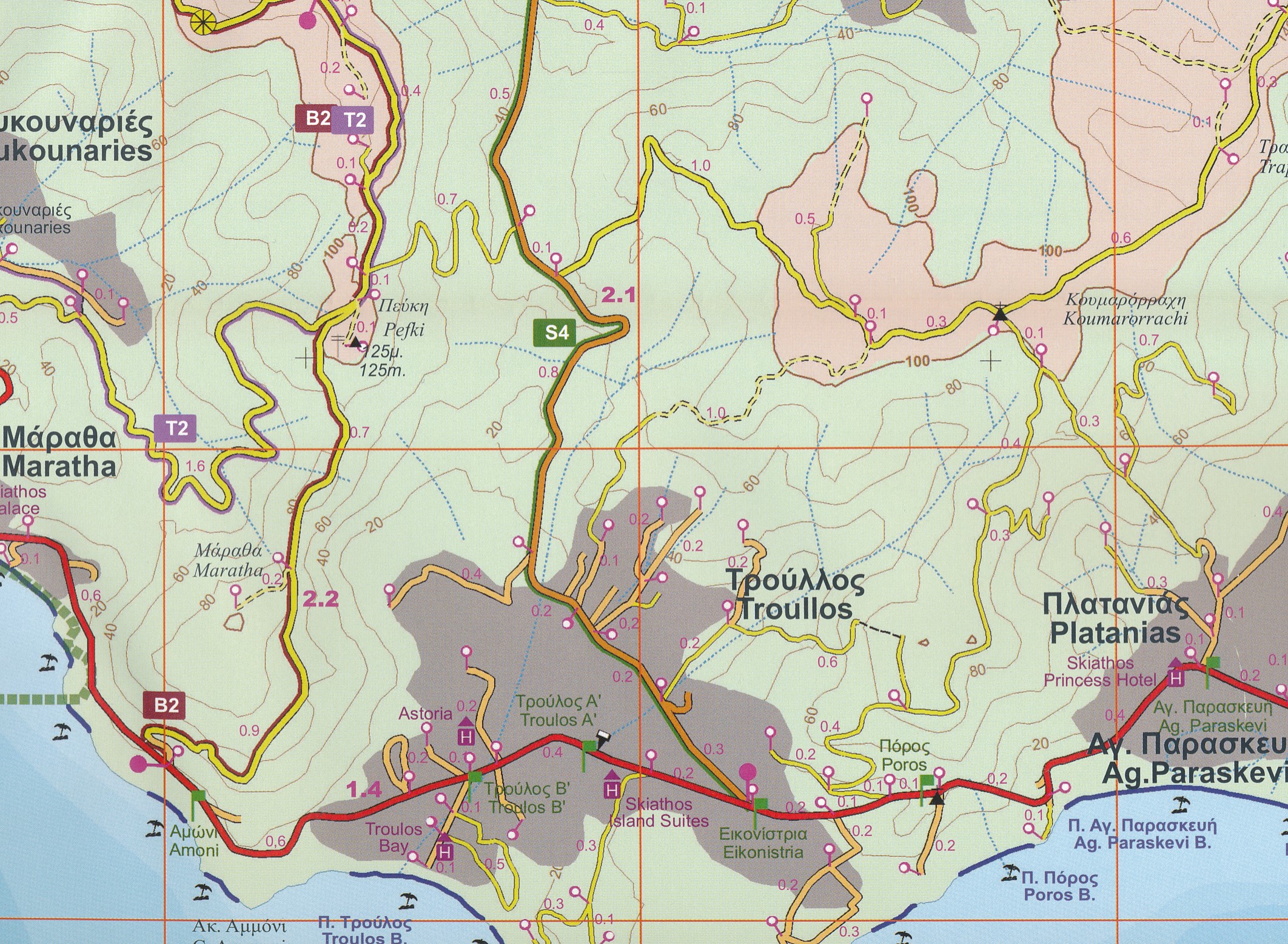
Gedetailleerde wegenkaart met aanduiding van de wandelwegen, lijst van hotels en toeristische informatie. Voor alle doeleinden een zeer geschikte kaart.
The features that make this and every other ROAD island map unique are:
*The coastline, hydrography and precision geophysical background based on data provided by the Hellenic Military Geographic Service and electronically processed by us for clarity and legibility. We have highlighted the mountain masses in shades of brown between the contour lines (at 20m intervals on this map) to outline clearly the relief of the island.
*The beaches are indicated by a special symbol next to which we have noted their names, as well as all the roads and footpaths leading to them (since most people primarily visit the islands for the beaches!). We have even included a short text in which the island’s best beaches are concisely referred to, to save you going on a wild goose hunt in search of them.
*The road network is mapped out with impressive and exemplary thoroughness and is updated in each new edition – thoroughness being a trait ROAD is internationally famous for. Even the most insignificant secondary and blind unsurfaced roads are charted (so that you know where not to turn!), with scenic routes specially highlighted in green (telling you where you should turn!) and precision distance measurements from intersection to intersection, to allow you to track your course with greater ease.
*The island’s major footpaths are clearly charted.
*The monasteries, country churches, archaeological sites, lighthouses, caves and many more places of interest, are marked with great accuracy.
*Short texts (in Greek and English) that present the history, the island as it is today, the local products and the most important things to know about the island.
*On the back of the map, which is also in colour, there is a complete listing of the accommodations on the island, useful telephone numbers, information about local transport schedules etc., as well as a short tour of the island and many photographs
Reviews
Geen reviews gevonden voor dit product.
Schrijf een review
Graag horen wij wat u van dit artikel vindt. Vindt u het goed, leuk, mooi, slecht, lelijk, onbruikbaar of erg handig: schrijf gerust alles op! Het is niet alleen leuk om te doen maar u informeert andere klanten er ook nog mee!
Alle gerelateerde rubrieken >
Ook interessant voor europa/griekenland/eilandensporadenmiddenoost
-
Wandelkaart 3.1/6.4 Zagori - Valia K
€ 12,95Wandelkaarten Vasteland Griekenland -

Wegenkaart - landkaart 301 Zakynthos
€ 8,95Wegenkaarten ♦ Zakynthos -
Wegenkaart - landkaart 327 Leros | O
€ 7,95Wegenkaarten Dodecanesos (zuid -oost) -

Wandelkaart - Wegenkaart - landkaart
€ 13,95Wandelkaarten Sporaden (midden - oost) -

Wandelkaart 306 Milos - Kimolos | Te
€ 13,95Wandelkaarten Cycladen Zuid



