Winkelwagen
Geen items in winkelwagen
Ga naar winkelwagen
Kaarten - Vogezen - Elzas - Lotharingen
 Wandelkaart - Topografische kaart 3613 SB - Serie Bleue Forbach - Sarreguemines | IGN - Institut Géographique National
 Wandelkaart - Topografische kaart 3613ET Sarreguemines | IGN - Institut Géographique National
 Wandelkaart - Topografische kaart 3614ET Sarre-Union - Phalsbourg | IGN - Institut Géographique National
 Wandelkaart - Topografische kaart 3616OT Lac de Pierre-Percée - Le Donon | IGN - Institut Géographique National★★★★★
 Wandelkaart - Topografische kaart 3617OT St-Dié-des-Vosges | IGN - Institut Géographique National
 Wandelkaart - Topografische kaart 3618OT Le Hohneck - Gérardmer | IGN - Institut Géographique National★★★★★★★★★★
 Wandelkaart - Topografische kaart 3619OT Bussang - La Bresse | IGN - Institut Géographique National★★★★★★★★★★
 Wandelkaart - Topografische kaart 3620ET Grand Ballon | IGN - Institut Géographique National★★★★★
 Wandelkaart - Topografische kaart 3621ET Dannemarie - Delle - Sundgau | IGN - Institut Géographique National
 Wandelkaart - Topografische kaart 3621OT Belfort - Montbeliard | IGN - Institut Géographique National
 Wandelkaart - Topografische kaart 3713ET Pays de Bitche - Dambach - PNR des Vosges du Nord | IGN - Institut Géographique National
 Wandelkaart - Topografische kaart 3714ET la Petite Pierre - Petite Pierre, Niederbronn-les-Bains, PNR Vosges du Nord | IGN - Institut Géographique National
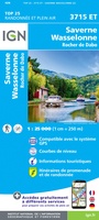 Wandelkaart - Topografische kaart 3715ET Wasselone - Rocher de Dabo - Saverne | IGN - Institut Géographique National
 Wandelkaart - Topografische kaart 3715OT Sarrebourg - Phalsbourg - Pays des Etangs | IGN - Institut Géographique National★★★★★
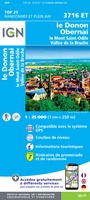 Wandelkaart - Topografische kaart 3716ET le Donon, Obernai, Mont Ste-Odile | IGN - Institut Géographique National★★★★★
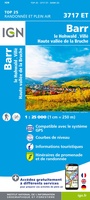 Wandelkaart - Topografische kaart 3717ET Barr - Le Howald - Villé - Vallée de la Bruche | IGN - Institut Géographique National★★★★★
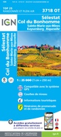 Wandelkaart - Topografische kaart 3718OT Selestat - Col Du Bonhomme | IGN - Institut Géographique National★★★★★
 Wandelkaart - Topografische kaart 3719 SB - Serie Bleue Colmar | IGN - Institut Géographique National
 Wandelkaart - Topografische kaart 3719OT Colmar & Le Hohneck | IGN - Institut Géographique National★★★★★★★★★★
 Wandelkaart - Topografische kaart 3720ET Mulhouse | IGN - Institut Géographique National
Laatste reviews

Jacobspad Uithuizen - Hasselt; De ontvanger was er heel blij mee
Mooi om te geven
★★★★★ door Martsjen Wiersma 01 januari 2026 | Heeft dit artikel gekocht
Moeilijk te zien
Voor mij een lastig te gebruiken plattegrond. Moeilijk om hiermee te oriënteren in de omgeving.
★★★★★ door Marco 01 januari 2026 | Heeft dit artikel gekocht
vermoedelijk een nuttig boekje naast Google translate
dit boekje aangeschaft ter ondersteuning bij mogelijke taalproblemen; de waarde ervan zal blijken tijden de reis in juni 2026
★★★★★ door Bert Bosch 31 december 2025 | Heeft dit artikel gekocht
inspiratie voor de te kiezen reisroute
het is nog te vroeg om iets zinnigs over het up-to-date zijn van de wegenkaart te vermelden, daar de reis pas over enige maanden start
★★★★★ door Bert Bosch 31 december 2025 | Heeft dit artikel gekocht