Winkelwagen
Geen items in winkelwagen
Ga naar winkelwagen
Kaarten - Vienne (departement)
 Wegenkaart - landkaart 322 Deux Sevres - Vienne | Michelin
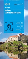 Wandelkaart 2027 SB - Serie Bleue Bélâbre / Saint-Benoît-du-Sault | IGN - Institut Géographique National
 Wandelkaart - Topografische kaart 1724 SB - Serie Bleue Loudun – Richelieu | IGN - Institut Géographique National★★★★★
 Wandelkaart - Topografische kaart 1725 SB - Serie Bleue Lencloitre, St-Jean-de-Sauves | IGN - Institut Géographique National
 Wandelkaart 1726 SB - Serie Bleue Neuville-de-Poitou - Vouillé - Mirebeau | IGN - Institut Géographique National
 Wandelkaart 1727 SB - Serie Bleue Poitiers - Coulombiers | IGN - Institut Géographique National
 Wandelkaart - Topografische kaart 1728 SB - Serie Bleue Vivonne - Lusignan | IGN - Institut Géographique National
 Wandelkaart - Topografische kaart 1729 SB - Serie Bleue Civray - Sauze - Vaussais | IGN - Institut Géographique National
 Wandelkaart - Topografische kaart 1825 SB - Serie Bleue Chatellerault - Descartes | IGN - Institut Géographique National
 Wandelkaart - Topografische kaart 1826 SB - Serie Bleue Vouneuil-sur-Vienne, Archigny, Jaunay-Clan | IGN - Institut Géographique National
 Wandelkaart - Topografische kaart 1827 SB - Serie Bleue Poitiers - Chauvigny | IGN - Institut Géographique National
 Wandelkaart - Topografische kaart 1828 SB - Serie Bleue Gençay - Persac | IGN - Institut Géographique National
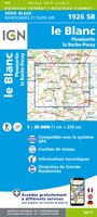 Wandelkaart - Topografische kaart 1926 SB - Serie Bleue Le Blanc, Pleumartin, La Roche-Posay | IGN - Institut Géographique National
 Wandelkaart - Topografische kaart 1927 SB - Serie Bleue La Trimouille | IGN - Institut Géographique National
 Wandelkaart - Topografische kaart 1928 SB - Serie Bleue Montmorillon, Lathus-St-Rémy | IGN - Institut Géographique National
 Wegenkaart - landkaart 11 TOP 250 Nouvelle-Aquitaine - Bassin Aquitain | IGN - Institut Géographique National
 Wegenkaart - landkaart 10 TOP 250 Nouvelle-Aquitaine - Limousin - Poitou | IGN - Institut Géographique National
 Fietskaart - Wegenkaart - landkaart D86 Top D100 Vienne Poitiers Châtellerault Loudun Montmorillon | IGN - Institut Géographique National
 Wandelkaart - Topografische kaart 1829 SB - Serie Bleue L'Isle-Jourdain - Charroux | IGN - Institut Géographique National
 Wandelkaart 1623 SB - Serie Bleue Saumur / Doué-la-Fontaine | IGN - Institut Géographique National
Laatste reviews

Onmisbaar
Deze kaart is onmisbaar bij het wandelen in de Eifel, we lopen jaarlijks de Hermannsweg met een vergelijkbare kaart en we kunnen echt niet zonder, …
★★★★★ door R. van den Driesche 01 juli 2026 | Heeft dit artikel gekocht
Prima kaart doe vlot is geleverd.
Ideale kaart om als toerist door Jutland te trekken. Prettige schaal.
★★★★★ door Irma van Hof 01 juli 2026 | Heeft dit artikel gekocht
Prima wandelgidsen
Kompassboekjes zijn prima gidsen. Dat wordt een leuke vakantie.
★★★★★ door Anna 01 juli 2026 | Heeft dit artikel gekocht
Handig formaat en gedetailleerd
Perfecte wegenatlas en door het A4 formaat handiger dan een uitvouwbare kaart. Fijne combinatie van de wegenatlas en het navigatiesysteem van google maps
★★★★★ door Hay van Emden 30 juni 2026 | Heeft dit artikel gekocht