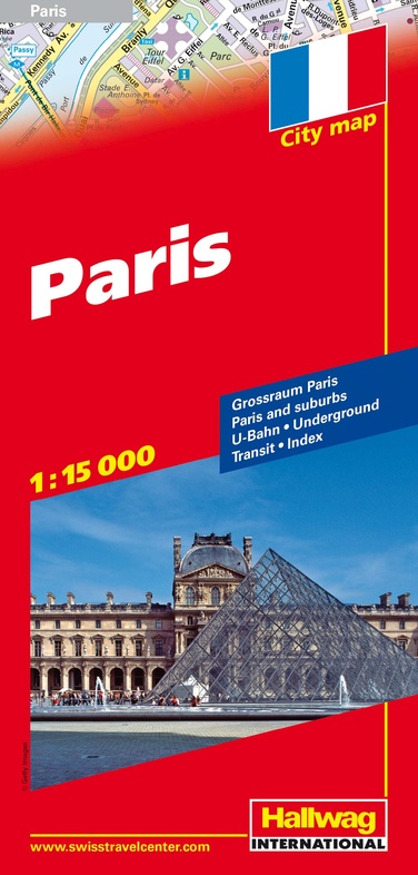
Stadsplattegrond City Map Parijs | Hallwag (9783828305274)
- ISBN / CODE: 9783828305274
- Schaal: 1:15000
- Uitgever: Hallwag
- Soort: Stadsplattegrond
- Serie: City Map
- Taal: Engels
- Uitvoering: -
- Bindwijze: -
- Schrijf als eerste een review
-
€ 7,95
Uitverkocht, nooit meer leverbaar
Beschrijving
Goede overzichtelijke stadsplattegrond van deze grote stad, waarbij de nadruk ligt op het centrum en de toeristische hoogtepunten. Met register, overzicht van openbaar vervoer en kleine inzetten van suburbs en de weg naar het vliegveld.
Paris within the Boulevard Péripherique at 1:15,000 on a clearly presented street plan from Hallwag, with a Metro/RER diagram, a map of the outer suburbs including Versailles and Disneyland, plus a road map of the city’s wider environs.
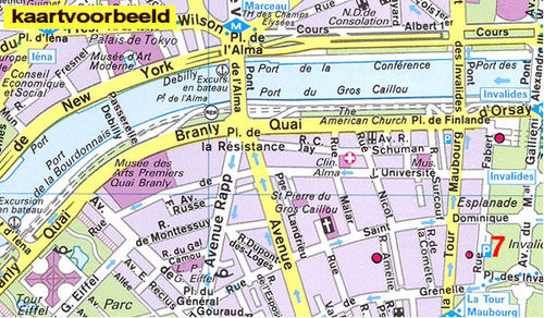
The plan covers the city within the Boulevard Péripherique, including parts of the Bois de Boulogne and Bois de Vincennes. Metro stations are prominently marked. For drivers the plan shows one way streets, selected car parks and names of exits from the ring road. Public buildings, including museums, are highlighted and named. Map legend includes English. The index, on the reverse side, lists streets outside the city’s administrative boundary separately by commune.
Also provided is a large, clear diagram of the Metro and RER networks, a road map of the city’s outer suburbs including access to Versailles, Disneyland and both Charles de Gaulle and Orly airports, plus a road map of the wider environs including Chartres, Fontainebleau, Compiègne, Senlis, Beauvais and Rouen.
Reviews
Geen reviews gevonden voor dit product.
Schrijf een review
Graag horen wij wat u van dit artikel vindt. Vindt u het goed, leuk, mooi, slecht, lelijk, onbruikbaar of erg handig: schrijf gerust alles op! Het is niet alleen leuk om te doen maar u informeert andere klanten er ook nog mee!
Ook interessant voor europa/frankrijk/parijs
-

Wegenkaart - landkaart 312 Essonne -
€ 11,95Wegenkaarten Seine-et-Marne -

Reisverhaal Op pad, zonder kameel |
€ 22,50Reisverhalen Ardennen -

Stadsplattegrond 52 Parijs - Paris c
€ 9,95Stadsplattegronden Parijs (departement) -

Reisgids Pocket Paris - Parijs | Lon
€ 14,95Reisgidsen Parijs -

Fietsgids Paris au Mont-Saint-Michel
€ 17,50Fietsgidsen Parijs (departement)