Winkelwagen
Geen items in winkelwagen
Ga naar winkelwagen
Normandische stranden
 Wegenkaart - landkaart 17617 Plages du Débarquement | Invasiestranden D-Day | Michelin
 Reisgids Major & Mrs Holt's Definitive Battlefield Guide to the D-Day Normandy Landing Beaches | Pen and Sword publications
 Historische Kaart Major & Mrs Holt's Battle Map of The Normandy D-Day Landing Beaches | Pen and Sword publications
 Reisgids Visiting the Normandy Invasion Beaches and Battlefields | Pen and Sword publications
 Reisgids Historische Route Normandië | Uitgeverij Elmar
 Reisgids The D-Day Visitor's Handbook, 80th Anniversary Edition | Skyhorse
 Reisgids ANWB Ontdek Normandië | ANWB Media★★★★★
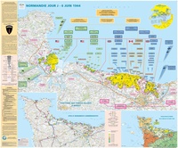 Wandkaart 70044 Normandie Jour J | D-Day | 132 x 100 cm | IGN - Institut Géographique National
 Wegenkaart - landkaart 87044 Normandie D Day, june 6, 1944 | IGN - Institut Géographique National★★★★★★★★★★
 Reisgids D-Day Landings - Normandie | Bradt Travel Guides
 Reisgids D-Day - een historische reisgids | Omniboek★★★★★
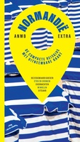 Reisgids ANWB extra Normandië | ANWB Media
Laatste reviews

Precies wat ik zocht en snel leverbaar.
Precies wat ik zocht. De informatie op de website was duidelijk en klopte. Het was eerst niet leverbaar, maar ik had aangegeven dat ik bericht …
★★★★★ door Mieke van den Broek 01 april 2026 | Heeft dit artikel gekocht
Perfect
Snelle levering, prima verpakt, en de atlas van Duitsland is precies wat ik had verwacht, heel erg goed.
★★★★★ door Wil Van der Vlist 01 april 2026 | Heeft dit artikel gekocht
Vlotte service en een prima product!
Vlotte service en prima kaart van Slovenie
★★★★★ door Bert van Jaarsveld 31 maart 2026 | Heeft dit artikel gekocht
Lekker lichtgewicht, maar wel goed overzicht.
132 dagen GR20 in het voorjaar en alles zelf meenemen, betekent dat iedere gram telt. Deze kaart geeft een mooi overzicht van de hele route …
★★★★★ door Martin-Jan Strebe 31 maart 2026 | Heeft dit artikel gekocht