Winkelwagen
Geen items in winkelwagen
Ga naar winkelwagen
Centre - Val de Loire
 Wandelkaart - Topografische kaart 2323 SB - Serie Bleue St-Martin-d'Auxigny, Foëcy | IGN - Institut Géographique National
 Wandelkaart - Topografische kaart 2324 SB - Serie Bleue Bourges, Mehun-sur-Yèvre | IGN - Institut Géographique National
 Wandelkaart - Topografische kaart 2413OT Dammartin-en-Goële, Centre | IGN - Institut Géographique National
 Wandelkaart - Topografische kaart 2414ET Marne-la-Vallée - Forêts: Crécy - Armainvilliers - Ferrières, Centre | IGN - Institut Géographique National
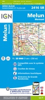 Wandelkaart - Topografische kaart 2416 SB - Serie Bleue Melun, Mormant | IGN - Institut Géographique National
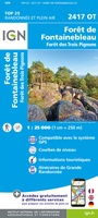 Wandelkaart - Topografische kaart 2417OT Forêt de Fontainebleau | IGN - Institut Géographique National★★★★★
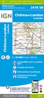 Wandelkaart - Topografische kaart 2418 SB - Serie Bleue Château-Landon, Corbeilles | IGN - Institut Géographique National
 Wandelkaart - Topografische kaart 2513OT Meaux - Vallée de l'Ourcq, Centre | IGN - Institut Géographique National
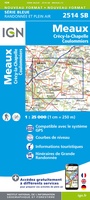 Wandelkaart - Topografische kaart 2514 SB - Serie Bleue Meaux | IGN - Institut Géographique National
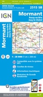 Wandelkaart - Topografische kaart 2515 SB - Serie Bleue Mormant, Rozay-en-Brie, Jouy-le-Châtel | IGN - Institut Géographique National
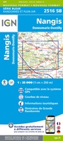 Wandelkaart - Topografische kaart 2516 SB - Serie Bleue Donnemarie-Dontilly, Nangis | IGN - Institut Géographique National
 Wandelkaart - Topografische kaart 2517 SB - Serie Bleue Montereau-Fault-Yonne, Moret-Loing-et-Orvanne | IGN - Institut Géographique National
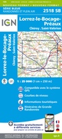 Wandelkaart - Topografische kaart 2518 SB - Serie Bleue Lorrez-le-Bocage-Préaux, Chéroy, St-Valérien | IGN - Institut Géographique National
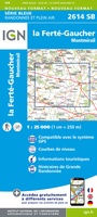 Wandelkaart - Topografische kaart 2614 SB - Serie Bleue La Ferté-Gaucher, Montmirail | IGN - Institut Géographique National
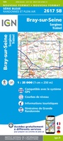 Wandelkaart - Topografische kaart 2617 SB - Serie Bleue Bray-sur-Seine | IGN - Institut Géographique National
 Fietskaart 2 Velo Ile-de-France a velo - by bike | IGN - Institut Géographique National
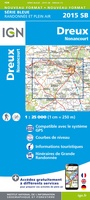 Wandelkaart - Topografische kaart 2015 SB - Serie Bleue Dreux - Nonancourt | IGN - Institut Géographique National
 Wandelkaart - Topografische kaart 2016 SB - Serie Bleue Chartres, Courville-sur-Eure | IGN - Institut Géographique National
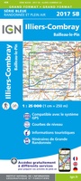 Wandelkaart - Topografische kaart 2017 SB - Serie Bleue Illiers-Combray, Bailleau-le-Pin | IGN - Institut Géographique National
 Topografische kaart - Wandelkaart 2018 SB - Serie Bleue Châteaudun - Brou | IGN - Institut Géographique National
Laatste reviews

Uitstekend
Ik gebruik deze kaart omdat ik een reis wil volgen van meerdere personen. Heb er veel plezier van.
★★★★★ door Loes Vechtmann 15 april 2026 | Heeft dit artikel gekocht
In een woord ..... "Puur"!!
Dit boek heeft me veel inzicht gegeven hoe om te gaan met jezelf in de wildernis. Een fijn, kwetsbaar en oprecht geschreven boek met veel …
★★★★★ door Arnold Jippes 15 april 2026 | Heeft dit artikel gekocht
An excellent detailed travel guide
The DK Eyewitness travel guide for Florence & Tuscany is an excellent guide with lots of details, including helpful photographs maps and diagrams of the …
★★★★★ door Andrew Wedgner 15 april 2026 | Heeft dit artikel gekocht
Goede kaart.
Wij zijn nu aan het reizen in zuid-west Australië. De kaart is heel goed te gebruiken. Blij mee!
★★★★★ door Wilma van der Maas 15 april 2026 | Heeft dit artikel gekocht