Aude
 Wandelkaart - Topografische kaart 2244 SB - Serie Bleue Revel, St-Félix-Lauragais, Sorèze | IGN - Institut Géographique National
IGN is bezig om de hele 25.000 serie vervangen: de oude versies Est en Ouest (E en O aanduiding achter het nummer van de kaart) gaan verdwijnen en worden vervangen …
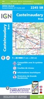 Wandelkaart - Topografische kaart 2245 SB - Serie Bleue Bram - Castelnaudary | IGN - Institut Géographique National
IGN is bezig om de hele 25.000 serie vervangen: de oude versies Est en Ouest (E en O aanduiding achter het nummer van de kaart) gaan verdwijnen en worden vervangen …
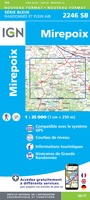 Wandelkaart - Topografische kaart 2246 SB - Serie Bleue Mirepoix | IGN - Institut Géographique National
IGN is bezig om de hele 25.000 serie vervangen: de oude versies Est en Ouest (E en O aanduiding achter het nummer van de kaart) gaan verdwijnen en worden vervangen …
 Wandelkaart - Topografische kaart 2247OT Lavelanet, Chalabre, Montségur, Laroque-d'Olmes | IGN - Institut Géographique National
De wandelkaart die de perfectie benadert! Werkelijk alle topografische details zijn er op te vinden; van hoogtelijnen tot aan bruggetjes en allerlei wandelpaden. Daarnaast hebben de makers een flinke dosis …
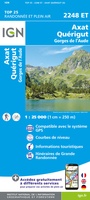 Wandelkaart - Topografische kaart 2248ET Axat, Querigut | IGN - Institut Géographique National
De wandelkaart die de perfectie benadert! Werkelijk alle topografische details zijn er op te vinden; van hoogtelijnen tot aan bruggetjes en allerlei wandelpaden. Daarnaast hebben de makers een flinke dosis …
★★★★★ Wandelkaart - Topografische kaart 2345 SB - Serie Bleue Carcassonne - Alzonne | IGN - Institut Géographique National
IGN is bezig om de hele 25.000 serie vervangen: de oude versies Est en Ouest (E en O aanduiding achter het nummer van de kaart) gaan verdwijnen en worden vervangen …
 Wandelkaart - Topografische kaart 2346 SB - Serie Bleue Cazilhac - Limoux | IGN - Institut Géographique National
IGN is bezig om de hele 25.000 serie vervangen: de oude versies Est en Ouest (E en O aanduiding achter het nummer van de kaart) gaan verdwijnen en worden vervangen …
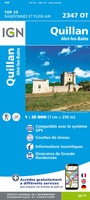 Wandelkaart - Topografische kaart 2347OT Quillan, Alet-les-Bains, Couiza, Rennes-les-Bains, Esperaza | IGN - Institut Géographique National
De wandelkaart die de perfectie benadert! Werkelijk alle topografische details zijn er op te vinden; van hoogtelijnen tot aan bruggetjes en allerlei wandelpaden. Daarnaast hebben de makers een flinke dosis …
 Wandelkaart 2545ET Béziers | IGN - Institut Géographique National
De wandelkaart die de perfectie benadert! Werkelijk alle topografische details zijn er op te vinden; van hoogtelijnen tot aan bruggetjes en allerlei wandelpaden. Daarnaast hebben de makers een flinke dosis …
★★★★★ Wandelkaart - Topografische kaart 2545OT St-Chinian - L'etang de Montady | IGN - Institut Géographique National
De wandelkaart die de perfectie benadert! Werkelijk alle topografische details zijn er op te vinden; van hoogtelijnen tot aan bruggetjes en allerlei wandelpaden. Daarnaast hebben de makers een flinke …
 Wandelkaart - Topografische kaart 2546OT Narbonne | IGN - Institut Géographique National
De wandelkaart die de perfectie benadert! Werkelijk alle topografische details zijn er op te vinden; van hoogtelijnen tot aan bruggetjes en allerlei wandelpaden. Daarnaast hebben de makers een flinke …
 Wandelkaart 2547OT Durban-Corbières / Leucate Plages du Roussillon | IGN - Institut Géographique National
De wandelkaart die de perfectie benadert! Werkelijk alle topografische details zijn er op te vinden; van hoogtelijnen tot aan bruggetjes en allerlei wandelpaden. Daarnaast hebben de makers een flinke dosis …
 Wandelkaart - Topografische kaart 2549OT Banyuls-sur-Mer | IGN - Institut Géographique National
De wandelkaart die de perfectie benadert! Werkelijk alle topografische details zijn er op te vinden; van hoogtelijnen tot aan bruggetjes en allerlei wandelpaden. Daarnaast hebben de makers een flinke dosis …
 Wandelkaart - Topografische kaart 2445 SB - Serie Bleue Lézignan - Corbieres, Rieux-Minervois | IGN - Institut Géographique National
IGN is bezig om de hele 25.000 serie vervangen: de oude versies Est en Ouest (E en O aanduiding achter het nummer van de kaart) gaan verdwijnen en worden vervangen …
 Wandelkaart - Topografische kaart 2446 SB - Serie Bleue Ferrals-les-Corbières, Capendu | IGN - Institut Géographique National
IGN is bezig om de hele 25.000 serie vervangen: de oude versies Est en Ouest (E en O aanduiding achter het nummer van de kaart) gaan verdwijnen en worden vervangen …
 Wandelkaart - Topografische kaart 2447OT Tuchan | IGN - Institut Géographique National
De wandelkaart die de perfectie benadert! Werkelijk alle topografische details zijn er op te vinden; van hoogtelijnen tot aan bruggetjes en allerlei wandelpaden. Daarnaast hebben de makers een flinke dosis …
 Wandelkaart - Topografische kaart 2448OT Thuir, Ille-sur-Tet, Latour-de-France, Estagel, Millas | IGN - Institut Géographique National
De wandelkaart die de perfectie benadert! Werkelijk alle topografische details zijn er op te vinden; van hoogtelijnen tot aan bruggetjes en allerlei wandelpaden. Daarnaast hebben de makers een flinke dosis …
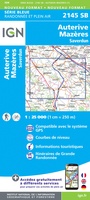 Wandelkaart - Topografische kaart 2145 SB - Serie Bleue Auterive - Mazères - Saverdun | IGN - Institut Géographique National
IGN is bezig om de hele 25.000 serie vervangen: de oude versies Est en Ouest (E en O aanduiding achter het nummer van de kaart) gaan verdwijnen en worden vervangen …
 Wandelgids 0360 Traversée de l'Aude - Pays Cathare GR36 - GR36A | FFRP
Fout lopen wordt op deze manier wel erg moeilijk. Met symbolen is weergegeven welke voorzieningen (openbaar vervoer / winkels / overnachtingen) er zijn langs of bij de route. De gids …
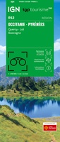 Wegenkaart - landkaart 12 TOP 250 Occitanie - Pyrénées - Quercy | IGN - Institut Géographique National
Laatste reviews

Kort voor vakantie naar de Galapagos eilanden toch nog behoefte aan extra reisgids. Simpel kunnen bestellen en snelle levering. Zou niet weten wat er beter …
★★★★★ door Piet Grootenboer 25 juni 2026 | Heeft dit artikel gekocht
Enorm mooie wereldkaart met details en snelle fijne levering.
★★★★★ door Steven Goyvaerts 25 juni 2026 | Heeft dit artikel gekocht
Deze Cicerone gids over de via Francigena is uitermate geschikt om je route en etappes te plannen als je de Via Francigena vanuit Zwitserland gaat …
★★★★★ door Vic 24 juni 2026 | Heeft dit artikel gekocht
Heerlijk om al te kunnen voorbereiden op een fantastische vakantie met dit uiterst fijne boek.
★★★★★ door Harry 24 juni 2026 | Heeft dit artikel gekocht