Winkelwagen
Geen items in winkelwagen
Ga naar winkelwagen
🥾 GR-5 wandelroute Frankrijk
 Wandelkaart - Topografische kaart 3313 SB - Serie Bleue Ars-sur-Moselle | IGN - Institut Géographique National
 Wandelkaart - Topografische kaart 3314 SB - Serie Bleue Pont-à-Mousson | IGN - Institut Géographique National★★★★★
 Wandelkaart - Topografische kaart 3411 SB - Serie Bleue Thionville | IGN - Institut Géographique National
 Wandelkaart - Topografische kaart 3412 SB - Serie Bleue Woippy | IGN - Institut Géographique National
 Wandelkaart - Topografische kaart 3413 SB - Serie Bleue Metz | IGN - Institut Géographique National
 Wandelgids 0390 Jura - L'échappée jurassienne GR59 - GR559 - GR509 - GR5 | FFRP
 Wandelgids 0502 Traversée du Massif des Vosges - Vogezen GR5 - GR53 | FFRP★★★★★
 Wandelgids 0504 GR5 Du Léman à la Vanoise | FFRP★★★★★★★★★★
 Wandelgids 0530 La Vanoise Parc national de la Vanoise GR5 GR55 GR5E | FFRP★★★★★★★★★★
 Wandelkaart - Topografische kaart 3515 SB - Serie Bleue Lorquin - Avricourt | IGN - Institut Géographique National
 Wandelkaart - Topografische kaart 3520ET Ballon d'Alsace | IGN - Institut Géographique National★★★★★★★★★★
 Wandelkaart - Topografische kaart 3616OT Lac de Pierre-Percée - Le Donon | IGN - Institut Géographique National★★★★★
 Wandelkaart - Topografische kaart 3618OT Le Hohneck - Gérardmer | IGN - Institut Géographique National★★★★★★★★★★
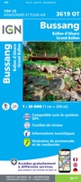 Wandelkaart - Topografische kaart 3619OT Bussang - La Bresse | IGN - Institut Géographique National★★★★★★★★★★
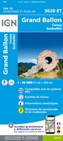 Wandelkaart - Topografische kaart 3620ET Grand Ballon | IGN - Institut Géographique National★★★★★
 Wandelkaart - Topografische kaart 3621OT Belfort - Montbeliard | IGN - Institut Géographique National
 Wandelkaart - Topografische kaart 3715OT Sarrebourg - Phalsbourg - Pays des Etangs | IGN - Institut Géographique National★★★★★
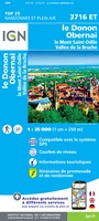 Wandelkaart - Topografische kaart 3716ET le Donon, Obernai, Mont Ste-Odile | IGN - Institut Géographique National★★★★★
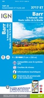 Wandelkaart - Topografische kaart 3717ET Barr - Le Howald - Villé - Vallée de la Bruche | IGN - Institut Géographique National★★★★★
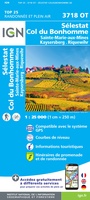 Wandelkaart - Topografische kaart 3718OT Selestat - Col Du Bonhomme | IGN - Institut Géographique National★★★★★
Laatste reviews

Als je er al bent: prachtige reliëfkaart van Vogezen en Elzas
Op ansichtkaartformaat een prachtige reliëfkaart van Vogezen en Elzas: alleen al voor het vooraf genieten een aanrader
★★★★★ door R.P. Koster 08 april 2026 | Heeft dit artikel gekocht
Michelin kaarten dit keer toeristisch Elzas: altijd topkwaliteit
De beste kaartenmaker van Frankrijk: Michelin. Weer met mooie toeritische tips van de Elzas: een aanrader
★★★★★ door R.P. Koster 08 april 2026 | Heeft dit artikel gekocht
Verrassend mooie Veluwe wandelingen met prima kaarten en toelichting
Mooie wandelgids (ook om cadeau te geven) als je van wandelen op de Veluwe houdt. Duidelijk, goed gedocumenteerd, zo te gebruiken
★★★★★ door R.P. Koster 08 april 2026 | Heeft dit artikel gekocht
Duidelijke kaart van Curaçao
Mooie overzichtelijke, zoveel mogelijk geüpdatete kaart van Curaçao. Wel groot. Goede kwaliteit.
★★★★★ door Maud van de Straat 08 april 2026 | Heeft dit artikel gekocht