Winkelwagen
Geen items in winkelwagen
Ga naar winkelwagen
Kaarten - Champagne - Ardennen
 Wandelkaart - Topografische kaart 3114 SB - Serie Bleue Pierrefitte-sur-Aire | IGN - Institut Géographique National
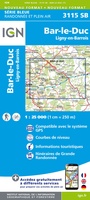 Wandelkaart - Topografische kaart 3115 SB - Serie Bleue Bar-le-Duc | IGN - Institut Géographique National
 Wandelkaart - Topografische kaart 3116 SB - Serie Bleue Joinville | IGN - Institut Géographique National★★★★★
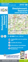 Wandelkaart - Topografische kaart 3117 SB - Serie Bleue Doulaincourt, Saucourt, Andelot-Blancheville | IGN - Institut Géographique National
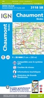 Wandelkaart - Topografische kaart 3118 SB - Serie Bleue Chaumont, Biesles | IGN - Institut Géographique National
 Topografische kaart - Wandelkaart 3119 SB - Serie Bleue Nogent | IGN - Institut Géographique National
 Topografische kaart - Wandelkaart 3120SB SB - Serie Bleue Langres - Auberive | IGN - Institut Géographique National
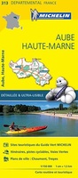 Wegenkaart - landkaart 313 Aube - Haute Marne | Michelin★★★★★
 Wandelkaart - Topografische kaart 3213 SB - Serie Bleue Vigneulles-lès-Hattonchâtel | IGN - Institut Géographique National★★★★★
 Wandelkaart - Topografische kaart 3215 SB - Serie Bleue Commercy | IGN - Institut Géographique National
 Wandelkaart - Topografische kaart 3216 SB - Serie Bleue Gondrecourt-le-Château | IGN - Institut Géographique National
 Wandelkaart - Topografische kaart 3217 SB - Serie Bleue Neufchateau, St-Blin | IGN - Institut Géographique National
 Wandelkaart - Topografische kaart 3218 SB - Serie Bleue Bourmont - Clefmont | IGN - Institut Géographique National
 Wandelkaart - Topografische kaart 3219 SB - Serie Bleue Bourbonne-les-Bains - Val-de-Meuse (Montigny-le-Roi) | IGN - Institut Géographique National
 Fietskaart 23 Fietsroute-Netwerk Franse Maasvallei - Ardennen - Champagne, Sedan, Arlon, Longwy, Virton | Sportoena
 Fietskaart 25 Fietsroute-Netwerk De Champagne rond Reims en het Natuurpark Montagne de Reims | Sportoena
 Fietskaart 26 Fietsroute-Netwerk Verdun 1914-1918 aan de Maas en de Franse Lorraine en Argonne | Sportoena
 Wandelkaart - Topografische kaart 2615 SB - Serie Bleue Esternay, Villiers-St-Georges | IGN - Institut Géographique National
 Wandelkaart - Topografische kaart 2616 SB - Serie Bleue Provins | IGN - Institut Géographique National
 Wandelkaart - Topografische kaart 2706OT Foret De Mormal | IGN - Institut Géographique National★★★★★
Laatste reviews

Super
Rother wandelgidsen stellen nooit teleur. Mooie routes, goede opgave kilometers, hoogtemeters en horeca. Een aanrader!
★★★★★ door Anita Geel 13 januari 2026 | Heeft dit artikel gekocht
Prachtig boek!
Mooi boek met prachtige foto’s! Voldoet helemaal aan mijn verwachtingen.
★★★★★ door Hans Eldering 13 januari 2026 | Heeft dit artikel gekocht
zeer vlotte levering
het product voldeed aan mijn verwachtingen en was geplastificeerd wat natuurlijk perfect is voor kaart die veel wordt geraadpleegd!
★★★★★ door Peter Lantinga 13 januari 2026 | Heeft dit artikel gekocht
Gedetailleerde wegenkaart
Ik heb de wegenkaart Maleisië aangeschaft om zelf een rondreis per huurauto te kunnen plannen. Deze kaart heeft daar heel goed bij geholpen doordat er …
★★★★★ door M. Rizvi 13 januari 2026 | Heeft dit artikel gekocht