Winkelwagen
Geen items in winkelwagen
Ga naar winkelwagen
Kaarten - Côtes-d‘Armor
 Wandelkaart - Topografische kaart 0714OT Perros-Guirec, Lannion, Trégastel-Plage, Trébeurden, Côte de Granit Rose | IGN - Institut Géographique National★★★★★
 Wandelkaart - Topografische kaart 0916ET Erquy - le Val-André | IGN - Institut Géographique National
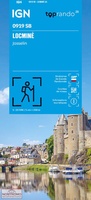 Wandelkaart 0919 SB - Serie Bleue Locminé - Josselin | IGN - Institut Géographique National
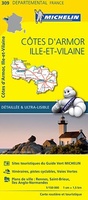 Wegenkaart - landkaart 309 Cotes d'Armor - Ille et Vilaine (Bretagne, Normandie) | Michelin★★★★★
 Wegenkaart - landkaart 06 TOP 250 Bretagne | IGN - Institut Géographique National
 Wandelkaart 0617OT Huelgoat - Monts d'Arrée | IGN - Institut Géographique National
 Wandelkaart 1117 SB - Serie Bleue Tinténiac / Caulnes | IGN - Institut Géographique National
 Wandelkaart 1118 SB - Serie Bleue Montfort-sur-Meu / Montauban-de-Bretagne | IGN - Institut Géographique National
 Fietskaart 10 Velo Cotes-d'Armor a velo - by bike | IGN - Institut Géographique National★★★★★
 Wandelkaart - Topografische kaart 1016ET St.-Cast-le-Guildo - Cap Fréhel | IGN - Institut Géographique National
 Wandelkaart - Topografische kaart 1017 SB - Serie Bleue Broons - Plenee Jugon | IGN - Institut Géographique National
 Wandelkaart - Topografische kaart 1018 SB - Serie Bleue Saint-Méen-le-Grand – Merdrignac | IGN - Institut Géographique National
 Wegenkaart - landkaart - Fietskaart D22 Top D100 Cotes-d'Armor (Bretagne noord) | IGN - Institut Géographique National★★★★★★★★★★
 Wandelkaart - Topografische kaart 815 SB - Serie Bleue Paimpol - Pontrieux | IGN - Institut Géographique National
 Wandelkaart - Topografische kaart 816 SB - Serie Bleue Guingamp | IGN - Institut Géographique National
 Wandelkaart - Topografische kaart 817 SB - Serie Bleue Quintin - St-Nicolas-du-Pelem | IGN - Institut Géographique National
 Wandelkaart - Topografische kaart 715 SB - Serie Bleue Bégard - Lannion | IGN - Institut Géographique National
 Wandelkaart - Topografische kaart 718 SB - Serie Bleue Rostrenen | IGN - Institut Géographique National
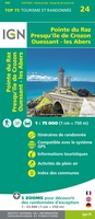 Fietskaart - Wandelkaart 75024 Bretagne - Pointe du Raz, Presqu'ile de Crozon, Ouessant - les Abers | IGN - Institut Géographique National
 Wandelkaart - Topografische kaart 917 SB - Serie Bleue Ploeuc-sur-Lié – Moncontour | IGN - Institut Géographique National
Laatste reviews

Mooie gedetailleerde kaart
We hebben de kaart nog niet mee op pad genomen maar al wel gebruikt voor de voorbereiding van onze vakantie. De kaart geeft voldoende detail …
★★★★★ door Pieter 02 maart 2026 | Heeft dit artikel gekocht
Fijne stadsplattegrond met duidelijke details
Voor iedere citytrip gebruik ik de stadsplattegronden van Borch. Het is een duidelijke kaart, op goede schaal en fijn dat de kaart geplastificeerd is.
★★★★★ door Mirte 27 februari 2026 | Heeft dit artikel gekocht
Fantastische puzzel
Prachtige puzzel met leuke extra’s, een standaard om de deksel in te zetten. Leuke weetjes over de wijnen aan de binnenkant van de deksel en …
★★★★★ door Angelique de Jonge 26 februari 2026 | Heeft dit artikel gekocht
perfect geleverd en ongeschonden aangekregen
perfect geleverd en ongeschonden aangekregen
★★★★★ door Steven Vansteenkiste 26 februari 2026 | Heeft dit artikel gekocht