Winkelwagen
Geen items in winkelwagen
Ga naar winkelwagen
Kaarten - Allier
 Wegenkaart - landkaart 326 Allier - Puy de Dome (Auvergne) | Michelin★★★★★★★★★★
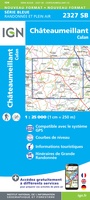 Wandelkaart - Topografische kaart 2327 SB - Serie Bleue Culan - Châteaumeillant | IGN - Institut Géographique National
 Wandelkaart - Topografische kaart 2328 SB - Serie Bleue Huriel - Boussac | IGN - Institut Géographique National
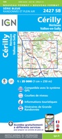 Topografische kaart - Wandelkaart 2427 SB - Serie Bleue Cérilly | IGN - Institut Géographique National
 Wandelkaart - Topografische kaart 2428 SB - Serie Bleue Montluçon | IGN - Institut Géographique National
 Wandelkaart 2527 SB - Serie Bleue Bourbon-l'Archambault | IGN - Institut Géographique National
 Wandelkaart - Topografische kaart 2528 SB - Serie Bleue Tronget - Montmarault | IGN - Institut Géographique National
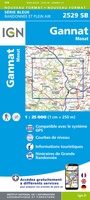 Wandelkaart - Topografische kaart 2529 SB - Serie Bleue Gannat | IGN - Institut Géographique National
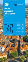 Wandelkaart 2530 SB - Serie Bleue Aigueperse / Châtel-Guyon / Manzat | IGN - Institut Géographique National
 Wandelkaart - Topografische kaart 2627 SB - Serie Bleue Moulins | IGN - Institut Géographique National
 Wandelkaart - Topografische kaart 2628 SB - Serie Bleue St-Pourçain-sur-Sioule | IGN - Institut Géographique National
 Wandelkaart - Topografische kaart 2629 SB - Serie Bleue Vichy | IGN - Institut Géographique National
 Wandelkaart - Topografische kaart 2630 SB - Serie Bleue Maringues | IGN - Institut Géographique National
 Wandelkaart - Topografische kaart 2727 SB - Serie Bleue Dompierre-sur-Besbre | IGN - Institut Géographique National
 Wandelkaart - Topografische kaart 2728 SB - Serie Bleue Le Donjon | IGN - Institut Géographique National
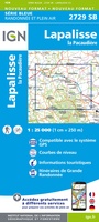 Wandelkaart - Topografische kaart 2729 SB - Serie Bleue Lapalisse | IGN - Institut Géographique National
 Wandelkaart 2730 SB - Serie Bleue Le Mayet-de-Montagne / St-just-en-Chevalet | IGN - Institut Géographique National
 Wandelkaart - Topografische kaart 2221 SB - Serie Bleue Lamotte-Beuvron | IGN - Institut Géographique National
 Wegenkaart - landkaart 14 TOP 250 Auvergne - Rhône-Alpes - Massif Central | IGN - Institut Géographique National
 Wegenkaart - landkaart 15 TOP 250 Auvergne - Rhône-Alpes - Massif Alpin | IGN - Institut Géographique National
Laatste reviews

LEUK ORIGINEEL KADO
enthousiast ontvangen door klanten. Is met de kinderen van 7 en 5 jaar oud gelijk aan de slag gegaan
★★★★★ door aam van ruler 30 december 2025 | Heeft dit artikel gekocht
Goede, uitgebreide gids
Nederlandstalige (vertaalde) reisgids met veel informatie, ook over praktische zaken. Duidelijke streek- en stadkaartjes met wandelroutes, ook handig.
★★★★★ door Kees H. 30 december 2025 | Heeft dit artikel gekocht
I.c.m. website een actuele basis
Dit boekje met beknopte omschrijving en de erin afgedrukte wandel(deel)kaarten vormen een prima basis voor het rondje Limburg. Je bent vrij om te bepalen waar …
★★★★★ door Greenline 29 december 2025 | Heeft dit artikel gekocht
Prima kaart
Snel geleverd en goede wandelkaart
★★★★★ door Rinske 29 december 2025 | Heeft dit artikel gekocht