Winkelwagen
Geen items in winkelwagen
Ga naar winkelwagen
Kaarten - Franse Atlantische Kust - Nouvelle-Aquitaine
 Wandelkaart - Topografische kaart 1437 SB - Serie Bleue Saint-Jean-d'Illac | IGN - Institut Géographique National
 Wandelkaart - Topografische kaart 1438 SB - Serie Bleue Belin-Béliet | IGN - Institut Géographique National
 Wandelkaart - Topografische kaart 1439 SB - Serie Bleue Parentis-en-Born | IGN - Institut Géographique National
 Wandelkaart - Topografische kaart 1440 SB - Serie Bleue Labouheyre | IGN - Institut Géographique National
 Wandelkaart - Topografische kaart 1441 SB - Serie Bleue Morcenx | IGN - Institut Géographique National
 Wandelkaart - Topografische kaart 1442 SB - Serie Bleue Tartas, Pontonx-sur-l'Adour | IGN - Institut Géographique National
 Wandelkaart - Topografische kaart 1528 SB - Serie Bleue Niort | IGN - Institut Géographique National
 Wandelkaart - Topografische kaart 1529 SB - Serie Bleue Mauzé-sur-le-Mignon, Frontenay-Rohan, Foret de Chize | IGN - Institut Géographique National
 Wandelkaart - Topografische kaart 1530 SB - Serie Bleue Saint-Jean-d'Angély | IGN - Institut Géographique National
 Wandelkaart - Topografische kaart 1532 SB - Serie Bleue Pons | IGN - Institut Géographique National
 Topografische kaart - Wandelkaart 1533 SB - Serie Bleue Jonzac | IGN - Institut Géographique National
 Topografische kaart - Wandelkaart 1534 SB - Serie Bleue Montendre, St-Ciers-sur-Girond | IGN - Institut Géographique National
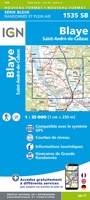 Wandelkaart - Topografische kaart 1535 SB - Serie Bleue Blaye | IGN - Institut Géographique National
 Topografische kaart - Wandelkaart 1537 SB - Serie Bleue Pessac | IGN - Institut Géographique National
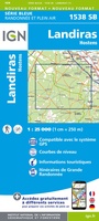 Wandelkaart - Topografische kaart 1538 SB - Serie Bleue Landiras | IGN - Institut Géographique National
 Wandelkaart - Topografische kaart 1539 SB - Serie Bleue St-Symphorien | IGN - Institut Géographique National
 Wandelkaart - Topografische kaart 1540 SB - Serie Bleue Labrit | IGN - Institut Géographique National
 Wandelkaart - Topografische kaart 1628 SB - Serie Bleue St-Maixent-l'Ecole, Lezay | IGN - Institut Géographique National
 Wandelkaart - Topografische kaart 1629 Melle | IGN - Institut Géographique National
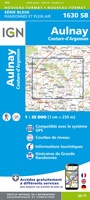 Wandelkaart - Topografische kaart 1630 SB - Serie Bleue Aulnay | IGN - Institut Géographique National
Laatste reviews

Hoogtepunten van Rügen in een oogopslag
Gidsje werkt voor mij goed als aanvulling op gedetailleerde reisgids Rügen, Hiddensee und Strallsund van Michael Müller Verlag. Wel een beetje populair/melig taalgebruik.
★★★★★ door Jacques 31 mei 2026 | Heeft dit artikel gekocht
Beste reisgids voor Rügen
Gedetailleerd, overzichtelijk en handzaam formaat.
★★★★★ door Jacques 31 mei 2026 | Heeft dit artikel gekocht
Overzichtelijk
Prachtig vormgegeven boek met veel wetenswaardigheden en routes over de Lanquedoc
★★★★★ door WIM LUCASSEN 31 mei 2026 | Heeft dit artikel gekocht
Mooi uitgevoerde kaart maar out-of-date
Mooi uitgevoerde kaart, veel (touristische) informatie en sterk watervast papier. Maar, hoewel uitgegeven in 2022, is het databestand uit 2010. Het wegennet is Noord Spanje …
★★★★★ door Soons 30 mei 2026 | Heeft dit artikel gekocht