Winkelwagen
Geen items in winkelwagen
Ga naar winkelwagen
Franse Atlantische Kust - Nouvelle-Aquitaine
 Wandelkaart 1430OT Rochefort / Marennes | IGN - Institut Géographique National
 Wandelkaart - Topografische kaart 1432 SB - Serie Bleue Saujon | IGN - Institut Géographique National
 Wandelkaart - Topografische kaart 1433 SB - Serie Bleue Lesparre-Médoc | IGN - Institut Géographique National
 Wandelkaart - Topografische kaart 1433OT Soulac-Sur-Mer & Montalivet Pointe De Grave | IGN - Institut Géographique National
 Topografische kaart - Wandelkaart 1434OT Hourtin, Lacs d'Hourtin Et De Carcans | IGN - Institut Géographique National
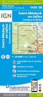 Wandelkaart - Topografische kaart 1436 SB - Serie Bleue St-Médard-en-Jalles | IGN - Institut Géographique National
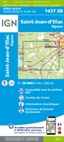 Wandelkaart - Topografische kaart 1437 SB - Serie Bleue Saint-Jean-d'Illac | IGN - Institut Géographique National
 Wandelkaart - Topografische kaart 1438 SB - Serie Bleue Belin-Béliet | IGN - Institut Géographique National
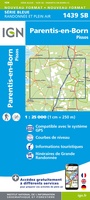 Wandelkaart - Topografische kaart 1439 SB - Serie Bleue Parentis-en-Born | IGN - Institut Géographique National
 Wandelkaart - Topografische kaart 1440 SB - Serie Bleue Labouheyre | IGN - Institut Géographique National
 Wandelkaart - Topografische kaart 1441 SB - Serie Bleue Morcenx | IGN - Institut Géographique National
 Wandelkaart - Topografische kaart 1442 SB - Serie Bleue Tartas, Pontonx-sur-l'Adour | IGN - Institut Géographique National
 Wandelkaart - Topografische kaart 1528 SB - Serie Bleue Niort | IGN - Institut Géographique National
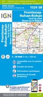 Wandelkaart - Topografische kaart 1529 SB - Serie Bleue Mauzé-sur-le-Mignon, Frontenay-Rohan, Foret de Chize | IGN - Institut Géographique National
 Wandelkaart - Topografische kaart 1530 SB - Serie Bleue Saint-Jean-d'Angély | IGN - Institut Géographique National
 Wandelkaart - Topografische kaart 1531 SB - Serie Bleue Saintes - Burie | IGN - Institut Géographique National★★★★★
 Wandelkaart - Topografische kaart 1532 SB - Serie Bleue Pons | IGN - Institut Géographique National
 Topografische kaart - Wandelkaart 1533 SB - Serie Bleue Jonzac | IGN - Institut Géographique National
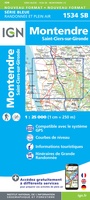 Topografische kaart - Wandelkaart 1534 SB - Serie Bleue Montendre, St-Ciers-sur-Girond | IGN - Institut Géographique National
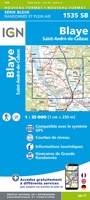 Wandelkaart - Topografische kaart 1535 SB - Serie Bleue Blaye | IGN - Institut Géographique National
Laatste reviews

Compact en toch volledig
Een compact boekje met 6 kaartjes van de voor een toerist belangrijkste Londense buurten met veel details en een overzicht van de metrolijnen. Super handig …
★★★★★ door Corine van der Hoeven 12 januari 2026 | Heeft dit artikel gekocht
Superleuk fiets boek
Erg blij met het boek onbegrensd fietsen naar Andalusië. We zijn ons nu aan het inlezen en krijgen enorm veel zin om te gaan. Er …
★★★★★ door Monique 12 januari 2026 | Heeft dit artikel gekocht
Compact gedetailleerd en overzichtelijk!
Heel blij met dit wandelgidsje. Mooie kaartjes, per etappe, ook restaurants en overnachting. Ideaal vooraf om te plannen en onderweg. Mooi compact!
★★★★★ door Peter 12 januari 2026 | Heeft dit artikel gekocht
Prima gids.
Gewoon handig boekje voor de info en planning. Route is heel goed gemarkeerd.
★★★★★ door Pieter 12 januari 2026 | Heeft dit artikel gekocht