Kaarten - North West England
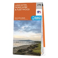 Wandelkaart - Topografische kaart 296 OS Explorer Map Lancaster, Morecambe, Fleetwood | Ordnance Survey
Met zijn 4cm voor 1 km (2 ½ cm voor 1 mijl) schaal, is de OS Explorer kaartenserie de ideale en meest gedetailleerde kaartenreeks voor mensen die graag outdoor-activiteiten zoals …
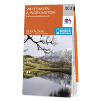 Wandelkaart - Topografische kaart 303 OS Explorer Map Whitehaven, Workington | Ordnance Survey
Met zijn 4cm voor 1 km (2 ½ cm voor 1 mijl) schaal, is de OS Explorer kaartenserie de ideale en meest gedetailleerde kaartenreeks voor mensen die graag outdoor-activiteiten zoals …
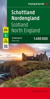 Wegenkaart - landkaart Schotland en Noord Engeland | Freytag & Berndt
Goede tweezijdige wegenkaart van het Noord Engeland en Schotland. Met register en enkele stadsplattegronden. De berijdbare wegen zijn goed weergeven, zowel de hoofdwegen als provinciale en lokale wegen; wegnummers worden …
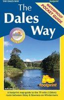 Wandelkaart The Dales Way | Footprint maps
Handzame wandelkaart voor de Dales Way in Noord Engeland. The Dales Way is a 79 mile (127km) long distance trail in the north of England, running between Ilkley, in North …
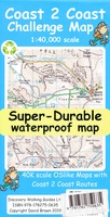 Wandelkaart Coast 2 Coast | Discovery Walking Guides
Goede scheur- en watervaste wandelkaart. The whole Coast 2 Coast on one double sided, 960mm by 694mm, map sheet. All 193 miles (308 kilometres) of the Wainwright route along with …
★★★★★ Wandelatlas Adventure Atlas Coast to Coast | A-Z Map Company
The A-Z Adventure Series is the perfect companion for walkers, off-road cyclists, and anyone wishing to explore the great outdoors. The Coast to Coast Walk (C2C) is one of …
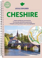 Wegenatlas Local Explorer Street Atlas Cheshire | Philip's Maps
Who hasn't explored and enjoyed their surrounding area recently and come to appreciate what is on our respective doorsteps? Philip's have created this new series for walkers, cyclists and local …
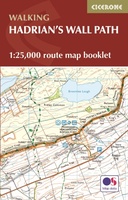 Wandelatlas Hadrian's Wall Path Map Booklet | Cicerone
All the mapping you need to walk the 84 mile (135km) Hadrian's Wall Path from Bowness-on-Solway in Cumbria to Wallsend, Newcastle. This booklet of Ordnance Survey 1:25,000 Explorer maps has …
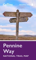 Wandelkaart National Trail Map Pennine Way | Collins
Overzichtskaart op vrij grove schaal van deze LAW Lange Afstands Wandeling in Engeland. Let op: je kunt er niet op lopen. Wel met veel informatie op de kaart, goed ingetekend, …
 Fietskaart The C2C Cycle Route - Coast to Coast | Footprint maps
- Britains most popular loing distance route. - New clear mapping, based on OS data,ata a scale of 1:90 000 - Waterproof paper and compact size - Excellent value for …
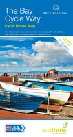 Fietskaart Cycle Map The Bay Cycle Way | Sustrans
Het is niet een heel overzichtelijke kaart, het zijn juist blokken van een deel van de route waarop deze staat ingetekend. Daarin juist wel heel goed met handige stedenkaarten en …
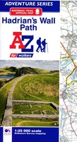 Wandelkaart Adventure Atlas Hadrian's Wall Path | A-Z Map Company
AZ heeft de meest gedetailleerde wandelkaarten van het Hadrian's Wall Path gebundeld in een atlasje. Daardoor is het heel handig qua formaat. De kaarten zelf zijn perfect voor het wandelen. …
 Wegenkaart - landkaart Nord- und Mittelengland / Northern England & the Midlands | Reise Know-How Verlag
Hochreißfeste und 100% wasserfeste Landkarte "Nord- und Mittelengland" aus der Serie world mapping project, erschienen im Reise Know-How Verlag. Reise Know-How Landkarten zeichnen sich durch besonders stabiles Kunststoffpapier aus, …
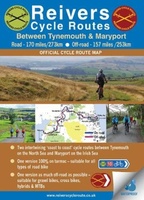 Fietskaart Reivers Cycle Routes | Northern Heritage Services
The long-distance Reivers Cycle Routes are two intertwining signed / waymarked bi-directional ‘coast to coast’ cycle routes between the North Sea and the Irish Sea. The original Reivers Cycle …
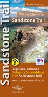 Wandelkaart Walking Cheshire's Sandstone Trail - 1:25,000 OS Map Book | Northern Eye Books
Large-scale Ordnance Survey maps for walking Cheshire’s Sandstone Trail in a handy pocket size book. Cheshire’s Sandstone Trail is probably the most popular middle-distance walk in Northwest England. Here, …
 Spoorwegenkaart England North and Central Rail and Road | ITMB
This is a new title for ITMB, and continues our expanded coverage of the United Kingdom. Many publishers carry a map of Great Britain (or of the UK), and a …
 Wandelkaart The Coast to Coast Map Booklet | Cicerone
All the mapping you need to complete the 185-mile (296km) unwaymarked Coast to Coast Walk from St Bees in Cumbria to Robin Hood's Bay, North Yorkshire. This booklet of …
 Wandelkaart - Topografische kaart OL06 OS Explorer Map English Lakes - South Western area | Ordnance Survey
Een van de beste detailkaarten die er op de wereld gemaakt worden: zeer gedetailleerd, prachtig helder kleurgebruik, veel topografische aspecten en - zeer belangrijk - allerlei toeristische en recreatieve aspecten …
★★★★★
Laatste reviews

Niet echt voor beginners. Ook zijn de routes soms moeilijk qua logistiek. Weer terugkomen aan het eind bv. En in voorseizoen (mei) blijft er niet …
★★★★★ door Tjeerd 17 mei 2024 | Heeft dit artikel gekocht
Van te voren had ik een andere kaart op het oog. Toen ik in de winkel was adviseerde zij mij deze kaart. Op hun verzoek …
★★★★★ door Koen 17 mei 2024 | Heeft dit artikel gekocht
Ideale schaal waar ook de kleinere wegen duidelijk zijn aangegeven. Beschrijving op website is correct.
★★★★★ door Peter 16 mei 2024 | Heeft dit artikel gekocht
Overzichtelijke kaart. Niks op aan te merken.
★★★★★ door Bastiaan de Leeuw 16 mei 2024 | Heeft dit artikel gekocht