North West England
 Wandelkaart - Topografische kaart 103 Landranger Blackburn & Burnley, Clitheroe & Skipton | Ordnance Survey
Zeer goede detailkaart met topografische ondergrond. Kleurgebruik is goed over nagedacht: bijzonder goed leesbaar en helder kaartbeeld. Hierop zijn toeristische symbolen van bezienswaardigheden ingetekend, daarnaast staan bijvoorbeeld campings en jeugdherbergen …
 Wandelkaart - Topografische kaart 108 Landranger Liverpool, Southport & Wigan | Ordnance Survey
Zeer goede detailkaart met topografische ondergrond. Kleurgebruik is goed over nagedacht: bijzonder goed leesbaar en helder kaartbeeld. Hierop zijn toeristische symbolen van bezienswaardigheden ingetekend, daarnaast staan bijvoorbeeld campings en jeugdherbergen …
 Wandelkaart - Topografische kaart 109 Landranger Manchester, Bolton & Warrington | Ordnance Survey
Zeer goede detailkaart met topografische ondergrond. Kleurgebruik is goed over nagedacht: bijzonder goed leesbaar en helder kaartbeeld. Hierop zijn toeristische symbolen van bezienswaardigheden ingetekend, daarnaast staan bijvoorbeeld campings en jeugdherbergen …
 Pelgrimsroute - Wandelgids The Two Saints Way | Northern Eye Books
An impressive guide book that coincides with the growing interest in pilgrimage as an aspect of ‘wellness’ tourism that benefits body, mind and spirit. The guide is packed with …
 Wandelgids The Ribble Way | Cicerone
The 72 mile (116km) Ribble Way is described in seven stages, ranging from 8.25 to 17 miles (13.3 to 27.4km). The route follows the Ribble valley, from the estuary mouth …
 Wandelgids Dales Way | Trailblazer Guides
The popular Dales Way long-distance footpath begins in Ilkley, West Yorkshire and runs for 84 miles (135km) to end in the Lake District, in Bowness-on-Windermere. It follows riverside paths along …
 Wandelgids Borders Abbeys Way | Rucksack Readers
The Borders Abbeys Way is one of Scotland's Great Trails, a fascinating circuit that takes in the historic ruined abbeys of Melrose, Dryburgh, Kelso and Jedburgh. Within its 68 miles …
 Fietskaart The C2C Cycle Route - Coast to Coast | Footprint maps
- Britains most popular loing distance route. - New clear mapping, based on OS data,ata a scale of 1:90 000 - Waterproof paper and compact size - Excellent value for …
 Fietsgids The Coast to Coast Cycle Route | Cicerone
This guidebook details the 137 mile sea-to-sea / C2C cycle route. This much loved short cycle tour across northern England takes you from Whitehaven or Workington on the west coast …
 Wandelgids 15 Short Walks Arnside and Silverdale | Cicerone
David Jordan has chosen 15 of the best short walks around Arnside and Silverdale for you to explore. Our guide comes with easy-to-read Ordnance Survey maps and clear route descriptions, …
 Wandelgids Friends Way 2 | Rucksack Readers
The Friends Way route will appeal not only to all Quakers who enjoy walking, but also to those walkers who don't yet know about Margaret Fell's remarkable story. This volume, …
 Fietsgids Cycling the Way of the Roses | Cicerone
Guidebook to the Way of the Roses, a 170-mile coast-to-coast cycle route across Lancashire and Yorkshire. The three-day journey (alternative two, four and five day itineraries are also outlined) begins …
 Reisgids Slow Travel Cheshire | Bradt Travel Guides
Een bijzondere serie van Bradt guides, waarin een gedeelte van Engeland of Schotland uitgebreid beschreven wordt. Met veel aandacht voor kleine details die je niet al gauw elders zult vinden. …
 Wandelgids The Cumbria Coastal Way | Cicerone
This guidebook follows the continuous 298km (182 mile) walking route from Silverdale, on Morecambe Bay, towards Gretna on the Scottish border. The route links a number of gems of landscape, …
 Wandelgids The Cumbria Way | Cicerone
A guidebook to the Cumbria Way, a 73-mile long distance path through the heart of the English Lake District from Ulverston to Carlisle. The route is largely low-level, and accessible …
 Reisgids Lake District and Yorkshire Dales | Wild Things Publishing
Imagine a summer spent swimming in mountain waterfalls, exploring lost ruins and caverns, and camping in ancient forests. In this explorer's compendium you will discover the most exciting and lesser-known …
★★★★★ Fietskaart Cycle Map The Bay Cycle Way | Sustrans
Het is niet een heel overzichtelijke kaart, het zijn juist blokken van een deel van de route waarop deze staat ingetekend. Daarin juist wel heel goed met handige stedenkaarten en …
 Wandelkaart Adventure Atlas Hadrian's Wall Path | A-Z Map Company
AZ heeft de meest gedetailleerde wandelkaarten van het Hadrian's Wall Path gebundeld in een atlasje. Daardoor is het heel handig qua formaat. De kaarten zelf zijn perfect voor het wandelen. …
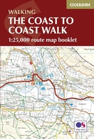 Wandelkaart The Coast to Coast Map Booklet | Cicerone
All the mapping you need to complete the 185-mile (296km) unwaymarked Coast to Coast Walk from St Bees in Cumbria to Robin Hood's Bay, North Yorkshire. This booklet of …
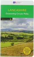 Wandelgids 53 Pathfinder Guides Lancashire | Ordnance Survey
Wandelgids van een deel van Engeland, Schotland of Wales. Deze gids bevat 28 dagwandelingen, variërend van korte tochten tot pittige dagtochten. De bijbehorende kaarten zijn uitstekend: men heeft de topografische …
Laatste reviews

Niet echt voor beginners. Ook zijn de routes soms moeilijk qua logistiek. Weer terugkomen aan het eind bv. En in voorseizoen (mei) blijft er niet …
★★★★★ door Tjeerd 17 mei 2024 | Heeft dit artikel gekocht
Van te voren had ik een andere kaart op het oog. Toen ik in de winkel was adviseerde zij mij deze kaart. Op hun verzoek …
★★★★★ door Koen 17 mei 2024 | Heeft dit artikel gekocht
Ideale schaal waar ook de kleinere wegen duidelijk zijn aangegeven. Beschrijving op website is correct.
★★★★★ door Peter 16 mei 2024 | Heeft dit artikel gekocht
Overzichtelijke kaart. Niks op aan te merken.
★★★★★ door Bastiaan de Leeuw 16 mei 2024 | Heeft dit artikel gekocht