North East England
 Wandelkaart Settle to Carlisle Way | Harvey Maps
Mooie, duidelijke kaart van de Settle to Carlisle Way in Noord-Engeland. Geplastificeerd met veel extra informatie en uitsnedes van de route. Settle Carlisle Way is a walking route linking the …
 Wandelkaart St Oswald's Way | Harvey Maps
Mooie, duidelijke kaart van de St Oswald's Way Noord-Engeland. Geplastificeerd met veel extra informatie en uitsnedes van de route. From Holy Island to Heavenfield, the 97 mile St Oswald's …
 Wandelgids 39 Pathfinder Guides Durham, north Pennines and Tyne and Wear | Ordnance Survey
Wandelgids van een deel van Engeland, Schotland of Wales. Deze gids bevat 28 dagwandelingen, variërend van korte tochten tot pittige dagtochten. De bijbehorende kaarten zijn uitstekend: men heeft de topografische …
★★★★★ Wandelgids Northumberland Coast Path | Aurum Press
Goede beschrijving van de aantrekkelijke route. Kaartmateriaal van Ordnance Survey - de Engelse topografische dienst op een schaal van 1:25.000. Praktische info voor overnachten ed. niet altijd uitgebreid, maar die …
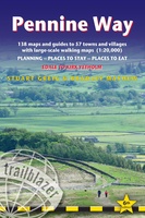 Wandelgids Pennine Way | Trailblazer Guides
Trailblazer British Walking Guide to the Pennine Way, Britain's best-known National Trail that winds for 256 miles through three National Parks - the Peak District, Yorkshire Dales and Northumberland. This …
★★★★★★★★★★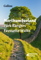 Wandelgids Park Rangers Favourite Walks Northumberland | Collins
The perfect companions for exploring the National Parks. Walking guide to the Northumberland National Park, with 20 best routes chosen by the park rangers. Each walk varies in length from …
 Campergids 96 nach England, der Norden | WOMO verlag
Tourenkarten Auf rund 4400 km in 11 Touren zu allen großen Attraktionen und weniger bekannten Orten in Nordengland reisen. Genaue Markierung freier Stell-, Bade-, Picknick-, Wander-, Pub- und Campingplätze incl. …
 Wegenkaart - landkaart Nord- und Mittelengland / Northern England & the Midlands | Reise Know-How Verlag
Hochreißfeste und 100% wasserfeste Landkarte "Nord- und Mittelengland" aus der Serie world mapping project, erschienen im Reise Know-How Verlag. Reise Know-How Landkarten zeichnen sich durch besonders stabiles Kunststoffpapier aus, …
 Reisgids British Breaks Newcastle and Northumbria | Rough Guides
Discover the best of Newcastle & Northumbria with this compact, practical, entertaining Pocket Rough Guide with a free eBook. This slim, trim treasure trove of trustworthy travel information is ideal …
★★★★★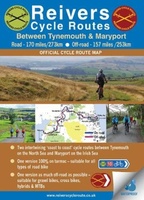 Fietskaart Reivers Cycle Routes | Northern Heritage Services
The long-distance Reivers Cycle Routes are two intertwining signed / waymarked bi-directional ‘coast to coast’ cycle routes between the North Sea and the Irish Sea. The original Reivers Cycle …
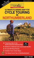 Fietskaart Cycle Touring Map of Northumberland | Northern Heritage Services
The official planner for recreational cycling and cycle touring in Northumberland and beyond. Version 3 printed 2020. Comprehensive list of promoted long distance cycle routes including: Coast and Castles …
★★★★★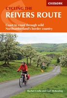 Fietsgids Cycling the Reivers Route | Cicerone
Guidebook to the Reivers Route, a 173 mile (280km) coast-to-coast cycle route across northern England and into Scotland from Tynemouth to Whitehaven. Exploring the rich history of traditional border territory, …
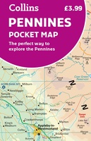 Wegenkaart - landkaart Pocket Map Pennines | Collins
Handy little full colour map of the Pennines. Main features of this map include: • Clear mapping • Main tourist attractions located and described • Ideal for touring with …
 Fietskaart 10 Cycling guides North York Moors | Goldeneye
Scheur- en watervast foetskaart van de North York Moors met ingetekende fietsroutes. Our maps are double-sided, printed on an A2 sheet with a concertina fold. This allows for easy …
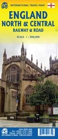 Spoorwegenkaart England North and Central Rail and Road | ITMB
This is a new title for ITMB, and continues our expanded coverage of the United Kingdom. Many publishers carry a map of Great Britain (or of the UK), and a …
 Wandelgids Borders Abbeys Way | Rucksack Readers
The Borders Abbeys Way is one of Scotland's Great Trails, a fascinating circuit that takes in the historic ruined abbeys of Melrose, Dryburgh, Kelso and Jedburgh. Within its 68 miles …
 Wandelgids Forth to Farne Way | Rucksack Readers
This inspiring 70-mile pilgrim route starts from North Berwick on the Firth of Forth near Edinburgh, and continues via Whitekirk's 12th century church to Dunbar. It follows the North Sea …
 Fietskaart The C2C Cycle Route - Coast to Coast | Footprint maps
- Britains most popular loing distance route. - New clear mapping, based on OS data,ata a scale of 1:90 000 - Waterproof paper and compact size - Excellent value for …
 Fietsgids The Coast to Coast Cycle Route | Cicerone
This guidebook details the 137 mile sea-to-sea / C2C cycle route. This much loved short cycle tour across northern England takes you from Whitehaven or Workington on the west coast …
 Reisgids Wild Guide North East England | Wild Things Publishing
Discover the hidden side of England's North East. From secret coves and deserted beaches to lost ruins, meadows and swimming rivers with over 1000 lesser-known places. Filled with spectacular photography …
Laatste reviews

Duidelijke kaart, ook met kleinere wegen. Snelle levering
★★★★★ door Ger Sulkers 02 mei 2024 | Heeft dit artikel gekocht
Ja wij zijn tevreden, alleen is mijn vriendin het boekje al kwijtgeraakt bij onze eerste wandeling.🙁
★★★★★ door Mark 02 mei 2024 | Heeft dit artikel gekocht
Ja ik ben dik tevreden over de wegenkaart van Kazachstan. Stond alles op wat ik wou dus heel erg tevreden daarover.
★★★★★ door Sjoerd Westra 02 mei 2024 | Heeft dit artikel gekocht
Zoals altijd mooie verzorgde kaarten die tijdens de reis van pas komen en achteraf mooie herinneringen oproepen.
★★★★★ door Klaas Wijnberg 02 mei 2024 | Heeft dit artikel gekocht