Winkelwagen
Geen items in winkelwagen
Ga naar winkelwagen
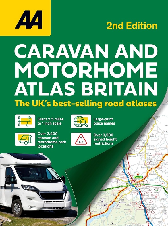
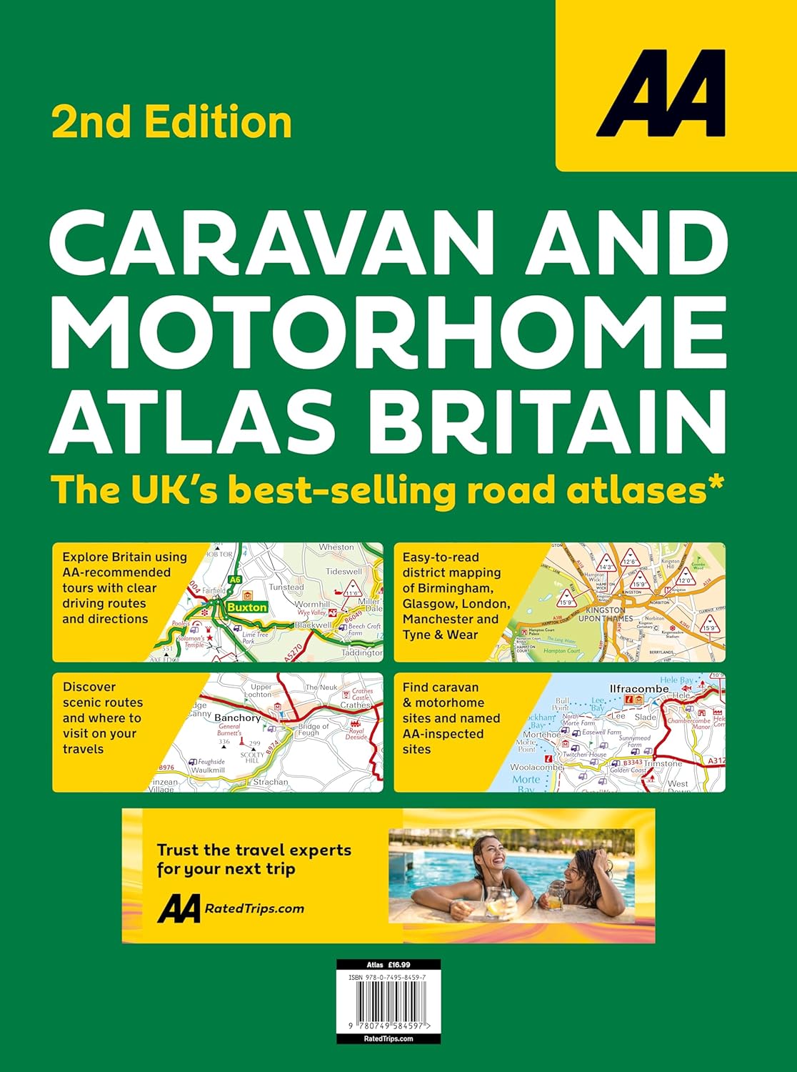
Campergids Road Map Britain Caravan & Motorhome Atlas 2026 | Ringband | AA Publishing (9780749584597)
- ISBN / CODE: 9780749584597
- Editie: 07-05-2026
- Druk: 2
- Aantal blz.: 208
- Uitgever: AA Publishing
- Soort: Campergids
- Serie: Road Map Britain
- Taal: Engels
- Hoogte: 25.0 cm
- Breedte: 12.0 cm
- Gewicht: 1300.0 g
- Bindwijze: Ringband
- Uitvoering: -
- Schrijf als eerste een review
-
€ 23,95
Dit artikel is (tijdelijk) niet leverbaar
Beschrijving
Van de uitgever
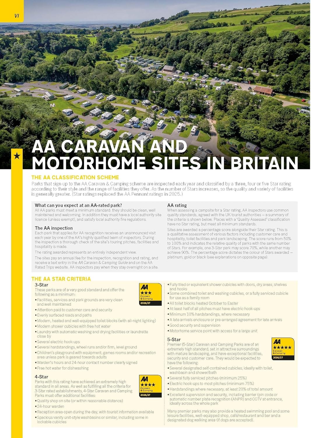
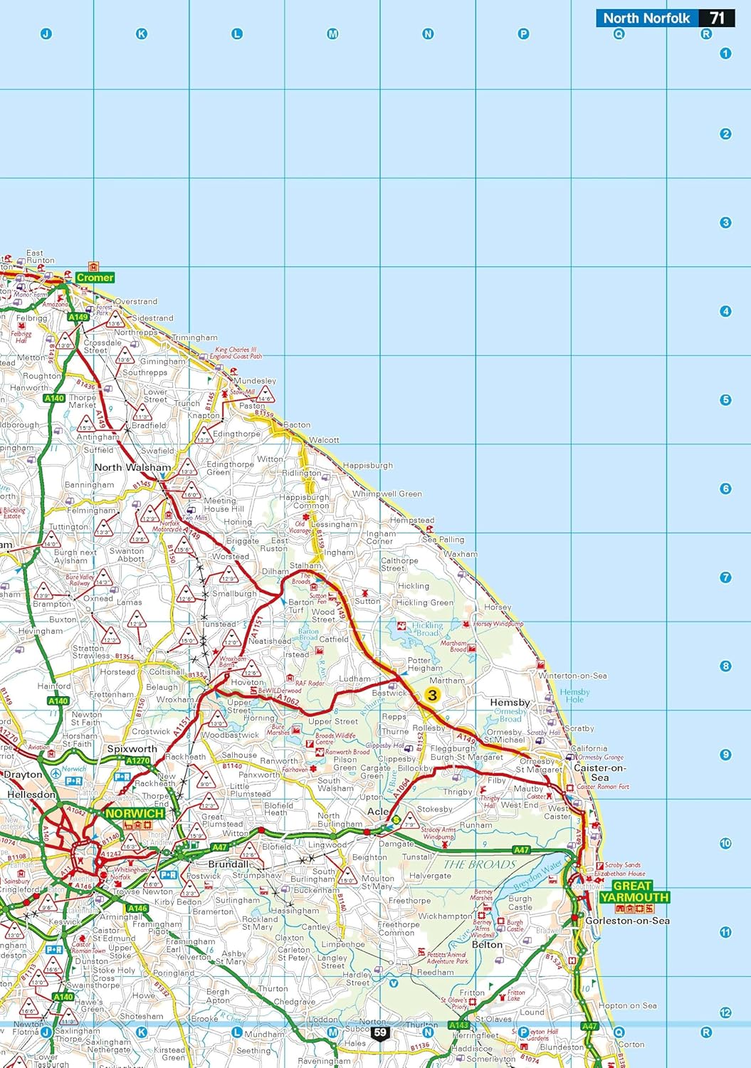
New for 2024, this A3 atlas provides information of particular importance to caravan and motorhome owners and includes named AA-inspected caravan parks and also non-AA parks, plus low bridge heights. Roads less than 4 metres wide are distinguished, as well as road tunnels, toll roads, service areas, steep gradients, level crossings and low emission zones. A special feature for caravanners is a listing of the AA-inspected sites with their ratings and 10 individual touring routes ranging from 96–480 miles with accompanying map and information on places of interest along the route. The giant scale mapping makes it easy to read and each page has been titled with its geographical location so you can turn to the page you need more easily. The atlas also includes a clear route planner map, quick reference distance chart and an explanatory list of restricted motorway junctions. Additionally there are large scale district maps of London, Birmingham, Glasgow, Manchester and Tyne & Wear. Over 8,700 places of interest shown on the mapping include National Trust and English Heritage sites, National Parks and tourist sites with the addition of scenic routes.Reviews
Geen reviews gevonden voor dit product.
Schrijf een review
Graag horen wij wat u van dit artikel vindt. Vindt u het goed, leuk, mooi, slecht, lelijk, onbruikbaar of erg handig: schrijf gerust alles op! Het is niet alleen leuk om te doen maar u informeert andere klanten er ook nog mee!
Alle gerelateerde rubrieken >
Ook interessant voor europa/engeland
-

Reisverhaal Walking the Great North
€ 14,95Reisverhalen Engeland -

Fietsgids Cols and Passes of the Bri
€ 18,50Fietsgidsen Wales -

Wandelgids Best Day Walks Great Brit
€ 26,50Wandelgidsen Wales -

Reisgids Wild Swimming Britain | Wil
€ 27,95Reisgidsen Wales -

Wandkaart 02022 Britain and Ireland
€ 25,95Wandkaarten van landen Engeland