Winkelwagen
Geen items in winkelwagen
Ga naar winkelwagen
Wandelkaarten - Europa
 Wandelkaart - Topografische kaart 1910 SB - Serie Bleue Yvetot | IGN - Institut Géographique National
 Wandelkaart - Topografische kaart 1911ET Rouen, Forets Rouennaises, PNR | IGN - Institut Géographique National
 Wandelkaart - Topografische kaart 1911OT Forets De Brotonne | IGN - Institut Géographique National
 Topografische kaart - Wandelkaart 1912 SB - Serie Bleue Elbeuf | IGN - Institut Géographique National
 Wandelkaart - Topografische kaart 1913 SB - Serie Bleue Evreux - Conches-en-Ouche | IGN - Institut Géographique National
 Wandelkaart - Topografische kaart 1914 SB - Serie Bleue Breteuil – La Neuve-Lyre | IGN - Institut Géographique National
 Wandelkaart - Topografische kaart 1915 SB - Serie Bleue Verneuil-sur-Avre, Bourth | IGN - Institut Géographique National
 Wandelkaart - Topografische kaart 1916 SB - Serie Bleue La Loupe - Rémalard | IGN - Institut Géographique National
 Wandelkaart - Topografische kaart 1917 SB - Serie Bleue Nogent-le-Rotrou, Thiron-Gardais | IGN - Institut Géographique National
 Wandelkaart - Topografische kaart 1918 SB - Serie Bleue Authon-du-Perche, La Bazoche-Gouet | IGN - Institut Géographique National
 Wandelkaart - Topografische kaart 1919 SB - Serie Bleue St-Calais - Droué | IGN - Institut Géographique National
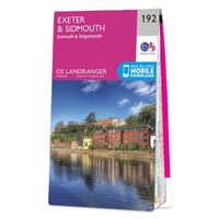 Wandelkaart - Topografische kaart 192 Landranger Exeter & Sidmouth, Exmouth & Teignmouth | Ordnance Survey
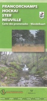 Wandelkaart 192 Francorchamps, Hockai, Ster, Neuville | NGI - Nationaal Geografisch Instituut★★★★★
 Wandelkaart - Topografische kaart 192 OS Explorer Map Buckingham, Milton Keynes | Ordnance Survey
 Wandelkaart - Topografische kaart 1920 SB - Serie Bleue Vendome, Montoire-sur-le-Loir | IGN - Institut Géographique National
 Wandelkaart - Topografische kaart 1921 SB - Serie Bleue Château-Renault, St-Amand-Longpré | IGN - Institut Géographique National
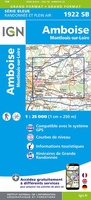 Wandelkaart - Topografische kaart 1922 SB - Serie Bleue Amboise, Montlouis-sur-Loire | IGN - Institut Géographique National
 Wandelkaart - Topografische kaart 1923 SB - Serie Bleue Bléré - Chenonceaux - Veigné | IGN - Institut Géographique National
 Wandelkaart - Topografische kaart 1924 SB - Serie Bleue Loches - Ligueil | IGN - Institut Géographique National
 Wandelkaart - Topografische kaart 1925 SB - Serie Bleue Preuilly-sur-Claise, le Grand-Pressigny | IGN - Institut Géographique National
Laatste reviews

Top kaart
Goeie kaar UK met alle relevante fietsroutes
★★★★★ door A 15 juni 2026 | Heeft dit artikel gekocht
Uitgebreide info en route in twee richtingen
Prima gids met een aparte kaart. Het enige missende is een overzicht van stijgen en dalen per dag. Er staat wel een totaal in aan …
★★★★★ door Pien 15 juni 2026 | Heeft dit artikel gekocht
Mooie duidelijke kaart.
De kaart is duidelijk en redelijk gedetailleerd, precies wat ik zocht, vrij groot, maar geen probleem...
★★★★★ door Paul Romijn 15 juni 2026 | Heeft dit artikel gekocht
Verassend goede en rijke wandelgids
Deze gids bevat een schat an informatie over talloze rondwandelingen langs de Jurassic Coast, met veel aandacht voor de geologische aspecten van deze kust. De …
★★★★★ door Raymond Franssen 13 juni 2026 | Heeft dit artikel gekocht