Winkelwagen
Geen items in winkelwagen
Ga naar winkelwagen
Topografische kaarten - Europa
 Wandelkaart - Topografische kaart 1716 SB - Serie Bleue Alençon - Sées | IGN - Institut Géographique National
 Wandelkaart - Topografische kaart 1717 SB - Serie Bleue Alençon - Marolles-les-Braults | IGN - Institut Géographique National
 Wandelkaart - Topografische kaart 1718 SB - Serie Bleue Beaumont-sur-Sarthe - Ballon | IGN - Institut Géographique National
 Wandelkaart - Topografische kaart 1719 SB - Serie Bleue Le Mans - La Suze-sur-Sarthe | IGN - Institut Géographique National
 Wandelkaart - Topografische kaart 172 OS Explorer Map Chiltern Hills East | Ordnance Survey★★★★★
 Wandelkaart - Topografische kaart 172 Landranger Bristol & Bath, Thornbury & Chew Magna | Ordnance Survey
 Wandelkaart - Topografische kaart 1720 SB - Serie Bleue Ecommoy – Cérans-Foulletourte | IGN - Institut Géographique National
 Topografische kaart - Wandelkaart 1721 SB - Serie Bleue le Lude | IGN - Institut Géographique National
 Wandelkaart - Topografische kaart 1723ET Chinon | IGN - Institut Géographique National
 Wandelkaart - Topografische kaart 1724 SB - Serie Bleue Loudun – Richelieu | IGN - Institut Géographique National★★★★★
 Wandelkaart - Topografische kaart 1725 SB - Serie Bleue Lencloitre, St-Jean-de-Sauves | IGN - Institut Géographique National
 Wandelkaart - Topografische kaart 1728 SB - Serie Bleue Vivonne - Lusignan | IGN - Institut Géographique National
 Wandelkaart - Topografische kaart 1729 SB - Serie Bleue Civray - Sauze - Vaussais | IGN - Institut Géographique National
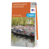 Wandelkaart - Topografische kaart 173 OS Explorer Map London North | Ordnance Survey
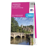 Wandelkaart - Topografische kaart 173 Landranger Swindon & Devizes, Marlborough & Trowbridge | Ordnance Survey
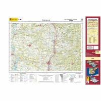 Topografische kaart 173 MT50 Tafalla | CNIG - Instituto Geográfico Nacional1
 Wandelkaart - Topografische kaart 1730 SB - Serie Bleue Ruffec - Villefagnan | IGN - Institut Géographique National
 Wandelkaart - Topografische kaart 1731 SB - Serie Bleue Mansle | IGN - Institut Géographique National
 Wandelkaart - Topografische kaart 1732 SB - Serie Bleue Angoulême, Ruelle-sur-Touvre | IGN - Institut Géographique National
 Wandelkaart - Topografische kaart 1733 SB - Serie Bleue Montmoreau-Saint-Cybard | IGN - Institut Géographique National
Laatste reviews

Goede kaart!
Fijne kaart, goed leesbaar. Niet waterafstotend maar in Spanje is dat vaak niet nodig
★★★★★ door Marlieke 18 mei 2026 | Heeft dit artikel gekocht
Credencial Camino de Santiago
Voor en goede prijs snel thuis ontvangen na bestellen.
★★★★★ door Veronica 18 mei 2026 | Heeft dit artikel gekocht
Prima kaart voor tochtplanning en backup
Duuraam resistent papier. Voor navigatie zou een meer gedetailleerde schaal beter zijn, maar de eigenlijke wandelroutes zijn ook in het veld vindbaar door markering. In …
★★★★★ door Jan Willem Genuit 14 mei 2026 | Heeft dit artikel gekocht
Duidelijke kaart
Prima kaart met veel informatie.
★★★★★ door Hans 13 mei 2026 | Heeft dit artikel gekocht