Winkelwagen
Geen items in winkelwagen
Ga naar winkelwagen
Topografische kaarten - Europa
 Wandelkaart - Topografische kaart 1210OT Cherbourg-en-Cotentin, Cap de la Hague | IGN - Institut Géographique National
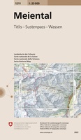 Wandelkaart - Topografische kaart 1211 Meiental | Swisstopo★★★★★
 Wandelkaart - Topografische kaart 1211OT Les Pieux, Barneville, Carteret | IGN - Institut Géographique National
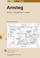 Wandelkaart - Topografische kaart 1212 Amsteg | Swisstopo
 Topografische kaart - Wandelkaart 1212ET La Haye-du-Puits / Lessay | IGN - Institut Géographique National
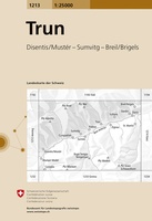 Wandelkaart - Topografische kaart 1213 Trun | Swisstopo
 Wandelkaart - Topografische kaart 1214 LLanz | Swisstopo
 Wandelkaart - Topografische kaart 1214ET Granville, Coutances, Iles Chausey | IGN - Institut Géographique National
 Wandelkaart - Topografische kaart 1215 Thusis | Swisstopo★★★★★
 Wandelkaart - Topografische kaart 1215ET Avranches, Granville, Le Mont Saint Michel | IGN - Institut Géographique National
 Wandelkaart - Topografische kaart 1215OT Le Mont St.-Michel, Dol-de-Bretagne | IGN - Institut Géographique National
 Wandelkaart - Topografische kaart 1216 SB - Serie Bleue Dol-de-Bretagne | IGN - Institut Géographique National
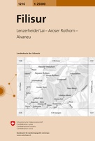 Wandelkaart - Topografische kaart 1216 Filisur | Swisstopo★★★★★
 Wandelkaart - Topografische kaart 1217 SB - Serie Bleue Combourg – St-Aubin-d'Aubigné | IGN - Institut Géographique National
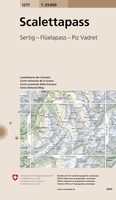 Wandelkaart - Topografische kaart 1217 Scalettapass | Swisstopo
 Wandelkaart - Topografische kaart 1218 Zernez | Swisstopo
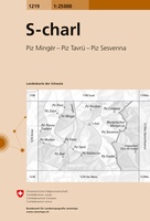 Wandelkaart - Topografische kaart 1219 S-charl | Swisstopo
 Wandelkaart - Topografische kaart 1219 SB - Serie Bleue Bruz - Janzé | IGN - Institut Géographique National
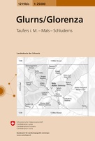 Wandelkaart - Topografische kaart 1219bis Glurns/Glorenza | Swisstopo
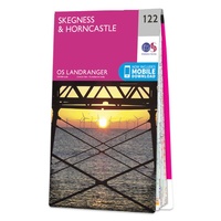 Wandelkaart - Topografische kaart 122 Landranger Skegness & Horncastle | Ordnance Survey
Laatste reviews

Hoogtepunten van Rügen in een oogopslag
Gidsje werkt voor mij goed als aanvulling op gedetailleerde reisgids Rügen, Hiddensee und Strallsund van Michael Müller Verlag. Wel een beetje populair/melig taalgebruik.
★★★★★ door Jacques 31 mei 2026 | Heeft dit artikel gekocht
Beste reisgids voor Rügen
Gedetailleerd, overzichtelijk en handzaam formaat.
★★★★★ door Jacques 31 mei 2026 | Heeft dit artikel gekocht
Overzichtelijk
Prachtig vormgegeven boek met veel wetenswaardigheden en routes over de Lanquedoc
★★★★★ door WIM LUCASSEN 31 mei 2026 | Heeft dit artikel gekocht
Mooi uitgevoerde kaart maar out-of-date
Mooi uitgevoerde kaart, veel (touristische) informatie en sterk watervast papier. Maar, hoewel uitgegeven in 2022, is het databestand uit 2010. Het wegennet is Noord Spanje …
★★★★★ door Soons 30 mei 2026 | Heeft dit artikel gekocht