Winkelwagen
Geen items in winkelwagen
Ga naar winkelwagen
Topografische kaarten - Europa
 Wandelkaart - Topografische kaart 2120 SB - Serie Bleue Beaugency, Mer, Meung-sur-Loire | IGN - Institut Géographique National★★★★★
 Wandelkaart - Topografische kaart 2121 SB - Serie Bleue Mer | IGN - Institut Géographique National
 Wandelkaart - Topografische kaart 2121OT Blois - Chambord - Cheverny | IGN - Institut Géographique National
 Wandelkaart - Topografische kaart 2122 SB - Serie Bleue Romorantin-Lanthenay | IGN - Institut Géographique National
 Wandelkaart - Topografische kaart 2123 SB - Serie Bleue Selles-sur-Cher, Chabris | IGN - Institut Géographique National
 Wandelkaart - Topografische kaart 2124 SB - Serie Bleue Lucay-le-Male | IGN - Institut Géographique National
 Wandelkaart - Topografische kaart 2125 SB - Serie Bleue Châteauroux, Levroux, Villedieu-sur-Indre | IGN - Institut Géographique National
 Wandelkaart - Topografische kaart 2126 SB - Serie Bleue Le Poinçonnet, Velles, Luant | IGN - Institut Géographique National
 Topografische kaart - Wandelkaart 2127 SB - Serie Bleue Argenton-sur-Creuse | IGN - Institut Géographique National
 Wandelkaart - Topografische kaart 2128 SB - Serie Bleue Dun-le-Palestel | IGN - Institut Géographique National★★★★★
 Wandelkaart - Topografische kaart 2129 SB - Serie Bleue La Souterraine | IGN - Institut Géographique National
 Wandelkaart - Topografische kaart 213 OS Explorer Map Aberystwyth, Cwm Rheidol | Ordnance Survey
 Topografische kaart 213 MT50 El Pont de Suert | CNIG - Instituto Geográfico Nacional1
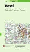 Wandelkaart - Topografische kaart 213 Basel | Swisstopo
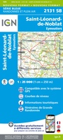 Wandelkaart - Topografische kaart 2131 SB - Serie Bleue St-Léonard-de-Noblat, Eymoutiers | IGN - Institut Géographique National
 Wandelkaart - Topografische kaart 2132 SB - Serie Bleue Châteauneuf-la-Forêt, Chamberet | IGN - Institut Géographique National
 Wandelkaart - Topografische kaart 2133 SB - Serie Bleue Uzerche, Treignac, Seilhac | IGN - Institut Géographique National
 Wandelkaart - Topografische kaart 2134 SB - Serie Bleue Tulle | IGN - Institut Géographique National
 Wandelkaart - Topografische kaart 2135 SB - Serie Bleue Beynat, Meyssac, Collonges-la-Rouge, Brive-la-Gaillarde | IGN - Institut Géographique National
 Wandelkaart - Topografische kaart 2137 SB - Serie Bleue Gramat | IGN - Institut Géographique National
Laatste reviews

Prima kaart voor tochtplanning en backup
Duuraam resistent papier. Voor navigatie zou een meer gedetailleerde schaal beter zijn, maar de eigenlijke wandelroutes zijn ook in het veld vindbaar door markering. In …
★★★★★ door Jan Willem Genuit 14 mei 2026 | Heeft dit artikel gekocht
Duidelijke kaart
Prima kaart met veel informatie.
★★★★★ door Hans 13 mei 2026 | Heeft dit artikel gekocht
Goede kaart, maar weinig meerwaarde boven de 1:200.000-kaart
Op zich een goede kaart, maar het is eigenlijk gewoon een uitvergroting van de bekende 1:200.000-kaarten, dus weinig tot geen extra informatie. Wel wat duidelijker …
★★★★★ door FGM Ballhaus 13 mei 2026 | Heeft dit artikel gekocht
Iets te grote schaal voor wandelen, maar verder een goede kaart voor wandelen en fietsen
Duidelijke kaart, goed voor fietsen, iets minder voor wandelen door de schaal, maar er is heel weinig kaartmateriaal voor dit gebied dus daarom toch dik …
★★★★★ door FGM Ballhaus 13 mei 2026 | Heeft dit artikel gekocht