Winkelwagen
Geen items in winkelwagen
Ga naar winkelwagen
Topografische kaarten - Europa
 Topografische kaart - Wandelkaart 21H Dalfsen | Kadaster
 Topografische kaart 22 MT50 Pontedeume | CNIG - Instituto Geográfico Nacional1
 Topografische kaart - Wandelkaart 22 Topo50 Gent | NGI - Nationaal Geografisch Instituut
 Wandelkaart - Topografische kaart 22/1-2 Topo25 Gent - Destelbergen - Melle - Sint Martens Latem | NGI - Nationaal Geografisch Instituut
 Wandelkaart - Topografische kaart 22/3-4 Topo25 Wetteren - Zele - Berlare - Beervelde | NGI - Nationaal Geografisch Instituut
 Wandelkaart - Topografische kaart 22/5-6 Topo25 Merelbeke | NGI - Nationaal Geografisch Instituut
 Wandelkaart - Topografische kaart 22/7-8 Topo25 Aalst - Lede | NGI - Nationaal Geografisch Instituut
 Topografische kaart 220 MT50 Agullana | CNIG - Instituto Geográfico Nacional1
 Wandelkaart - Topografische kaart 220 OS Explorer Map Birmingham | Ordnance Survey
 Topografische kaart 220-I La Jonquera | CNIG - Instituto Geográfico Nacional1
 Topografische kaart 220-II/221-I Mas Pils | CNIG - Instituto Geográfico Nacional
 Topografische kaart 220-III Agullana | CNIG - Instituto Geográfico Nacional
 Topografische kaart 220-IV Garriguella | CNIG - Instituto Geográfico Nacional
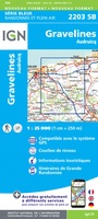 Wandelkaart - Topografische kaart 2203 SB - Serie Bleue Gravelines - Andruicq | IGN - Institut Géographique National
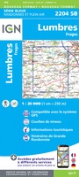 Wandelkaart - Topografische kaart 2204 SB - Serie Bleue Lumbres - Fruges | IGN - Institut Géographique National
 Wandelkaart - Topografische kaart 2206 SB - Serie Bleue Hesdin, Auxi-le-Château | IGN - Institut Géographique National
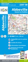 Wandelkaart - Topografische kaart 2207 SB - Serie Bleue Abbeville, Domart-en-Ponthieu | IGN - Institut Géographique National
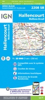 Wandelkaart - Topografische kaart 2208 SB - Serie Bleue Picquigny, Hallencourt, Molliens-Dreuil | IGN - Institut Géographique National
 Wandelkaart - Topografische kaart 2209 SB - Serie Bleue Poix-de-Picardie, Hornoy-le-Bourg | IGN - Institut Géographique National
 Topografische kaart 221 MT50 Portbou | CNIG - Instituto Geográfico Nacional1
Laatste reviews

Hoogtepunten van Rügen in een oogopslag
Gidsje werkt voor mij goed als aanvulling op gedetailleerde reisgids Rügen, Hiddensee und Strallsund van Michael Müller Verlag. Wel een beetje populair/melig taalgebruik.
★★★★★ door Jacques 31 mei 2026 | Heeft dit artikel gekocht
Beste reisgids voor Rügen
Gedetailleerd, overzichtelijk en handzaam formaat.
★★★★★ door Jacques 31 mei 2026 | Heeft dit artikel gekocht
Overzichtelijk
Prachtig vormgegeven boek met veel wetenswaardigheden en routes over de Lanquedoc
★★★★★ door WIM LUCASSEN 31 mei 2026 | Heeft dit artikel gekocht
Mooi uitgevoerde kaart maar out-of-date
Mooi uitgevoerde kaart, veel (touristische) informatie en sterk watervast papier. Maar, hoewel uitgegeven in 2022, is het databestand uit 2010. Het wegennet is Noord Spanje …
★★★★★ door Soons 30 mei 2026 | Heeft dit artikel gekocht