Winkelwagen
Geen items in winkelwagen
Ga naar winkelwagen
Topografische kaarten - Europa
 Wandelkaart - Topografische kaart 242 OS Explorer Map Telford, Ironbridge, the Wrekin | Ordnance Survey
 Wandelkaart - Topografische kaart 242 Avenches | Swisstopo
 Wandelkaart - Topografische kaart 2420 SB - Serie Bleue Châtillon-Coligny, Nogent-sur-Vernisson | IGN - Institut Géographique National
 Wandelkaart - Topografische kaart 2421 SB - Serie Bleue Briare | IGN - Institut Géographique National
 Wandelkaart - Topografische kaart 2422 SB - Serie Bleue St-Satur, Léré, Vailly-sur-Sauldre | IGN - Institut Géographique National
 Wandelkaart - Topografische kaart 2424 SB - Serie Bleue Nérondes - Avord | IGN - Institut Géographique National
 Wandelkaart - Topografische kaart 2425 SB - Serie Bleue Dun-sur-Aubron - Blet | IGN - Institut Géographique National
 Topografische kaart - Wandelkaart 2426 SB - Serie Bleue Charenton-du-Cher | IGN - Institut Géographique National
 Topografische kaart - Wandelkaart 2427 SB - Serie Bleue Cérilly | IGN - Institut Géographique National
 Wandelkaart - Topografische kaart 2428 SB - Serie Bleue Montluçon | IGN - Institut Géographique National
 Wandelkaart - Topografische kaart 2429 SB - Serie Bleue Saint-Éloy-les-Mines | IGN - Institut Géographique National
 Wandelkaart - Topografische kaart 243 Bern | Swisstopo
 Wandelkaart - Topografische kaart 243 OS Explorer Map Market Drayton | Ordnance Survey
 Wandelkaart - Topografische kaart 2432ET Massif du Sancy | IGN - Institut Géographique National★★★★★
 Topografische kaart - Wandelkaart 2433 SB - Serie Bleue la Bourboule | IGN - Institut Géographique National
 Wandelkaart - Topografische kaart 2434OT Riom es Montagnes, Bort-les-Orgues, PNR des Volcans d'Auvergne | IGN - Institut Géographique National
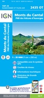 Wandelkaart - Topografische kaart 2435OT Monts du Cantal | IGN - Institut Géographique National★★★★★
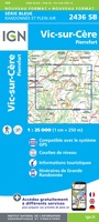 Wandelkaart - Topografische kaart 2436 SB - Serie Bleue Pierrefort, Barrage de Sarrans, Vic-sur-Cère | IGN - Institut Géographique National★★★★★
 Wandelkaart - Topografische kaart 2437 SB - Serie Bleue Laguiole, Entraygues-sur-Truyere | IGN - Institut Géographique National★★★★★
 Wandelkaart - Topografische kaart 2438 SB - Serie Bleue Espalion - Estaing | IGN - Institut Géographique National
Laatste reviews

Matig
Deze gids is dun en makkelijk mee te nemen tijdens je wandeltocht. Het beschrijft echter een andere route dan de gebruikelijke route vanaf Echternach. Jammer …
★★★★★ door Sven 22 april 2026 | Heeft dit artikel gekocht
Mooie en degelijke wereldbol
Mooie en degelijke wereldbol. Voldoet volledig aan mijn wensen.
★★★★★ door Ben te Molder 21 april 2026 | Heeft dit artikel gekocht
Mooie kaart
Grote sortering en prima verzending
★★★★★ door Willem 21 april 2026 | Heeft dit artikel gekocht
Lichtgewicht en handzaam
Heel blij mee! Super handzaam, lichtgewicht boekje om mee te nemen op de camino. Alles staat er overzichtelijk in wat nodig is. Deze gaat zeker …
★★★★★ door Greetje 20 april 2026 | Heeft dit artikel gekocht