Winkelwagen
Geen items in winkelwagen
Ga naar winkelwagen
Topografische kaarten - Europa
 Wandelkaart - Topografische kaart 2718 SB - Serie Bleue Auxon | IGN - Institut Géographique National
 Wandelkaart - Topografische kaart 2719 SB - Serie Bleue Saint-Florentin – Flogny-la-Chapelle | IGN - Institut Géographique National
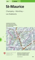 Wandelkaart - Topografische kaart 272 St-Maurice | Swisstopo
 Wandelkaart - Topografische kaart 272 OS Explorer Map Lincoln | Ordnance Survey
 Topografische kaart - Wandelkaart 2721 SB - Serie Bleue Vermenton | IGN - Institut Géographique National
 Wandelkaart - Topografische kaart 241 OS Explorer Map Shrewsbury | Ordnance Survey
 Topografische kaart 241 MT50 Anguiano | CNIG - Instituto Geográfico Nacional1
 Topografische kaart 241-I Anguiano | CNIG - Instituto Geográfico Nacional1
 Topografische kaart 241-II Torrecilla en Cameros | CNIG - Instituto Geográfico Nacional1
 Topografische kaart 241-IV Laguna de Cameros | CNIG - Instituto Geográfico Nacional1
 Wandelkaart - Topografische kaart 2410 SB - Serie Bleue Ressons-sur-Matz, Montdidier | IGN - Institut Géographique National
 Wandelkaart - Topografische kaart 2411 SB - Serie Bleue Estrées-St-Denis, Clermont | IGN - Institut Géographique National
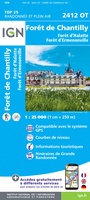 Wandelkaart - Topografische kaart 2412OT Forêt de Chantilly | IGN - Institut Géographique National★★★★★
 Wandelkaart - Topografische kaart 2413OT Dammartin-en-Goële, Centre | IGN - Institut Géographique National
 Wandelkaart - Topografische kaart 2414ET Marne-la-Vallée - Forêts: Crécy - Armainvilliers - Ferrières, Centre | IGN - Institut Géographique National
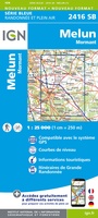 Wandelkaart - Topografische kaart 2416 SB - Serie Bleue Melun, Mormant | IGN - Institut Géographique National
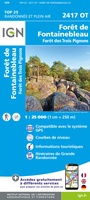 Wandelkaart - Topografische kaart 2417OT Forêt de Fontainebleau | IGN - Institut Géographique National★★★★★
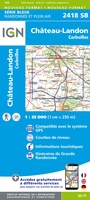 Wandelkaart - Topografische kaart 2418 SB - Serie Bleue Château-Landon, Corbeilles | IGN - Institut Géographique National
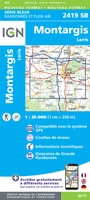 Wandelkaart - Topografische kaart 2419 SB - Serie Bleue Montargis - Lorris | IGN - Institut Géographique National
 Topografische kaart 242 MT50 Arnedillo | CNIG - Instituto Geográfico Nacional1
Laatste reviews

Prima kaart voor tochtplanning en backup
Duuraam resistent papier. Voor navigatie zou een meer gedetailleerde schaal beter zijn, maar de eigenlijke wandelroutes zijn ook in het veld vindbaar door markering. In …
★★★★★ door Jan Willem Genuit 14 mei 2026 | Heeft dit artikel gekocht
Duidelijke kaart
Prima kaart met veel informatie.
★★★★★ door Hans 13 mei 2026 | Heeft dit artikel gekocht
Goede kaart, maar weinig meerwaarde boven de 1:200.000-kaart
Op zich een goede kaart, maar het is eigenlijk gewoon een uitvergroting van de bekende 1:200.000-kaarten, dus weinig tot geen extra informatie. Wel wat duidelijker …
★★★★★ door FGM Ballhaus 13 mei 2026 | Heeft dit artikel gekocht
Iets te grote schaal voor wandelen, maar verder een goede kaart voor wandelen en fietsen
Duidelijke kaart, goed voor fietsen, iets minder voor wandelen door de schaal, maar er is heel weinig kaartmateriaal voor dit gebied dus daarom toch dik …
★★★★★ door FGM Ballhaus 13 mei 2026 | Heeft dit artikel gekocht