Winkelwagen
Geen items in winkelwagen
Ga naar winkelwagen
Topografische kaarten - Europa
 Wandelkaart - Topografische kaart 3124 SB - Serie Bleue Seurre | IGN - Institut Géographique National
 Wandelkaart - Topografische kaart 3125 SB - Serie Bleue Pierre-de-Bresse, St-Martin-de-Bresse | IGN - Institut Géographique National
 Wandelkaart - Topografische kaart 3126 SB - Serie Bleue Mervans, Montret. Louhans | IGN - Institut Géographique National
 Wandelkaart - Topografische kaart 3127 SB - Serie Bleue Cuiseaux | IGN - Institut Géographique National
 Wandelkaart - Topografische kaart 3128 SB - Serie Bleue Montrevel-en-Bresse, Marboz | IGN - Institut Géographique National
 Wandelkaart - Topografische kaart 3129 SB - Serie Bleue Bourg-en-Bresse | IGN - Institut Géographique National
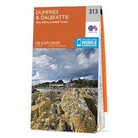 Wandelkaart - Topografische kaart 313 OS Explorer Map Dumfries, Dalbeattie | Ordnance Survey
 Wandelkaart - Topografische kaart 3130 SB - Serie Bleue Ambérieu-en-Bugey | IGN - Institut Géographique National
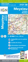 Wandelkaart - Topografische kaart 3131 SB - Serie Bleue Meyzieu | IGN - Institut Géographique National
 Wandelkaart - Topografische kaart 3132 SB - Serie Bleue Bourgoin-Jallieu - La Velpillere | IGN - Institut Géographique National
 Wandelkaart - Topografische kaart 3133 SB - Serie Bleue La Côte-St-André – St-Jean-de-Bournay | IGN - Institut Géographique National
 Wandelkaart - Topografische kaart 3134 SB - Serie Bleue St-Etienne-de-St-Geoirs – Le Grand-Serre | IGN - Institut Géographique National
 Topografische kaart - Wandelkaart 3135 Romans-sur-Isère, St-Marcellin | IGN - Institut Géographique National
 Wandelkaart - Topografische kaart 3136 SB - Serie Bleue Bourg-de-Péage – Chabeuil | IGN - Institut Géographique National
 Wandelkaart - Topografische kaart 3136ET Combe Laval | IGN - Institut Géographique National★★★★★
 Wandelkaart - Topografische kaart 3137OT Die – Crest – Saillans | IGN - Institut Géographique National★★★★★
 Wandelkaart - Topografische kaart 3138OT Dieulefit | IGN - Institut Géographique National★★★★★
 Wandelkaart - Topografische kaart 3139OT Nyons - Rémuzat | IGN - Institut Géographique National★★★★★
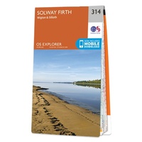 Wandelkaart - Topografische kaart 314 OS Explorer Map Solway Firth, Wigton, Silloth explorer | Ordnance Survey
 Wandelkaart - Topografische kaart 3140ET Mont Ventoux | IGN - Institut Géographique National★★★★★★★★★★
Laatste reviews

Super
Rother wandelgidsen stellen nooit teleur. Mooie routes, goede opgave kilometers, hoogtemeters en horeca. Een aanrader!
★★★★★ door Anita Geel 13 januari 2026 | Heeft dit artikel gekocht
Prachtig boek!
Mooi boek met prachtige foto’s! Voldoet helemaal aan mijn verwachtingen.
★★★★★ door Hans Eldering 13 januari 2026 | Heeft dit artikel gekocht
zeer vlotte levering
het product voldeed aan mijn verwachtingen en was geplastificeerd wat natuurlijk perfect is voor kaart die veel wordt geraadpleegd!
★★★★★ door Peter Lantinga 13 januari 2026 | Heeft dit artikel gekocht
Gedetailleerde wegenkaart
Ik heb de wegenkaart Maleisië aangeschaft om zelf een rondreis per huurauto te kunnen plannen. Deze kaart heeft daar heel goed bij geholpen doordat er …
★★★★★ door M. Rizvi 13 januari 2026 | Heeft dit artikel gekocht