Winkelwagen
Geen items in winkelwagen
Ga naar winkelwagen
Topografische kaarten - Europa
 Topografische kaart 192 MT50 Lucillo | CNIG - Instituto Geográfico Nacional
 Wandelkaart - Topografische kaart 192 Landranger Exeter & Sidmouth, Exmouth & Teignmouth | Ordnance Survey
 Topografische kaart 192-I Pobladura De La Sierra | CNIG - Instituto Geográfico Nacional
 Topografische kaart 192-II Santa Colomba De Somoza | CNIG - Instituto Geográfico Nacional
 Wandelkaart - Topografische kaart 1920 SB - Serie Bleue Vendome, Montoire-sur-le-Loir | IGN - Institut Géographique National
 Wandelkaart - Topografische kaart 1921 SB - Serie Bleue Château-Renault, St-Amand-Longpré | IGN - Institut Géographique National
 Wandelkaart - Topografische kaart 1922 SB - Serie Bleue Amboise, Montlouis-sur-Loire | IGN - Institut Géographique National
 Wandelkaart - Topografische kaart 1923 SB - Serie Bleue Bléré - Chenonceaux - Veigné | IGN - Institut Géographique National
 Wandelkaart - Topografische kaart 1924 SB - Serie Bleue Loches - Ligueil | IGN - Institut Géographique National
 Wandelkaart - Topografische kaart 1925 SB - Serie Bleue Preuilly-sur-Claise, le Grand-Pressigny | IGN - Institut Géographique National
 Wandelkaart - Topografische kaart 1926 SB - Serie Bleue Le Blanc, Pleumartin, La Roche-Posay | IGN - Institut Géographique National
 Wandelkaart - Topografische kaart 1927 SB - Serie Bleue La Trimouille | IGN - Institut Géographique National
 Wandelkaart - Topografische kaart 1928 SB - Serie Bleue Montmorillon, Lathus-St-Rémy | IGN - Institut Géographique National
 Wandelkaart - Topografische kaart 1929 SB - Serie Bleue Bellac - Adriers | IGN - Institut Géographique National
 Wandelkaart - Topografische kaart 193 Landranger Taunton & Lyme Regis, Chard & Bridport | Ordnance Survey
 Topografische kaart 193 MT50 Astorga | CNIG - Instituto Geográfico Nacional1
 Wandelkaart - Topografische kaart 193 OS Explorer Map Luton, Stevenage | Ordnance Survey
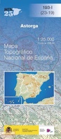 Topografische kaart 193-I Astorga | CNIG - Instituto Geográfico Nacional
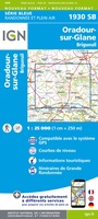 Wandelkaart - Topografische kaart 1930 SB - Serie Bleue Oradour-sur-Glane | IGN - Institut Géographique National
 Wandelkaart - Topografische kaart 1931 SB - Serie Bleue Rochechouart | IGN - Institut Géographique National
Laatste reviews

De beste kaart
We kochten deze kaart omdat we naar een gedeelte van Kreta gingen waar we 12 jaar niet waren geweest. De kaart gaf ons actuele info …
★★★★★ door Jan Hendriks 01 juni 2026 | Heeft dit artikel gekocht
Schot in de roos!
Zeer tevreden!
★★★★★ door Godert Mollerus 01 juni 2026 | Heeft dit artikel gekocht
Hoogtepunten van Rügen in een oogopslag
Gidsje werkt voor mij goed als aanvulling op gedetailleerde reisgids Rügen, Hiddensee und Strallsund van Michael Müller Verlag. Wel een beetje populair/melig taalgebruik.
★★★★★ door Jacques 31 mei 2026 | Heeft dit artikel gekocht
Beste reisgids voor Rügen
Gedetailleerd, overzichtelijk en handzaam formaat.
★★★★★ door Jacques 31 mei 2026 | Heeft dit artikel gekocht