Zuid-Afrika
 Wandelkaart 1&2 South Africa: Drakensberg North | Slingsby Maps
DRAKENSBERG NORTH: This double‑sided A1-sized map is the first of three maps in the latest edition of our famous “Slingsby” Drakensberg map series. Side One covers the area from Mpokelana …
 Wandelkaart 3&4 South Africa: Drakensberg Central | Slingsby Maps
DRAKENSBERG CENTRAL: This double‑sided A1-sized map is the second of three maps in the latest edition of our famous “Slingsby” Drakensberg map series. Side One covers the area from Injesuthi …
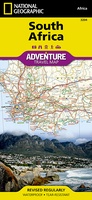 Wegenkaart - landkaart 3204 Adventure Map South Africa - Zuid Afrika | National Geographic
Wegenkaart van Zuid Afrika met vermelding van veel bezienswaardigheden, nationale parken en attrakties. Watervast en scheurvast. Juist door deze vermeldingen onderscheidt de kaart zich van andere wegenkaarten. National Geographic’s South …
★★★★★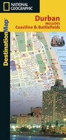 Stadsplattegrond Durban Coastline & Battlefields | National Geographic
Handige geplastificeerde stadsplattegrond van Durban. In addition to the easy-to-read map on the front, the back includes: Regional map Points of interest Information and map of the North Coast Information …
★★★★★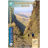 Wandelkaart 5&6 South Africa: Drakensberg South | Slingsby Maps
This double-sided map is the third of three maps in the latest edition of our famous “Slingsby” Drakensberg map series. Side One covers the area from Lotheni southwards through Vergelegen …
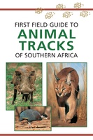 Natuurgids First Field Guide to Animal Tracks of Southern Africa | Struik Nature
Dit handzame gidsje is een goed hulpmiddel voor het spotten van de sporen van meest voorkomende dieren in zuidelijk Afrika. Met kleurenfoto's, tekeningen van pootafdrukken en kaartjes van leefgebieden. The …
 Reisverhaal Zuid-Afrika | Dolf de Vries
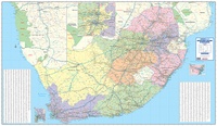 Wandkaart South Africa business map 4-delig | 260 x 152 cm | MapStudio
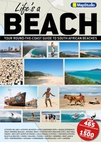 Reisgids Life's a Beach - Zuid-Afrika | MapStudio
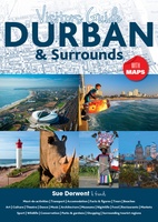 Reisgids Durban & omgeving | MapStudio
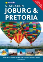 Reisgids Staycation Joburg & Pretoria | MapStudio
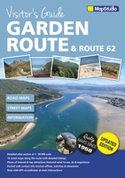 Wegenatlas - Reisgids Garden Route & Route 62 Visitors Guide | MapStudio
Visitor’s Guide to the Garden Route & Route 62 is your GPS Companion This Visitor’s Guide includes 14 street maps along with the various routes and detailed listing of …
★★★★★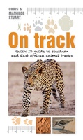 Natuurgids On Track | Struik Nature
Following the success of the earlier Scatalog: Quick ID guide to southern African animal droppings, here’s another quick and quirky identification guide, this time to tracks of the region’s most …
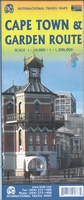 Stadsplattegrond - Wegenkaart - landkaart Cape Town & Garden Route: Kaapstad & Garden Route: Zuidelijk Afrika | ITMB★★★★★★★★★★
 Wegenkaart - landkaart Zuid Afrika - South Africa incl Lesotho & Swaziland | Tracks4Africa
Gerenommeerde wegenkaart van Zuid Afrika, vooral gericht op navigeren met GPS en het rijden over de kleinere wegen. De eerste toeristische kaart van Zuid-Afrika die reistijden en afstanden vermeld. De …
★★★★★★★★★★ Reisgids Insight guides Insight Guide Zuid-Afrika | Tree Books
 Reisgids - Reishandboek Addo Self-drive | HPH Publishing
Addo Elephant National Park is a diverse wildlife conservation park situated close to Gqeberha in South Africa and is one of the country's 20 national parks. It currently ranks third …
 Legpuzzel South Africa Wine Puzzle | Water & Wine
 Wegenkaart - landkaart Zuid Afrika - South Africa | ITMB
Uitstekende wegenkaart van Zuid Afrika met zowel de toeristische informatie als Nationale Parken en bezienswaardigheden, maar ook de topografische details en afstanden. Gedrukt op 'waterproof' papier. Double-sided map of South …
★★★★★★★★★★ Wegenatlas Travel Atlas Afrika Africa Overland: Cairo to Cape Town | ITMB
Handzame wegenatlas, formaat A5, van de hele route van Cairo naar Kaapstad langs de oostelijke kant van Afrika. Naast de wegenkaarten bevat deze atlas ook een aantal centrumkaarten van de …
- 1
- 2
- 3
- Volgende >>
- 6
Laatste reviews

Kort voor vakantie naar de Galapagos eilanden toch nog behoefte aan extra reisgids. Simpel kunnen bestellen en snelle levering. Zou niet weten wat er beter …
★★★★★ door Piet Grootenboer 25 juni 2026 | Heeft dit artikel gekocht
Enorm mooie wereldkaart met details en snelle fijne levering.
★★★★★ door Steven Goyvaerts 25 juni 2026 | Heeft dit artikel gekocht
Deze Cicerone gids over de via Francigena is uitermate geschikt om je route en etappes te plannen als je de Via Francigena vanuit Zwitserland gaat …
★★★★★ door Vic 24 juni 2026 | Heeft dit artikel gekocht
Heerlijk om al te kunnen voorbereiden op een fantastische vakantie met dit uiterst fijne boek.
★★★★★ door Harry 24 juni 2026 | Heeft dit artikel gekocht