Wegenkaart - landkaart Namibië - Botswana | Nelles Verlag (9783865745217)
Scheur- en watervast

- ISBN / CODE: 9783865745217
- Editie: 01-05-2019
- Aantal blz.: 1
- Schaal: 1:1500000
- Uitgever: Nelles Verlag
- Soort: Wegenkaart
- Taal: Engels, Duits
- Hoogte: 25.0 cm
- Breedte: 12.0 cm
- Gewicht: 57.0 g
- Uitvoering: Scheur- en watervast
- Bindwijze: -
- Beoordeling: 4,8 ★★★★★ (5 reviews) Schrijf een review
-
€ 11,95
Uitverkocht, nooit meer leverbaar
Beschrijving
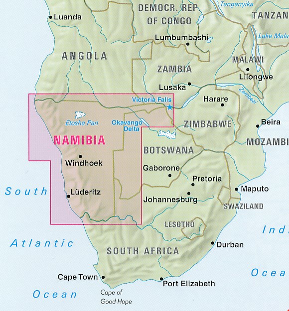
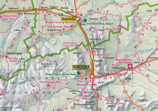
Goede kaart van Namibië en een gedeelte van Botswana. Aan beide kanten bedrukt. Met veel toeristische aanduidingen als nationale parken en culturele bezienswaardigheden. Prima leesbare kaart.
Around Lüderitz 1 : 250.000
Keetmanshoop 1 : 23.800
Reviews
vlotte en duidelijke communicatie
★★★★★ door An Katrien 12 januari 2022 | Heeft dit artikel gekochtVond u dit een nuttige review? (login om te beoordelen)
Ik ben zoals altijd zeer tevreden over de zending.
★★★★★ door Johanna Elias 10 december 2019Vond u dit een nuttige review? (login om te beoordelen)
Prima kaart (kan tegen water, sterk). Enige nadeel: ik had graag een plattegrond gehad waar heel Namibie aan 1 kant staat. Om op te hangen
★★★★★ door Wik de Jong 5 november 2019 | Heeft dit artikel gekochtVond u dit een nuttige review? (login om te beoordelen)
Schrijf een review
Graag horen wij wat u van dit artikel vindt. Vindt u het goed, leuk, mooi, slecht, lelijk, onbruikbaar of erg handig: schrijf gerust alles op! Het is niet alleen leuk om te doen maar u informeert andere klanten er ook nog mee!
Ook interessant voor afrika/namibie
-

Natuurgids South Africa Wildlife | W
€ 10,95Natuurgidsen Botswana -

Vogelgids Field Guide to Birds of Gr
€ 54,95Vogelgidsen Botswana -

Reisgids The Complete Guide To Afric
€ 29,95Reisgidsen Botswana -

Woordenboek Wat & Hoe taalgids Afrik
€ 12,50Woordenboeken & Taalgidsen Namibië -

Reisverhaal Laatste trein naar Zona
€ 24,99Reisverhalen Angola