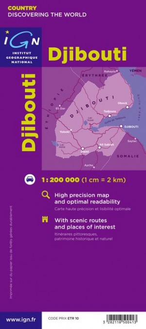
Wegenkaart - landkaart Djibouti | IGN - Institut Géographique National (3282118500413)

- ISBN / CODE: 3282118500413
- Schaal: 1:200000
- Uitgever: IGN - Institut Géographique National
- Soort: Wegenkaart
- Serie: Découverte du Monde
- Taal: Frans
- Uitvoering: -
- Bindwijze: -
- Schrijf als eerste een review
-
€ 11,75
Uitverkocht, nooit meer leverbaar
Beschrijving
Goede overzichtskaart van het Franse Cartografisch Instituut. Met autoroutes en stadsplattegronden van de belangrijkste steden.
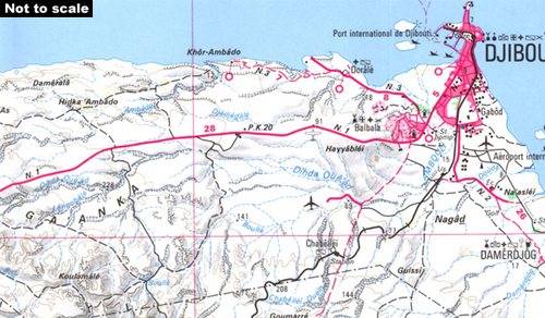
Indexed map showing relief and including an inset map of Djibouti city. Road classification distinguishes unsurfaced routes and includes 4WD trails and tracks. Intermediate distances are marked on main roads and some minor routes. Railways and airports are included, and a further range of symbols show such landmarks and details as hotels, petrol stations, churches, mosques, post offices, hospitals, wells, pylons and lighthouses. Relief is depicted by hill-shading complemented by contours and spot heights, with additional graphics for ridges and colours for landscape variations eg. mangroves, areas liable to flooding, sand and forest. District boundaries are marked and latitude and longitude lines are drawn at 15’ intervals.
The map of greater Djibouti City is at 1:50,000 and includes adjacent Balbala and the international airport. No street names are marked but various buildings are indicated e.g. mosques, hospitals, the railway station. The map legend is in French only.
Reviews
Geen reviews gevonden voor dit product.
Schrijf een review
Graag horen wij wat u van dit artikel vindt. Vindt u het goed, leuk, mooi, slecht, lelijk, onbruikbaar of erg handig: schrijf gerust alles op! Het is niet alleen leuk om te doen maar u informeert andere klanten er ook nog mee!
Ook interessant voor afrika/djibouti
-

Wegenkaart - landkaart Ethiopia - Er
€ 17,95Wegenkaarten Djibouti -

Vogelgids Birds of the Horn of Afric
€ 54,95Vogelgidsen Djibouti -

Woordenboek Miniwoordenboek Arabisch
€ 14,99Woordenboeken & Taalgidsen Algerije -

Wegenkaart - landkaart Somalië & Hoo
€ 14,95Wegenkaarten Djibouti -

Natuurgids Stuarts' Field Guide to t
€ 34,95Natuurgidsen Angola