Ordnance Survey
De Engelse precisie van Ordnance Survey resulteert in fantastische wandelkaarten!
Groot-Brittannië en Ierland hebben wandelaars en reizigers veel te bieden als het om natuur gaat: ruige landschappen, hemelhoge klippen en ongerepte, groene weides. Niet voor niets dat onder andere Game of Thrones en Star Wars hier werden opgenomen. Ook niet voor niets dat de eilanden dus geliefde bestemmingen zijn voor allerhande natuurliefhebbers!
De topografische dienst Ordnance Survey maakt een van de mooiste kaarten die beschikbaar zijn van het Verenigd Koninkrijk en Ierland. De schaal van de kaarten is altijd uiterst gedetailleerd, het kleurgebruik is prachtig. Alles wat je maar nodig hebt onderweg, staat erop en er is veel aandacht voor English Heritage. Alle langeafstandswandelpaden (GR-paden) staan ingetekend. De wegenkaarten (ofwel: road maps) van het Verenigd Koninkrijk komen in delen van acht stuks en zijn zeer goed.
Ordnance Survey biedt twee verschillende soorten kaarten: OS Explorer Maps en OS Landranger Maps. De Explorer Maps zijn vooral geschikt voor wandelen, hardlopen, bergfietsen en paardrijden en hebben een schaal van 1:25.000 (4 centimeter op de kaart is 1 kilometer op de grond), waarop voetpaden goed zijn aangegeven.
Landranger Maps omvatten grotere gebieden, maar bevatten minder details maar zijn ook zeker geschikt voor wandeltochten, road trips en vakanties. De schaal is van deze kaarten is 1:50.000 (2 centimeter op de kaart is 1 kilometer op de grond).
 Wegenkaart - landkaart Great British Folklore & superstition map | Ordnance Survey
 Wandelgids Epic British Walks | Ordnance Survey
This magnificent collection of truly EPIC WALKS brings together Britain’s most beautiful countryside with the long-distance trails that present the very best means of experiencing it. An inspiring introduction …
★★★★★ Wandelgids Peak District | Ordnance Survey
Each walk features a simple-to-follow route profile and accompanying description and pictures, and new-look walk mapping that makes it easier for the user to focus on the route and the …
 Wandelgids Pathfinder Guides London | Ordnance Survey
 Wandkaart United-Kingdom Administration | 93 x 104 cm | Ordnance Survey
 Wandelgids Yorkshire Dales | Ordnance Survey
Enjoy the magnificent waterfalls, sweeping scenery and cosy Dale pubs with ten short, leisurely walks suitable for all ages and abilities. Discover the Yorkshire Dales with its natural wonders, lush …
 Wegenkaart - landkaart Roman Britain | Ordnance Survey
An informative map showing the location of the most important ancient monuments of Roman Britain. The map has been produced by Ordnance Survey in collaboration with the Ancient Monument Trusts …
 Wandelgids North Pennines | Ordnance Survey
 Wandelgids Isle of Skye | Ordnance Survey
Each walk features a simple-to-follow route profile and accompanying description and pictures, and new-look walk mapping that makes it easier for the user to focus on the route and the …
 Wandelgids Dorset's Jurassic coast | Ordnance Survey
 Wegenkaart - landkaart Ancient Britain | Ordnance Survey
The Ordnance Survey Ancient Britain map is a comprehensive guide to the most important archaeological sites of early English, Welsh and Scottish history. Ordnance Survey's Ancient Britain map shows Neolithic, …
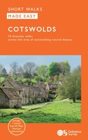 Wandelgids Cotswolds | Ordnance Survey
Explore ten easy-paced, family-friendly short walks across the Cotswolds Area of Outstanding Natural Beauty. Originating from a Saxon term meaning ‘wooded hollows, amid gentle hills’, the AONB straddles six counties, …
 Wandelgids Pembrokeshire Coast 10 leisure walks | Ordnance Survey
 Stadsplattegrond - Wandelkaart Edinburg walk - Urban maps | Ordnance Survey
 Stadsplattegrond - Wandelkaart London walk - Urban maps | Ordnance Survey
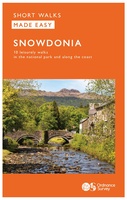 Wandelgids Snowdonia | Ordnance Survey
Everybody can explore Snowdonia, from England and Wales’ highest mountain to magical medieval castles and the spectacular Conwy coastline, with these accessible, family-friendly walks. Get outside and active with the …
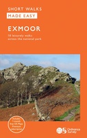 Wandelgids Exmoor 10 leisure walks | Ordnance Survey
 Wandelgids Mull & Iona 10 leisure walks | Ordnance Survey
 Wandelgids Brecon Beacons | Ordnance Survey
Get outside and enjoy ten short leisurely strolls across the Brecon Beacons National Park, indulging in wonderful mountain views across Southern Britain’s hilliest terrain. With routes for all abilities, enjoy …
 Wandelgids Wye Valley & Forest of Dean | Ordnance Survey
Laatste reviews

De puzzel heeft niet de karakteristiek gevormde puzzelstukjes, maar computer gegenereerde stukjes. Dat makt het leggen van de puzzel een nieuwe en interessante ervaring. Het …
★★★★★ door Wim Scheenen 15 december 2025 | Heeft dit artikel gekocht
Het was een beetje een gok, maar mijn 4 jarige kleinzoon is een puzzel fanaat. Het verbaasde mij hoe zelfstandig hij de puzzel kan maken. …
★★★★★ door Gerard Lijnzaad 15 december 2025 | Heeft dit artikel gekocht
Prima levering. Prima kaart.
★★★★★ door Felix 11 december 2025 | Heeft dit artikel gekocht
Goed afleesbaar, waterbestendig, zal niet gauw scheuren. We hadden hem ook snel in huis.
★★★★★ door Margo 11 december 2025 | Heeft dit artikel gekocht