Winkelwagen
Geen items in winkelwagen
Ga naar winkelwagen
IGN - Institut Géographique National
IGN is de officiële instantie voor geografische informatie in Frankrijk ofwel Institut Géographique National. Ze staan bekend om de zeer goede wandelkaarten op schaal 1:25.000 (Serie Bleue en Top 25) van Frankrijk. De wandelkaarten zijn dan ook zeer uitgebreid. De wandelaar vindt hier alle wandelpaden, campings en langeafstandswandelpaden, ook wel GR-paden (Grande Randonnée) genoemd. Kleine weggetjes en paden, maar ook de verschillende types landschappen en bebouwingen, populaire gebieden en onontdekte parels: de wandelaar in Frankrijk vindt alles terug op deze betrouwbare kaarten van IGN.
Naast wandelkaarten geeft het IGN ook goede fiets- c.q. wegenkaarten op schaal 1:100.000 (serie Top 100) en fietskaarten op schaal 1:75.000 (serie Top 75) uit.
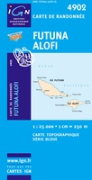 Topografische kaart - Wandelkaart 4902 Futuna (Ile) - Alofi (Ile) | IGN - Institut Géographique National
 Fietskaart 6 Velo Le Var a Velo - by Bike | IGN - Institut Géographique National★★★★★
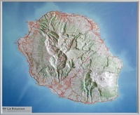 Reliëfkaart 60075 Réunion | 72 x 57 cm | IGN - Institut Géographique National
 Reliëfkaart 60170 Ecrins / Queyras met voelbaar 3D reliëf | 104 x 75 cm | IGN - Institut Géographique National
 Reliëfkaart 60171 Chartreuse / Vercors met voelbaar 3D-reliëf | IGN - Institut Géographique National
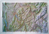 Reliëfkaart 60172 Annecy / Mont-Blanc met voelbaar 3D reliëf | 79 x 106 cm | IGN - Institut Géographique National
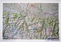 Reliëfkaart 60175 Hautes Pyrenées met voelbaar 3D Relief 106 x 73 cm (9782758555513) | IGN - Institut Géographique National
 Reliëfkaart 60176 Monts d'Auvergne rmet voelbaar 3D eliëf | 113 x 80 cm | IGN - Institut Géographique National
 Reliëfkaart 60177 Massif des Vosges - Vogezen met voelbaar 3D reliëf | 80 x 113 cm | IGN - Institut Géographique National
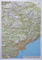 Reliëfkaart 60178 Mercantour / Côte d'Azur met voelbaar 3D reliëf | 80 x 113 cm | IGN - Institut Géographique National
 Reliëfkaart 60179 Cevennes - Gorges du Tarn et de L'Ardèche met voelbaar 3D reliëf | 113 x 80 cm | IGN - Institut Géographique National
 Reliëfkaart 60180 Pays-Basque met voelbaar 3D reliëf | 113 x 80 cm | IGN - Institut Géographique National★★★★★
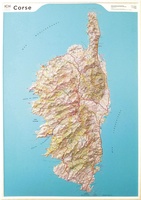 Reliëfkaart 60201 Corsica met voelbaar 3D reliëf | 113 x 80 cm | IGN - Institut Géographique National
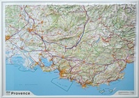 Reliëfkaart 60202 Provence met voelbaar 3D reliëf | 113 x 80 cm | IGN - Institut Géographique National
 Reliëfkaart 60203 Pyrénées Ariègeoises & Catalanes met voelbaar 3D | 113 x 80 cm reliëf | IGN - Institut Géographique National
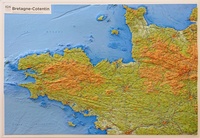 Reliëfkaart 60303 Bretagne-Cotentin met voelbaar 3D reliëf | 113 x 80 cm | IGN - Institut Géographique National
 Wandelkaart - Topografische kaart 618 SB - Serie Bleue Sillé-le-Guillaum, Conlie Ste-Suzanne | IGN - Institut Géographique National
 Wandelkaart - Topografische kaart 618 SB - Serie Bleue Scaër | IGN - Institut Géographique National
 Fietskaart 7 Velo Finistere a Velo - Finistere by Bike - Bretagne | IGN - Institut Géographique National
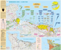 Wandkaart 70044 Normandie Jour J | D-Day | 132 x 100 cm | IGN - Institut Géographique National
Laatste reviews

Compact en toch volledig
Een compact boekje met 6 kaartjes van de voor een toerist belangrijkste Londense buurten met veel details en een overzicht van de metrolijnen. Super handig …
★★★★★ door Corine van der Hoeven 12 januari 2026 | Heeft dit artikel gekocht
Superleuk fiets boek
Erg blij met het boek onbegrensd fietsen naar Andalusië. We zijn ons nu aan het inlezen en krijgen enorm veel zin om te gaan. Er …
★★★★★ door Monique 12 januari 2026 | Heeft dit artikel gekocht
Compact gedetailleerd en overzichtelijk!
Heel blij met dit wandelgidsje. Mooie kaartjes, per etappe, ook restaurants en overnachting. Ideaal vooraf om te plannen en onderweg. Mooi compact!
★★★★★ door Peter 12 januari 2026 | Heeft dit artikel gekocht
Prima gids.
Gewoon handig boekje voor de info en planning. Route is heel goed gemarkeerd.
★★★★★ door Pieter 12 januari 2026 | Heeft dit artikel gekocht