Winkelwagen
Geen items in winkelwagen
Ga naar winkelwagen
IGN - Institut Géographique National
IGN is de officiële instantie voor geografische informatie in Frankrijk ofwel Institut Géographique National. Ze staan bekend om de zeer goede wandelkaarten op schaal 1:25.000 (Serie Bleue en Top 25) van Frankrijk. De wandelkaarten zijn dan ook zeer uitgebreid. De wandelaar vindt hier alle wandelpaden, campings en langeafstandswandelpaden, ook wel GR-paden (Grande Randonnée) genoemd. Kleine weggetjes en paden, maar ook de verschillende types landschappen en bebouwingen, populaire gebieden en onontdekte parels: de wandelaar in Frankrijk vindt alles terug op deze betrouwbare kaarten van IGN.
Naast wandelkaarten geeft het IGN ook goede fiets- c.q. wegenkaarten op schaal 1:100.000 (serie Top 100) en fietskaarten op schaal 1:75.000 (serie Top 75) uit.
 Wandelkaart - Topografische kaart 2925 SB - Serie Bleue Autun - Le Creusot | IGN - Institut Géographique National
 Wandelkaart - Topografische kaart 2926 SB - Serie Bleue Montceau-les-Mines, Ecuisses | IGN - Institut Géographique National
 Wandelkaart - Topografische kaart 2927 SB - Serie Bleue St-Bonnet-de-Joux – Saint-Gengoux-le-National | IGN - Institut Géographique National
 Wandelkaart - Topografische kaart 2928 SB - Serie Bleue Cluny Matour | IGN - Institut Géographique National
 Wandelkaart - Topografische kaart 2929ET Beaujeu - Belleville - Haut Beaujolais – Rhônevallei – Bourgondië | IGN - Institut Géographique National
 Wandelkaart - Topografische kaart 2930ET Villefranche-sur-Saône | IGN - Institut Géographique National
 Wandelkaart - Topografische kaart 2931ET L'Arbresle - Monts de Tarare – Col de la Luère – Rhônevallei - Bourgondië | IGN - Institut Géographique National
 Wandelkaart - Topografische kaart 2932ET Monts du Lyonnais | IGN - Institut Géographique National
 Wandelkaart - Topografische kaart 2933ET Massif du Pilat - St-Etienne - St-Chamond - PNR du Pilat Ardéche | IGN - Institut Géographique National
 Wandelkaart - Topografische kaart 2934ET Bourg-Argental - Col de la République - PNR du Pilat Ardéche | IGN - Institut Géographique National
 Topografische kaart - Wandelkaart 2936 SB - Serie Bleue le Cheylard | IGN - Institut Géographique National★★★★★
 Wandelkaart - Topografische kaart 2937OT Privas – Vals-les-Bains | IGN - Institut Géographique National
 Wandelkaart - Topografische kaart 2938 SB - Serie Bleue Largentière, Aubenas, Villeneuve-de-Berg | IGN - Institut Géographique National★★★★★
 Wandelkaart - Topografische kaart 2939OT Gorges de l'Ardèche | IGN - Institut Géographique National★★★★★
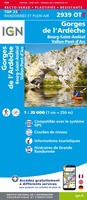 Wandelkaart - Topografische kaart 2939OTR Gorges de l'Ardèche / Bourg-St-Andéol | IGN - Institut Géographique National
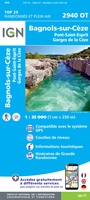 Wandelkaart - Topografische kaart 2940OT Bagnols-sur-Cèze | IGN - Institut Géographique National
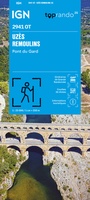 Wandelkaart 2941OT Uzès / Remoulins / Pont du Gard | IGN - Institut Géographique National
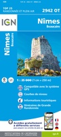 Wandelkaart - Topografische kaart 2942OT Nîmes | IGN - Institut Géographique National
 Wandelkaart - Topografische kaart 2943ET Arles | IGN - Institut Géographique National
 Wandelkaart 2943OT Saint-Gilles / Vauvert / le Petite Camargue | IGN - Institut Géographique National
Laatste reviews

Cadeau voor mijn vriendin
Review van mijn vriendin. Heel mooi boek met gedetailleerde informatie over waar je op welk moment de foto's kan maken die je zou willen. Zelfs …
★★★★★ door Tony Everaert 17 januari 2026 | Heeft dit artikel gekocht
Goed
Precies wat ik zocht
★★★★★ door Hans Linneman 16 januari 2026 | Heeft dit artikel gekocht
Gedetailleerde landkaart
Het is een zeer gedetailleerde landkaart, zoals ook door de Zwerver duidelijk omschreven. Zal voor mijn vakantie met een huurauto zeer nuttig zijn. De levering …
★★★★★ door Jeroen 16 januari 2026 | Heeft dit artikel gekocht
Informatief boekje voor kleine wandelingen
Mooi uitgevoerd en fijn. Bij elke wandeling niet alleen een kaartje en routebeschrijving, maar ook achtergrondinformatie en informatie over de natuur. Bevat dus echt korte …
★★★★★ door Arjan de Jong 15 januari 2026 | Heeft dit artikel gekocht