Harvey Maps
Superhandige wandelkaarten van Harvey Maps voor Engeland, Schotland & Wales
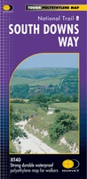 Wandelkaart - Fietskaart South Downs Way | Harvey Maps
Mooie, geplastificcerde kaart van de South Downs Way. De kaart is geschikt voor zowel wandelaars, fietsers als ruiters. Met veel extra informatie en uitsnedes van de route. Suitable …
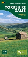
 Wandelkaart Yorkshire Dales | Harvey Maps
A huge area on one map. Yorkshire Dales - the latest addition to the British Mountain Map series - is the sixth title in this highly successful & innovative range. …
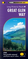 Wandelkaart Great Glen Way | Harvey Maps
Mooie, duidelijke kaart van de Great Glen Way in Schotland. Geplastificeerd met veel extra informatie en uitsnedes van de route. Leap forward in technical excellence. Tough, light and 100% …
★★★★★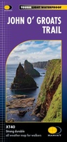 Wandelkaart John O'Groats trail | Harvey Maps
Mooie, duidelijke kaart van de John O'Groats trail in Schotland. Geplastificeerd met veel extra informatie en uitsnedes van de route. The John o' Groats Trail is a 237 km (147 …
★★★★★★★★★★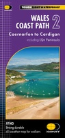 Wandelkaart Wales Coast Path 2 | Harvey Maps★★★★★
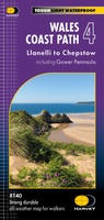 Wandelkaart Wales Coast Path 4 | Harvey Maps
 Wandelkaart Lake District East | Harvey Maps
 Wandelkaart South West Coast Path 2 | Harvey Maps★★★★★
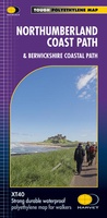 Wandelkaart Northumberland Coast Path and Berwickshire Coastal Path | Harvey Maps
Mooie, duidelijke kaart van de Northumberland Coast Path en het vervolg daarop de Berwickshire Coastal Path in Noord-Engeland en Schotland. Geplastificeerd met veel extra informatie en uitsnedes van de route. …
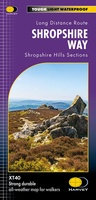 Wandelkaart National Trail Maps Shropshire Way XT40 | Harvey Maps
 Wandelkaart Offa's Dyke Path | Harvey Maps
Wandelkaart van het Offa's Dyke Path met uitsnedes van de route. Entire route on one map Offa's Dyke Path is a National Trail 285km long (178 miles) along the …
 Wandelkaart East Highland Way | Harvey Maps
Mooie, duidelijke kaart van de East highland Way in Engeland. Geplastificeerd met veel extra informatie en uitsnedes van de route. East Highland Way is an exciting new unofficial long distance …
★★★★★ Wandelkaart Lake District Noord | Harvey Maps
New Superwalker XT25 of the Lake District. Revised and re-designed It's got everything! Genuine original HARVEY mapping at 1:25,000. Clear, easy to read. Easy to re-fold. Opens directly to either …
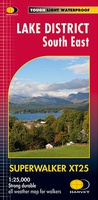 Wandelkaart Lake District Zuid Oost | Harvey Maps
Superwalker XT25 of the Lake District. Revised and re-designed. It's got everything! Genuine original HARVEY mapping at 1:25,000. Clear, easy to read. Easy to re-fold. Opens directly to either side …
 Wandelkaart Exmoor | Harvey Maps
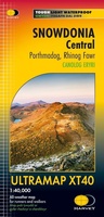 Wandelkaart Snowdonia Central | Harvey Maps
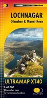 Wandelkaart Lochnagar - Glenshee & Mount Keen | Harvey Maps
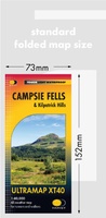 Wandelkaart Campsie Fells & Kilpatrick Hills | Harvey Maps
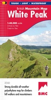 Wandelkaart White Peak | Harvey Maps
"British Mountain Maps are fit for purpose with great cartography, full of relevant information and include a geological map. Imagine a completely waterproof map that is lighter than paper and …
 Fietskaart Yorkshire Dales Touring / Nidderdale Area of NB | Harvey Maps
This map provides a colourful overview of the Dales - famous Swaledale, Wensleydale, Wharfedale & Nidderdale. Colour shading makes it easy to pick out the hills & dales. Driveable roads …
Laatste reviews

Kort voor vakantie naar de Galapagos eilanden toch nog behoefte aan extra reisgids. Simpel kunnen bestellen en snelle levering. Zou niet weten wat er beter …
★★★★★ door Piet Grootenboer 25 juni 2026 | Heeft dit artikel gekocht
Enorm mooie wereldkaart met details en snelle fijne levering.
★★★★★ door Steven Goyvaerts 25 juni 2026 | Heeft dit artikel gekocht
Deze Cicerone gids over de via Francigena is uitermate geschikt om je route en etappes te plannen als je de Via Francigena vanuit Zwitserland gaat …
★★★★★ door Vic 24 juni 2026 | Heeft dit artikel gekocht
Heerlijk om al te kunnen voorbereiden op een fantastische vakantie met dit uiterst fijne boek.
★★★★★ door Harry 24 juni 2026 | Heeft dit artikel gekocht