Harvey Maps
Superhandige wandelkaarten van Harvey Maps voor Engeland, Schotland & Wales
 Wandelkaart Pentland Hills | Harvey Maps
The whole of the Pentlands on one side of one sheet. More than a map, an essential piece of equipment this new generation HARVEY Superwalker is designed to be the …
 Wandelkaart South Loch Ness Trail | Harvey Maps
Mooie, duidelijke kaart van de South Loch Ness Trail in Schotland. Geplastificeerd met veel extra informatie en uitsnedes van de route. This map has been produced in association with …
★★★★★ Wandelkaart Brecon Beacons | Harvey Maps
"The Brecon Beacons have an irresistible draw and this is where I began my journey to the roof of the world. The breathtaking landscape provides challenges and adventures for all …
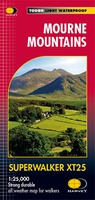 Wandelkaart Mourne Mountains | Harvey Maps
The Mournes, a granite mountain range in County Down, includes the highest mountains in Northern Ireland. The highest is Slieve Donard at 850 metres. Detailed map for hillwalkers of …
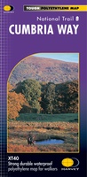 Wandelkaart Cumbria Way | Harvey Maps
Duidelijke kaart van de Cumbria Way met veel extra informatie. Cumbria Way Map XT40 edition Leap forward in technical excellence. Tough, light and 100% wateproof Compact and light - the …
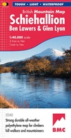 Wandelkaart Schiehallion / Ben Lawers & Glen Lyon | Harvey Maps
"I've spent most of my climbing career searching for new crags and bouldering areas and until Harvey Maps came along it was a process of trial and error. Their attention …
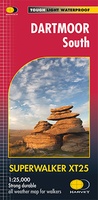 Wandelkaart Dartmoor Zuid | Harvey Maps
The whole of Dartmoor on two Maps. Dartmoor's famous Tors including Haytor Rocks and Yes Tor. The format gives more mapping on the sheet without making the map heavy and …
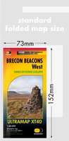 Wandelkaart Brecon Beacons West | Harvey Maps
Covers a large area yet is handily compact. Pocket perfect! Detailed map for runners and walkers of the western part of the Brecon Beacons National Park at the magic …
 Wandelkaart Wicklow Mountains | Harvey Maps
Zeer duidelijke kaart van de Wicklow Mountains in Ierland. Met o.a. hoogtelijnen en geschikt voor gebruik met GPS. HARVEY Superwalker map at 1:30,000 scale. Clear, easy to use, waterproof. GPS …
★★★★★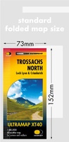 Wandelkaart Trossachs Noord | Harvey Maps
Covers a large area yet is handily compact. Pocket perfect! Detailed map for runners and walkers of the northern section of the Trossachs National Park at the magic scale …
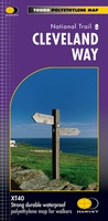 Wandelkaart Cleveland Way | Harvey Maps
Mooie, duidelijke kaart van de Cleveland Way in Noord-Engeland. Geplastificeerd met veel extra informatie en uitsnedes van de route. Leap forward in technical excellence. Tough, light and 100% waterproof …
★★★★★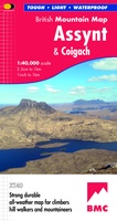 Wandelkaart Assynt & Coigach | Harvey Maps
"This is a fabulous map for a fabulous area; for the first time it shows crags, bouldering areas and clear details in what could seem a maze of rock and …
 Wandelkaart Loch Lomond & The Trossachs | Harvey Maps
Covers a large area yet is handily compact. Pocket perfect! Detailed map for runners and walkers of Loch Lomond & the Trossachs National Park at the magic scale of …
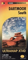 Wandelkaart Dartmoor Zuid | Harvey Maps
Covers a large area yet is handily compact. Pocket perfect! Detailed map for runners and walkers of the south section of Dartmoor National Park at the magic scale of …
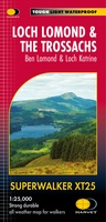 Wandelkaart Loch Lomond & The Trossachs | Harvey Maps
Detailed Superwalker map for walkers of Loch Lomond & the Trossachs National Park at 1:25,000 scale. Includes Scotland?s most southerly Munro, Ben Lomond and an inset map for access to …
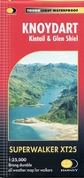 Wandelkaart Knoydart / Kintail / Glen Shiel harvey | Harvey Maps
This remote and beautiful area is often known as 'Scotland's last wilderness'. Detailed map for hillwalkers of Knoydart and Glen Shiel at the popular scale of 1:25,000. Includes …
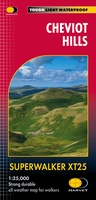 Wandelkaart Cheviot Hills | Harvey Maps
Includes the Cheviot, Newton Tors and Kirknewton. Detailed map for hillwalkers and cyclists of the Cheviot Hills at 1:25,000 scale. Includes the northern section of the Pennine Way from Brownhart …
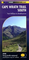 Wandelkaart Cape Wrath Trail South | Harvey Maps
Een bijzonder handige kaart van dit lange-afstands-wandelpad. Op waterafstotend papier met veel details. Het enige dat je eigenlijk een beetje mist is een overzicht. Verder uitstekend en voldoende voor de …
★★★★★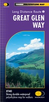 Wandelkaart Great Glen Way | Harvey Maps
Mooie, duidelijke kaart van de Great Glen Way in Schotland. Geplastificeerd met veel extra informatie en uitsnedes van de route. Leap forward in technical excellence. Tough, light and 100% …
★★★★★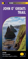 Wandelkaart John O'Groats trail | Harvey Maps
Mooie, duidelijke kaart van de John O'Groats trail in Schotland. Geplastificeerd met veel extra informatie en uitsnedes van de route. The John o' Groats Trail is a 237 km (147 …
★★★★★★★★★★
Laatste reviews

Op zich een goede kaart, maar het is eigenlijk gewoon een uitvergroting van de bekende 1:200.000-kaarten, dus weinig tot geen extra informatie. Wel wat duidelijker …
★★★★★ door FGM Ballhaus 13 mei 2026 | Heeft dit artikel gekocht
Duidelijke kaart, goed voor fietsen, iets minder voor wandelen door de schaal, maar er is heel weinig kaartmateriaal voor dit gebied dus daarom toch dik …
★★★★★ door FGM Ballhaus 13 mei 2026 | Heeft dit artikel gekocht
Fietskaart is een goede aanvulling op de Nederlandse fietskaarten, laat de Achterhoek zien maar ook een heel stuk Duitsland in (naar het oosten). Kwalitatief ook …
★★★★★ door FGM Ballhaus 13 mei 2026 | Heeft dit artikel gekocht
Keurig verpakt, snel verzonden. Boek voldoet aan mijn verwachtingen!
★★★★★ door Beatrice 12 mei 2026 | Heeft dit artikel gekocht