Hallewell Publications
Ontdek Schotland en Engeland met Hallewell Pocket Wandelgidsen
De wandelgidsen van HalleWell Publications bestrijken het grootste deel van Schotland en geselecteerde gebieden in het noorden, zuiden en zuidwesten van Engeland. De belangrijkste wandelgebieden worden behandeld - het eiland Skye, Speyside, Fort William en de Trossachs in Schotland; het Lake District, de Yorkshire Dales en het Peak District in het noorden van Engeland; Dartmoor, Cornwall en het New Forest in het zuiden van Engeland - evenals minder bekende hoekjes, zoals Caithness, Noord-Aberdeenshire en Orkney, die ook uitstekende wandelmogelijkheden bieden. De wandelingen die in de boeken zijn opgenomen, kunnen van elke lengte zijn, zolang ze algemeen aanvaard, toegankelijk, plezierig en redelijk eenvoudig te volgen zijn.
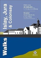 Wandelgids Islay, Jura & Colonsay | Hallewell Publications
Walks Islay, Jura & Colonsay features walks on the three inner Hebridean islands. Each island has it's own distinct character and the 26 walks featured give a good feel for …
 Wandelgids Angus | Hallewell Publications
This guide covers the old county of Angus: from the cliffs and beaches of the coast, through the wide farmland of Strathmore to the fine hill paths of the Angus …
 Wandelgids Walks West Sutherland | Hallewell Publications
This guide covers walks in the rugged, empty landscape of West Sutherland, in the far north-west of Scotland. Walks range from 1 mile to 14 miles (1.5-22.5km). Routes include: Point …
 Wandelgids Ullswater and the Eastern Lakes | Hallewell Publications
Rewalked and updated in 2016, Walks Ullswater & the Eastern Lakes features walks in The Lake District - the famous area of spectacular peaks and lakes in the north-west of …
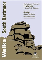 Wandelgids South Dartmoor | Hallewell Publications
Rewalked and revised in 2021, Walks South Dartmoor features walks in and around the southern half of the Dartmoor National Park - an area famous for its rolling moorland, ponies …
 Wandelgids Oban and North Argyll | Hallewell Publications
Rewalked and updated in 2018, Walks Oban & North Argyll covers the area around the popular coastal town of Oban, the offshore islands which can be reached from the town, …
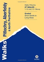 Wandelgids Pitlochry, Aberfeldy & North Perthshire | Hallewell Publications
Walks Pitlochry, Aberfeldy & North Perthshire covers the northern part of the county of Perthshire: from the wilderness of Rannoch Moor to the popular holiday town of Pitlochry. Formerly published …
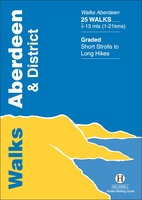 Wandelgids Aberdeen and District | Hallewell Publications
Walks Aberdeen & District covers the city of Aberdeen and the surrounding coast and countryside. Most of the walks are fairly gentle, though there are some fine hill walks on …
 Wandelgids North Peak District : Including Castleton, Edale and the Upper Derwent Valley | Hallewell Publications
Walks North Peak District features walks around Castleton, Edale and the Upper Derwent Valley, in the northern part of the Peak District National Park. Although there are no truly high …
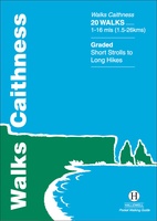 Wandelgids Walks Caithness | Hallewell Publications
This guide covers the old county of Caithness: and area of low-lying moorland and spectacular cliffs in the far north-east of the Scottish mainland. Walks range from 1 mile to …
 Wandelgids Walks Fort William and District | Hallewell Publications
Including Glencoe and the lower Great Glen, this guide covers the mountainous district of central Lochaber, including Britain’s highest peak – Ben Nevis – and the dramatic scenery around Glen …
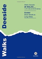 Wandelgids Deeside | Hallewell Publications
This guide covers the walks around Royal Deeside: Banchory, Aboyne, Ballater and Braemar, as well as Balmoral. Routes include climbs in the Cairngorm National Park, hill paths around Loch Muick …
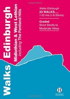 Wandelgids Edinburgh, Midlothian and West Lothian | Hallewell Publications
Rewalked and updated in 2021, Walks Edinburgh, Midlothian & West Lothian including The Pentland Hills features walks in and around Scotland's capital city. The guide covers the city of Edinburgh, …
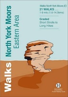 Wandelgids North York Moors: Eastern Area | Hallewell Publications
Rewalked and undated in 2022, this guide features walks in Eastern part of the North York Moors National Park (OS Sheet OL27), including sections of the Cleveland Way along the …
 Wandelgids Grasmere, Ambleside and Windermere | Hallewell Publications
Rewalked and revised in 2021, Walks Grasmere, Ambleside & Windermere features walks in The Lake District - the famous area of spectacular peaks and lakes in the north-west of England. …
 Wandelgids Padstow to Falmouth | Hallewell Publications
Walks Padstow to Falmouth features a selection of the best short walks from the section of South West Coast Path which runs between the towns of Padstow in the north …
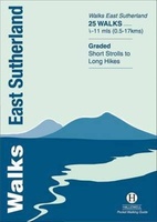 Wandelgids Walks East Sutherland | Hallewell Publications
This guide covers the less mountainous, eastern side of the county of Sutherland: an area of small coastal villages and wide, empty moorland. Walks range from 0.5 miles to 11 …
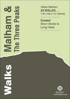 Wandelgids Malham and the Three Peaks | Hallewell Publications
Last rewalked and updated in 2021, Walks Malham & The Three Peaks covers part of The Yorkshire Dales National Park - an area of rolling green hills, dramatic limestone features …
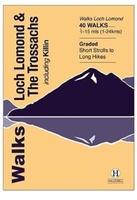 Wandelgids Walks Loch Lomond & The Trossachs | Hallewell Publications
The area covered by this guide (much of it now a National Park) is one of the most popular walking districts in Scotland, and its hills, lochs, glens and woodlands …
 Wandelgids Stirling : Including Clackmannanshire & the Campsie Fells | Hallewell Publications
Rewalked and revised in 2021, Walks Stirling (a new edition of our previous guide to Stirling & District) features 24 walks, and now covers the Campsie Fells as well as …
Kenmerken en formaat van hallewell wandelgidsen
Diversiteit aan routes voor elke wandelaar
Gedetailleerde Beschrijvingen en Praktische Informatie in Elke Gids
Laatste reviews

Prachtige wandelgids voorzien van alle voor de wandelaars benodigde informatie (accommodaties, restaurants en cafés, vervoersmogelijkheden enz.). Ook is de gids beschreven in twee richtingen en …
★★★★★ door Mathie Hoenjet 27 juni 2026 | Heeft dit artikel gekocht
Zoals altijd duidelijke en overzichtelijke kaart van Michelin
★★★★★ door Charles Trippelvitz 26 juni 2026 | Heeft dit artikel gekocht
Door deze gids konden we ons heel goed voorbereiden op onze fietstocht. En het gebruik onderweg was ook prima. Jammer dat de campings onderweg wat …
★★★★★ door Helma Feenstra 26 juni 2026 | Heeft dit artikel gekocht
Kort voor vakantie naar de Galapagos eilanden toch nog behoefte aan extra reisgids. Simpel kunnen bestellen en snelle levering. Zou niet weten wat er beter …
★★★★★ door Piet Grootenboer 25 juni 2026 | Heeft dit artikel gekocht