Winkelwagen
Geen items in winkelwagen
Ga naar winkelwagen
CNIG - Instituto Geográfico Nacional
Wegen-, wandel-, en topografische kaarten van elk deel van Spanje, zeer gedetailleerd
De CNIG is de Spaanse topografische dienst. Net als het kadaster in Nederland geven ze ook topografische kaarten uit op verschillende schalen. Zo heb je 50,000 topografische serie met zowat elk details van een heel klein gebied (deze zijn op bestelling leverbaar). Handig is de serie die per provincie een kaart heeft, de Mapa Provincial op een schaal van 1:200,000. Van de minder bekende streken in Spanje is dit vaak de enige goede kaart voor bijvoorbeeld fietsers: een redelijke duidelijke kaart met vooral topografische details.
Daarnaast geeft het CNIG een aantal goede wandelkaarten uit van de Nationale Parken in Spanje zoals het Parque Nacional Ordesa en Picos de Europa.
 Wegenkaart - landkaart Mapa Provincial Huesca | CNIG - Instituto Geográfico Nacional★★★★★
 Wegenkaart - landkaart Mapa Provincial Madrid | CNIG - Instituto Geográfico Nacional
 Wegenkaart - landkaart Mapa Provincial Albacete | CNIG - Instituto Geográfico Nacional
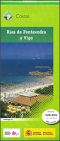 Wandelkaart Rías de Pontevedra y Vigo | CNIG - Instituto Geográfico Nacional
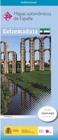 Wegenkaart - landkaart Mapa Provincial Extremadura | CNIG - Instituto Geográfico Nacional
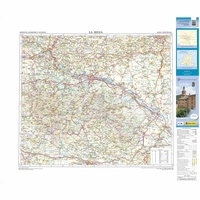 Wegenkaart - landkaart Mapa Provincial La Rioja | CNIG - Instituto Geográfico Nacional
 Wegenkaart - landkaart Mapa Provincial A Coruna | CNIG - Instituto Geográfico Nacional
 Stadsplattegrond Zaragoza y su entorno especial | CNIG - Instituto Geográfico Nacional
 Wegenkaart - landkaart Mapa Provincial Barcelona | CNIG - Instituto Geográfico Nacional★★★★★
 Stadsplattegrond Sevilla y su entorno especial | CNIG - Instituto Geográfico Nacional
 Wegenkaart - landkaart Mapa Provincial Valladolid | CNIG - Instituto Geográfico Nacional
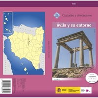 Stadsplattegrond Ávila y su entorno especial | CNIG - Instituto Geográfico Nacional
 Pelgrimsroute (kaart) - Wandelkaart Caminos de Santiago en España y Portugal | CNIG - Instituto Geográfico Nacional★★★★★
 Wandelkaart Parques Nacionales Serranía de Cuenca Parque Natural | CNIG - Instituto Geográfico Nacional
 Wegenkaart - landkaart Mapa Provincial Huelva | CNIG - Instituto Geográfico Nacional
 Wegenkaart - landkaart Mapa Provincial Alava Guipuzcoa Vizcaya | CNIG - Instituto Geográfico Nacional
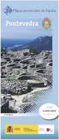 Wegenkaart - landkaart Mapa Provincial Pontevedra | CNIG - Instituto Geográfico Nacional
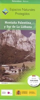 Wandelkaart Montaña Palentina y Sur de la Liébana | CNIG - Instituto Geográfico Nacional
 Wegenkaart - landkaart Mapa Provincial Murcia | CNIG - Instituto Geográfico Nacional
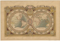 Historische wereldkaart Mundi de Luis X de Francia 1688 (Postel/Jaugeon) | 107,5 x 71 | CNIG - Instituto Geográfico Nacional
Laatste reviews

Goede kaart, maar weinig meerwaarde boven de 1:200.000-kaart
Op zich een goede kaart, maar het is eigenlijk gewoon een uitvergroting van de bekende 1:200.000-kaarten, dus weinig tot geen extra informatie. Wel wat duidelijker …
★★★★★ door FGM Ballhaus 13 mei 2026 | Heeft dit artikel gekocht
Iets te grote schaal voor wandelen, maar verder een goede kaart voor wandelen en fietsen
Duidelijke kaart, goed voor fietsen, iets minder voor wandelen door de schaal, maar er is heel weinig kaartmateriaal voor dit gebied dus daarom toch dik …
★★★★★ door FGM Ballhaus 13 mei 2026 | Heeft dit artikel gekocht
Goede fietskaart voor nét over de grens
Fietskaart is een goede aanvulling op de Nederlandse fietskaarten, laat de Achterhoek zien maar ook een heel stuk Duitsland in (naar het oosten). Kwalitatief ook …
★★★★★ door FGM Ballhaus 13 mei 2026 | Heeft dit artikel gekocht
Leuk informatief boek, precieze route goed weergegeven.
Keurig verpakt, snel verzonden. Boek voldoet aan mijn verwachtingen!
★★★★★ door Beatrice 12 mei 2026 | Heeft dit artikel gekocht