Winkelwagen
Geen items in winkelwagen
Ga naar winkelwagen
Kaarten
De beste wegenkaarten, routekaarten, fiets- of wandelkaarten en topografische kaarten vindt u hier!
Gaat u wandelen, met de auto toeren of op andere manier de omgeving op uw vakantiebestemming verkennen? Onze tip: neem een goede kaart mee! Er zijn speciale kaarten beschikbaar voor campervakanties, fietsroutes, pelgrimsroutes, wandeltochten en veel meer. Ook wegenatlassen en wegenkaarten kunnen handig zijn onderweg.
 Topografische kaart 241 MT50 Anguiano | CNIG - Instituto Geográfico Nacional1
 Wandelkaart - Fietskaart 241 Mt. Hymettus - Imittos | Terrain maps
 Fietskaart - Wandelkaart 241 Innsbrück - Stubai - Sellrain - Brenner | Freytag & Berndt
 Wandelkaart - Topografische kaart 241 OS Explorer Map Shrewsbury | Ordnance Survey
 Topografische kaart 241-I Anguiano | CNIG - Instituto Geográfico Nacional1
 Topografische kaart 241-II Torrecilla en Cameros | CNIG - Instituto Geográfico Nacional1
 Topografische kaart 241-IV Laguna de Cameros | CNIG - Instituto Geográfico Nacional1
 Wandelkaart - Topografische kaart 2410 SB - Serie Bleue Ressons-sur-Matz, Montdidier | IGN - Institut Géographique National
 Wandelkaart - Topografische kaart 2411 SB - Serie Bleue Estrées-St-Denis, Clermont | IGN - Institut Géographique National
 Wandelkaart - Topografische kaart 2412OT Forêt de Chantilly | IGN - Institut Géographique National★★★★★
 Wandelkaart - Topografische kaart 2413OT Dammartin-en-Goële, Centre | IGN - Institut Géographique National
 Wandelkaart - Topografische kaart 2414ET Marne-la-Vallée - Forêts: Crécy - Armainvilliers - Ferrières, Centre | IGN - Institut Géographique National
 Wandelkaart 2415OT Evry / Melun / Forêt Sénart / Forêt Notre-Dame | IGN - Institut Géographique National
 Wandelkaart - Topografische kaart 2416 SB - Serie Bleue Melun, Mormant | IGN - Institut Géographique National
 Wandelkaart 2417OT Forêt de Fontainebleau mini | IGN - Institut Géographique National
 Wandelkaart - Topografische kaart 2417OT Forêt de Fontainebleau | IGN - Institut Géographique National★★★★★
 Wandelkaart - Topografische kaart 2418 SB - Serie Bleue Château-Landon, Corbeilles | IGN - Institut Géographique National
 Wandelkaart - Topografische kaart 2419 SB - Serie Bleue Montargis - Lorris | IGN - Institut Géographique National
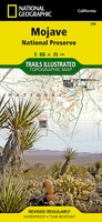 Wandelkaart - Topografische kaart 256 Mojave National Preserve | National Geographic
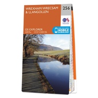 Wandelkaart - Topografische kaart 256 OS Explorer Map Wrexham, Wrecsam, Llangollen | Ordnance Survey
Laatste reviews

Prima service en overzichtelijke, gedetailleerde en stevige kaart
Met de kaart leek het of we de route al aan het lopen waren!
★★★★★ door Muskens Joost 10 april 2026 | Heeft dit artikel gekocht
gedeeltelijk bruikbaar
Blij met een fietskaart, maar: Het was mij niet duidelijk dat bij een aparte fietskaart van het Gota-kanaal met die naamgeving, het westelijk deel tussen …
★★★★★ door Remco Korteweg 09 april 2026 | Heeft dit artikel gekocht
Als je er al bent: prachtige reliëfkaart van Vogezen en Elzas
Op ansichtkaartformaat een prachtige reliëfkaart van Vogezen en Elzas: alleen al voor het vooraf genieten een aanrader
★★★★★ door R.P. Koster 08 april 2026 | Heeft dit artikel gekocht
Michelin kaarten dit keer toeristisch Elzas: altijd topkwaliteit
De beste kaartenmaker van Frankrijk: Michelin. Weer met mooie toeritische tips van de Elzas: een aanrader
★★★★★ door R.P. Koster 08 april 2026 | Heeft dit artikel gekocht